TopoQuest Logo
Do you find TopoQuest useful?
Help keep TopoQuest running and adding new maps/features by donating!
Bitcoin:  19c7KJd3qBynnjoSw5npx9KScwjBe4ifkT
Litecoin:  LXs6TkuXGGXo1vDsWCkWVdjQX94eUKd6ui
Home View Maps Find Maps Find Places Resources & Links


Battle Mountain, Colorado Topographic Map

USGS Map Title: Battle Mountain, CO
USGS Map MRC: 39106H2
DRG (GeoTIFF) Download: o39106h2.tif


Neighboring USGS Topographic Map Quads:


  Junction Butte, CO  
40106A3
 

  Parshall, CO  
40106A2
 

  Hot Sulphur Springs, CO  
40106A1
 

  King Creek, CO  
39106H3
 

  Battle Mountain, CO  
39106H2
 

  Sylvan Reservoir, CO  
39106H1
 

  Mount Powell, CO  
39106G3
 

  Squaw Creek, CO  
39106G2
 

  Ute Peak, CO  
39106G1


Map MRC Location:

N40°
W107°
N40°
W106°
H8 H7 H6 H5 H4 H3 H2 H1
G8 G7 G6 G5 G4 G3 G2 G1
F8 F7 F6 F5 F4 F3 F2 F1
E8 E7 E6 E5 E4 E3 E2 E1
D8 D7 D6 D5 D4 D3 D2 D1
C8 C7 C6 C5 C4 C3 C2 C1
B8 B7 B6 B5 B4 B3 B2 B1
A8 A7 A6 A5 A4 A3 A2 A1
N39°
W107°
N39°
W106°

Battle Mountain, CO USGS 1:24K Topographic Map Preview:
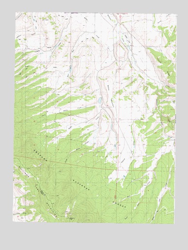
Battle Mountain, CO USGS Topographic Map
Click on map above to begin viewing in our Map Viewer.

This topographic map contains these locations and features:
Feature Name Type Latitude Longitude GNIS ID View Map
Battle MountainSummitN39.9422°W106.1728°175719View Map
Brinker GulchValleyN39.9575°W106.1335°175712View Map
Bull RunStreamN39.9969°W106.1972°175635View Map
Cole DamDamN39.9333°W106.1756°201460View Map
Cole ReservoirReservoirN39.9323°W106.1748°201461View Map
Columbine SchoolSchoolN39.9997°W106.1884°175721View Map
Cow CreekStreamN39.9480°W106.1389°175713View Map
Curtis RidgeRidgeN39.9675°W106.1347°196745View Map
Dale DamDamN39.9200°W106.1706°201560View Map
Dale DitchCanalN39.9115°W106.1872°2764977View Map
Dale ReservoirReservoirN39.9209°W106.1716°201561View Map
Langholen DamDamN39.9483°W106.1839°201466View Map
Langholen ReservoirReservoirN39.9478°W106.1840°201467View Map
Lost CreekStreamN39.9394°W106.1359°175715View Map
Mule CreekStreamN39.9219°W106.2092°175716View Map
North Battle CreekStreamN39.9472°W106.1839°175636View Map
North Skylark DitchCanalN39.9033°W106.1734°2765000View Map
Rohan DitchCanalN39.9571°W106.2236°2765004View Map
Skylark CreekStreamN39.9622°W106.1489°175717View Map
South Battle CreekStreamN39.9361°W106.1847°175722View Map
South Fork Mule CreekStreamN39.8964°W106.1486°196748View Map
Williams PeakSummitN39.8773°W106.2063°175691View Map
Williams Peak TrailTrailN39.8822°W106.1384°169368View Map
Willow View SchoolSchoolN39.9408°W106.1828°175720View Map

Note: Coordinates in the location and feature list above are referenced to NAD83 datum.


Copyright (C) 2008-2024 Ryan Niemi / Sunset Dynamics ... All Rights Reserved