TopoQuest Logo
Do you find TopoQuest useful?
Help keep TopoQuest running and adding new maps/features by donating!
Bitcoin:  19c7KJd3qBynnjoSw5npx9KScwjBe4ifkT
Litecoin:  LXs6TkuXGGXo1vDsWCkWVdjQX94eUKd6ui
Home View Maps Find Maps Find Places Resources & Links


Loon Lake, Idaho Topographic Map

USGS Map Title: Loon Lake, ID
USGS Map MRC: 45115B7
DRG (GeoTIFF) Download: o45115b7.tif


Neighboring USGS Topographic Map Quads:


  Burgdorf, ID  
45115C8
 

  War Eagle Mountain, ID  
45115C7
 

  Warren, ID  
45115C6
 

  Victor Peak, ID  
45115B8
 

  Loon Lake, ID  
45115B7
 

  Pony Meadows, ID  
45115B6
 

  Box Lake, ID  
45115A8
 

  Enos Lake, ID  
45115A7
 

  Williams Peak, ID  
45115A6


Map MRC Location:

N46°
W116°
N46°
W115°
H8 H7 H6 H5 H4 H3 H2 H1
G8 G7 G6 G5 G4 G3 G2 G1
F8 F7 F6 F5 F4 F3 F2 F1
E8 E7 E6 E5 E4 E3 E2 E1
D8 D7 D6 D5 D4 D3 D2 D1
C8 C7 C6 C5 C4 C3 C2 C1
B8 B7 B6 B5 B4 B3 B2 B1
A8 A7 A6 A5 A4 A3 A2 A1
N45°
W116°
N45°
W115°

Loon Lake, ID USGS 1:24K Topographic Map Preview:
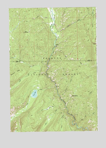
Loon Lake, ID USGS Topographic Map
Click on map above to begin viewing in our Map Viewer.

This topographic map contains these locations and features:
Feature Name Type Latitude Longitude GNIS ID View Map
Alex CreekStreamN45.2018°W115.8154°396031View Map
Blue Lake CreekStreamN45.1318°W115.7807°377929View Map
Chinook CampgroundLocaleN45.2124°W115.8098°379311View Map
Enos CreekStreamN45.1480°W115.7948°381483View Map
Enos MeadowFlatN45.1491°W115.8204°381485View Map
Fernan CreekStreamN45.2385°W115.8123°381671View Map
Grimmet CreekStreamN45.1557°W115.7996°382689View Map
Jungle CreekStreamN45.1463°W115.7987°384070View Map
Long GulchValleyN45.2260°W115.8026°386050View Map
Loon CreekStreamN45.1699°W115.8096°386122View Map
Loon LakeLakeN45.1632°W115.8402°386127View Map
Ruby MountainSummitN45.2255°W115.8529°389709View Map
Secesh MeadowsFlatN45.2363°W115.8101°390074View Map
Stratton MeadowFlatN45.2452°W115.7543°391525View Map
Victor CreekStreamN45.1824°W115.8226°392729View Map
West Fork Enos CreekStreamN45.1485°W115.8043°393100View Map
Whangdoodle CreekStreamN45.1496°W115.7962°393274View Map
Willow Basket CreekStreamN45.1860°W115.8318°393482View Map

Note: Coordinates in the location and feature list above are referenced to NAD83 datum.


Copyright (C) 2008-2024 Ryan Niemi / Sunset Dynamics ... All Rights Reserved