TopoQuest Logo
Do you find TopoQuest useful?
Help keep TopoQuest running and adding new maps/features by donating!
Bitcoin:  19c7KJd3qBynnjoSw5npx9KScwjBe4ifkT
Litecoin:  LXs6TkuXGGXo1vDsWCkWVdjQX94eUKd6ui
Home View Maps Find Maps Find Places Resources & Links


Long Lake, Wisconsin Topographic Map

USGS Map Title: Long Lake, WI
USGS Map MRC: 45088G6
DRG (GeoTIFF) Download: o45088g6.tif


Neighboring USGS Topographic Map Quads:


  Alvin, WI  
45088H7
 

  Tipler, WI  
45088H6
 

  Long Lake NE, WI  
45088H5
 

  Alvin SE, WI  
45088G7
 

  Long Lake, WI  
45088G6
 

  Long Lake SE, WI  
45088G5
 

  Crandon NE, WI  
45088F7
 

  Newald, WI  
45088F6
 

  Lake Gordon, WI  
45088F5


Map MRC Location:

N46°
W89°
N46°
W88°
H8 H7 H6 H5 H4 H3 H2 H1
G8 G7 G6 G5 G4 G3 G2 G1
F8 F7 F6 F5 F4 F3 F2 F1
E8 E7 E6 E5 E4 E3 E2 E1
D8 D7 D6 D5 D4 D3 D2 D1
C8 C7 C6 C5 C4 C3 C2 C1
B8 B7 B6 B5 B4 B3 B2 B1
A8 A7 A6 A5 A4 A3 A2 A1
N45°
W89°
N45°
W88°

Long Lake, WI USGS 1:24K Topographic Map Preview:
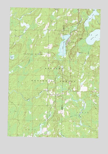
Long Lake, WI USGS Topographic Map
Click on map above to begin viewing in our Map Viewer.

This topographic map contains these locations and features:
Feature Name Type Latitude Longitude GNIS ID View Map
Bastile LakeLakeN45.8267°W88.7461°1578709View Map
Bastile Lake State Natural AreaParkN45.8263°W88.7446°2060880View Map
Beaver PondLakeN45.8317°W88.6536°1578744View Map
Brice Spur (historical)LocaleN45.8041°W88.6860°1845329View Map
Coldwater CreekStreamN45.8350°W88.6810°1579033View Map
Fay LakeLakeN45.8673°W88.6376°1579233View Map
Forest Home CemeteryCemeteryN45.7527°W88.6971°1579272View Map
Halsey LakeLakeN45.8480°W88.6328°1579377View Map
Halsey Lake OutletStreamN45.8594°W88.6454°1579378View Map
Halsey Lake SloughStreamN45.8397°W88.6373°1579379View Map
Kingstone CreekStreamN45.8647°W88.7343°1579592View Map
Little Popple RiverStreamN45.7972°W88.6746°1579702View Map
Long LakeLakeN45.8388°W88.6755°1579739View Map
Long LakePopulated PlaceN45.8427°W88.6679°1579744View Map
Long Lake CemeteryCemeteryN45.8533°W88.6576°1579749View Map
Long Lake Census Designated PlaceCensusN45.8430°W88.6673°2586528View Map
Long Lake Civilian Conservation Corps Camp (historical)LocaleN45.8111°W88.6643°1845386View Map
Long Lake Fire and RescueBuildingN45.8446°W88.6693°2696690View Map
Long Lake Lookout LowerLocaleN45.8461°W88.6532°1579750View Map
Long Lake OutletStreamN45.8661°W88.6423°1579751View Map
Martin CreekStreamN45.7711°W88.6523°1579821View Map
Moore and Montambo Spur (historical)LocaleN45.7794°W88.6896°1845339View Map
North School (historical)SchoolN45.8538°W88.6940°1845341View Map
Peterson Spur (historical)LocaleN45.7538°W88.7040°1845342View Map
Popple RiverPopulated PlaceN45.7913°W88.6851°1580192View Map
Popple River TownhallBuildingN45.7941°W88.6960°1837800View Map
Quinlan Spur (historical)LocaleN45.8191°W88.6829°1845343View Map
South School (historical)SchoolN45.7936°W88.6968°1845349View Map
Town of Popple RiverCivilN45.8346°W88.7361°1583952View Map

Note: Coordinates in the location and feature list above are referenced to NAD83 datum.


Copyright (C) 2008-2024 Ryan Niemi / Sunset Dynamics ... All Rights Reserved