TopoQuest Logo
Do you find TopoQuest useful?
Help keep TopoQuest running and adding new maps/features by donating!
Bitcoin:  19c7KJd3qBynnjoSw5npx9KScwjBe4ifkT
Litecoin:  LXs6TkuXGGXo1vDsWCkWVdjQX94eUKd6ui
Home View Maps Find Maps Find Places Resources & Links


Lohman, Missouri Topographic Map

USGS Map Title: Lohman, MO
USGS Map MRC: 38092E3
DRG (GeoTIFF) Download: o38092e3.tif


Neighboring USGS Topographic Map Quads:


  Centertown NW, MO  
38092F4
 

  Hartsburg, MO  
38092F3
 

  Jefferson City NW, MO  
38092F2
 

  Russellville, MO  
38092E4
 

  Lohman, MO  
38092E3
 

  Jefferson City, MO  
38092E2
 

  Enon, MO  
38092D4
 

  Brazito, MO  
38092D3
 

  Wardsville, MO  
38092D2


Map MRC Location:

N39°
W93°
N39°
W92°
H8 H7 H6 H5 H4 H3 H2 H1
G8 G7 G6 G5 G4 G3 G2 G1
F8 F7 F6 F5 F4 F3 F2 F1
E8 E7 E6 E5 E4 E3 E2 E1
D8 D7 D6 D5 D4 D3 D2 D1
C8 C7 C6 C5 C4 C3 C2 C1
B8 B7 B6 B5 B4 B3 B2 B1
A8 A7 A6 A5 A4 A3 A2 A1
N38°
W93°
N38°
W92°

Lohman, MO USGS 1:24K Topographic Map Preview:
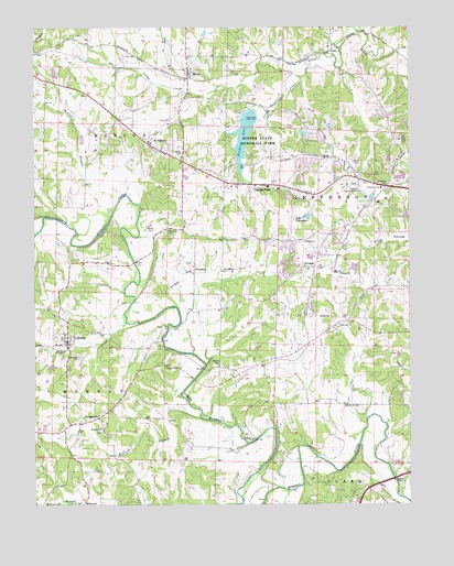
Lohman, MO USGS Topographic Map
Click on map above to begin viewing in our Map Viewer.

This topographic map contains these locations and features:
Feature Name Type Latitude Longitude GNIS ID View Map
Anderson LakeReservoirN38.6131°W92.3683°764023View Map
Anderson Lake DamDamN38.6117°W92.3702°764022View Map
Apache FlatsPopulated PlaceN38.5836°W92.2996°713352View Map
Bennie BranchStreamN38.5770°W92.3491°713959View Map
Binder LakeReservoirN38.5970°W92.3051°758251View Map
Binder Lake DamDamN38.6017°W92.3019°763638View Map
Binder Memorial ParkParkN38.5961°W92.3027°714248View Map
Capital MallLocaleN38.5856°W92.2532°742022View Map
City of LohmanCivilN38.5429°W92.3646°2395747View Map
City of Saint MartinsCivilN38.5942°W92.3312°2396503View Map
Clarence Lawson Elementary SchoolSchoolN38.5704°W92.2697°2571070View Map
Cole CountyCivilN38.5054°W92.2816°758480View Map
Cole County Fire Protection District Station 1BuildingN38.5571°W92.2672°2620549View Map
Cole County Fire Protection District Station 4 HeadquartersBuildingN38.5098°W92.2508°2620760View Map
Corinth School (historical)SchoolN38.5339°W92.2988°742244View Map
Dickerson CreekStreamN38.6117°W92.2863°716883View Map
Eberhardt CemeteryCemeteryN38.5258°W92.2670°717386View Map
Eberhardt FordLocaleN38.5014°W92.2985°742243View Map
ElstonPopulated PlaceN38.6128°W92.3238°717562View Map
Fish Trap BridgeBridgeN38.5070°W92.2549°742242View Map
Gordon CemeteryCemeteryN38.5371°W92.3159°718612View Map
Harmony School (historical)SchoolN38.5734°W92.2705°742245View Map
Hawthorn Memorial GardensCemeteryN38.5838°W92.2673°719243View Map
Hemstreet BridgeBridgeN38.5331°W92.3219°742238View Map
Islamic Cemetery of Mid MissouriCemeteryN38.5118°W92.2513°2681478View Map
Jefferson City Fire Department Station 5BuildingN38.5719°W92.2692°2620538View Map
Kautsch BranchStreamN38.5225°W92.3202°720481View Map
Kohler BridgeBridgeN38.5750°W92.3677°742240View Map
Lake ClaradeanReservoirN38.5754°W92.2842°758266View Map
Lake Claradean DamDamN38.5750°W92.2835°764054View Map
Logan CreekStreamN38.5475°W92.3452°721421View Map
LohmanPopulated PlaceN38.5431°W92.3644°721431View Map
Lohman Post OfficePost OfficeN38.5415°W92.3649°2782834View Map
Long View CemeteryCemeteryN38.5948°W92.2534°729332View Map
MoreauLocaleN38.5531°W92.3405°743507View Map
Old Catholic CemeteryCemeteryN38.5361°W92.3320°723720View Map
Old Catholic Church (historical)ChurchN38.5361°W92.3324°743508View Map
Pleasant View School (historical)SchoolN38.5725°W92.3257°742246View Map
PlummerPopulated PlaceN38.5614°W92.3227°741163View Map
Regional West Fire Protection District Station 2BuildingN38.5908°W92.3284°2620611View Map
Regional West Fire Protection District Station 3 HeadquartersBuildingN38.5811°W92.2860°2620493View Map
Renns Lake DamDamN38.6234°W92.3185°765411View Map
Russellville - Lohman Fire Protection District Station 2 LohmanBuildingN38.5425°W92.3641°2621277View Map
Saddle BridgeBridgeN38.5173°W92.3016°742239View Map
Saint Johns CemeteryCemeteryN38.5192°W92.3527°743509View Map
Saint Johns ChurchChurchN38.5200°W92.3532°725782View Map
Saint MartinsPopulated PlaceN38.5942°W92.3371°725824View Map
Saint Pauls CemeteryCemeteryN38.5389°W92.3599°743510View Map
Saint Pauls ChurchChurchN38.5386°W92.3605°725882View Map
ScottPopulated PlaceN38.6189°W92.2771°741248View Map
ScruggsPopulated PlaceN38.5623°W92.2824°741252View Map
South Moreau CreekStreamN38.5000°W92.3074°726770View Map
Stone CemeteryCemeteryN38.5722°W92.3354°727129View Map
StringtownPopulated PlaceN38.5228°W92.3541°741298View Map
Stringtown School (historical)SchoolN38.5245°W92.3499°742241View Map
Thomas Jefferson Middle SchoolSchoolN38.5684°W92.2703°2571069View Map
Walser BridgeBridgeN38.5636°W92.3419°742237View Map
West Union School (historical)SchoolN38.6206°W92.3675°753777View Map
Wilkerson CemeteryCemeteryN38.5721°W92.3310°728861View Map
Woodward LakeReservoirN38.5972°W92.2855°764041View Map
Woodward Lake DamDamN38.5984°W92.2869°764040View Map
Zion CemeteryCemeteryN38.5360°W92.2525°743511View Map
Zion ChurchChurchN38.5359°W92.2532°729246View Map

Note: Coordinates in the location and feature list above are referenced to NAD83 datum.


Copyright (C) 2008-2024 Ryan Niemi / Sunset Dynamics ... All Rights Reserved