TopoQuest Logo
Do you find TopoQuest useful?
Help keep TopoQuest running and adding new maps/features by donating!
Bitcoin:  19c7KJd3qBynnjoSw5npx9KScwjBe4ifkT
Litecoin:  LXs6TkuXGGXo1vDsWCkWVdjQX94eUKd6ui
Home View Maps Find Maps Find Places Resources & Links


Logan Valley West, Oregon Topographic Map

USGS Map Title: Logan Valley West, OR
USGS Map MRC: 44118B6
DRG (GeoTIFF) Download: o44118b6.tif


Neighboring USGS Topographic Map Quads:


  Pine Creek Mountain, OR  
44118C7
 

  Strawberry Mountain, OR  
44118C6
 

  Roberts Creek, OR  
44118C5
 

  Big Canyon, OR  
44118B7
 

  Logan Valley West, OR  
44118B6
 

  Logan Valley East, OR  
44118B5
 

  Jump-off Joe Mountain, OR  
44118A7
 

  Magpie Table, OR  
44118A6
 

  Dollar Basin, OR  
44118A5


Map MRC Location:

N45°
W119°
N45°
W118°
H8 H7 H6 H5 H4 H3 H2 H1
G8 G7 G6 G5 G4 G3 G2 G1
F8 F7 F6 F5 F4 F3 F2 F1
E8 E7 E6 E5 E4 E3 E2 E1
D8 D7 D6 D5 D4 D3 D2 D1
C8 C7 C6 C5 C4 C3 C2 C1
B8 B7 B6 B5 B4 B3 B2 B1
A8 A7 A6 A5 A4 A3 A2 A1
N44°
W119°
N44°
W118°

Logan Valley West, OR USGS 1:24K Topographic Map Preview:
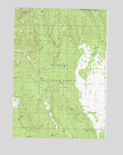
Logan Valley West, OR USGS Topographic Map
Click on map above to begin viewing in our Map Viewer.

This topographic map contains these locations and features:
Feature Name Type Latitude Longitude GNIS ID View Map
B S SpringSpringN44.1623°W118.7153°1137366View Map
Big CreekStreamN44.1446°W118.6260°1138004View Map
Blowfly SpringSpringN44.1457°W118.7402°1138278View Map
Buck SpringSpringN44.1330°W118.6428°1138825View Map
Byars GulchValleyN44.1368°W118.6424°1139087View Map
Crooked CreekStreamN44.1510°W118.6372°1140463View Map
Dago SpringSpringN44.1937°W118.6804°1156932View Map
Dark Canyon CreekStreamN44.2046°W118.7327°1140630View Map
Davenport Cabin (historical)LocaleN44.2196°W118.6269°1140646View Map
Frazier CreekStreamN44.1404°W118.6272°1142419View Map
Hidden SpringSpringN44.1374°W118.6930°1143550View Map
Italian SpringSpringN44.1935°W118.6817°1140588View Map
Lake CreekStreamN44.1449°W118.6260°1144761View Map
Lake Creek Guard StationLocaleN44.2068°W118.6422°1144775View Map
Lake Creek Organization CampLocaleN44.2063°W118.6416°1156933View Map
Lake Creek TrailTrailN44.2499°W118.6511°1163814View Map
Little Bear Creek MeadowFlatN44.1592°W118.7447°1145091View Map
McCoy CreekStreamN44.1696°W118.6558°1145945View Map
Merit MeadowsFlatN44.1510°W118.6999°1146100View Map
Merit Meadows SpringSpringN44.1644°W118.7011°1154174View Map
Murray Recreation SiteLocaleN44.2124°W118.6383°1156195View Map
Mystery SpringSpringN44.2310°W118.6928°1154173View Map
Ok Truck BarnBuildingN44.1727°W118.7161°1147174View Map
Rockingchair CreekStreamN44.1710°W118.6872°1148644View Map
Shoestring GladeFlatN44.1819°W118.7148°1149416View Map
Shootingstar MeadowFlatN44.1329°W118.6774°1150282View Map
Star GladeFlatN44.1287°W118.6348°1150343View Map
Tony SpringSpringN44.1370°W118.7107°1151337View Map

Note: Coordinates in the location and feature list above are referenced to NAD83 datum.


Copyright (C) 2008-2024 Ryan Niemi / Sunset Dynamics ... All Rights Reserved