TopoQuest Logo
Do you find TopoQuest useful?
Help keep TopoQuest running and adding new maps/features by donating!
Bitcoin:  19c7KJd3qBynnjoSw5npx9KScwjBe4ifkT
Litecoin:  LXs6TkuXGGXo1vDsWCkWVdjQX94eUKd6ui
Home View Maps Find Maps Find Places Resources & Links


Lodi, Mississippi Topographic Map

USGS Map Title: Lodi, MS
USGS Map MRC: 33089E5
DRG (GeoTIFF) Download: o33089e5.tif


Neighboring USGS Topographic Map Quads:


  Duck Hill, MS  
33089F6
 

  Sweatman, MS  
33089F5
 

  Cadaretta, MS  
33089F4
 

  Eskridge, MS  
33089E6
 

  Lodi, MS  
33089E5
 

  Little Sand Creek, MS  
33089E4
 

  Winona, MS  
33089D6
 

  Kilmichael, MS  
33089D5
 

  Stewart, MS  
33089D4


Map MRC Location:

N34°
W90°
N34°
W89°
H8 H7 H6 H5 H4 H3 H2 H1
G8 G7 G6 G5 G4 G3 G2 G1
F8 F7 F6 F5 F4 F3 F2 F1
E8 E7 E6 E5 E4 E3 E2 E1
D8 D7 D6 D5 D4 D3 D2 D1
C8 C7 C6 C5 C4 C3 C2 C1
B8 B7 B6 B5 B4 B3 B2 B1
A8 A7 A6 A5 A4 A3 A2 A1
N33°
W90°
N33°
W89°

Lodi, MS USGS 1:24K Topographic Map Preview:
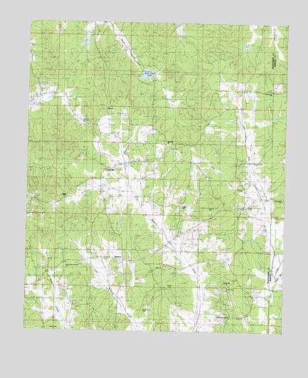
Lodi, MS USGS Topographic Map
Click on map above to begin viewing in our Map Viewer.

This topographic map contains these locations and features:
Feature Name Type Latitude Longitude GNIS ID View Map
Beat Three LakeReservoirN33.6044°W89.5676°683293View Map
Bogue Watershed Y-30-52 DamDamN33.6135°W89.5201°682243View Map
Bogue Watershed Y-30-89 DamDamN33.6035°W89.5667°682236View Map
Bogue Watershed Y-54-38 DamDamN33.6218°W89.5951°682248View Map
Bronte CemeteryCemeteryN33.5012°W89.6128°683296View Map
Campbells BranchStreamN33.5085°W89.5765°683297View Map
Cedar HillPopulated PlaceN33.5651°W89.5867°668207View Map
Choctawville (historical)LocaleN33.5223°W89.6029°683298View Map
Church of the Living GodChurchN33.5060°W89.5248°677143View Map
Dabney (historical)LocaleN33.5979°W89.5098°683299View Map
Edwards SchoolSchoolN33.5190°W89.5273°669690View Map
Laura (historical)LocaleN33.5876°W89.5862°683317View Map
LodiPopulated PlaceN33.5504°W89.5209°672762View Map
Lodi CreekStreamN33.5576°W89.5134°672763View Map
Loggins CemeteryCemeteryN33.5501°W89.5498°672773View Map
MinervaPopulated PlaceN33.5285°W89.5792°673673View Map
Mulberry Baptist Church (historical)ChurchN33.5501°W89.5376°705908View Map
Mulberry CemeteryCemeteryN33.5490°W89.5378°674457View Map
New Liberty Baptist ChurchChurchN33.5982°W89.5087°674769View Map
New Liberty Baptist Church CemeteryCemeteryN33.5985°W89.5072°674765View Map
Old Northern Grocery CemeteryCemeteryN33.5254°W89.6062°675219View Map
Patts BranchStreamN33.5237°W89.5034°675506View Map
Pittman CemeteryCemeteryN33.5176°W89.5545°683326View Map
Pleasant Hill ChurchChurchN33.5193°W89.5273°676077View Map
Purnell CemeteryCemeteryN33.5179°W89.5276°683327View Map
Salem CemeteryCemeteryN33.5265°W89.5590°677265View Map
Salem ChurchChurchN33.5248°W89.5584°677285View Map
Shady Grove CemeteryCemeteryN33.5179°W89.5553°677545View Map
Shady Grove ChurchChurchN33.5168°W89.5584°677580View Map
Shiloh Baptist ChurchChurchN33.5901°W89.5879°677695View Map
Shiloh CemeteryCemeteryN33.5898°W89.5873°677669View Map
Spring Hill CemeteryCemeteryN33.5754°W89.5578°678100View Map
Spring Hill ChurchChurchN33.5760°W89.5573°678128View Map
Spring Hill SchoolSchoolN33.5757°W89.5573°678144View Map
Sugar HillPopulated PlaceN33.5493°W89.5867°683332View Map
Supervisor District 3CivilN33.5515°W89.5893°711994View Map
Union Grove Missionary Baptist ChurchChurchN33.5540°W89.5017°679082View Map
Young SchoolSchoolN33.5540°W89.6087°679969View Map
Youngs ChapelChurchN33.5537°W89.6067°679965View Map

Note: Coordinates in the location and feature list above are referenced to NAD83 datum.


Copyright (C) 2008-2024 Ryan Niemi / Sunset Dynamics ... All Rights Reserved