TopoQuest Logo
Do you find TopoQuest useful?
Help keep TopoQuest running and adding new maps/features by donating!
Bitcoin:  19c7KJd3qBynnjoSw5npx9KScwjBe4ifkT
Litecoin:  LXs6TkuXGGXo1vDsWCkWVdjQX94eUKd6ui
Home View Maps Find Maps Find Places Resources & Links


Livonia, New York Topographic Map

USGS Map Title: Livonia, NY
USGS Map MRC: 42077G6
DRG (GeoTIFF) Download: o42077g6.tif


Neighboring USGS Topographic Map Quads:


  Caledonia, NY  
42077H7
 

  Rush, NY  
42077H6
 

  Honeoye Falls, NY  
42077H5
 

  Geneseo, NY  
42077G7
 

  Livonia, NY  
42077G6
 

  Honeoye, NY  
42077G5
 

  Sonyea, NY  
42077F7
 

  Conesus, NY  
42077F6
 

  Springwater, NY  
42077F5


Map MRC Location:

N43°
W78°
N43°
W77°
H8 H7 H6 H5 H4 H3 H2 H1
G8 G7 G6 G5 G4 G3 G2 G1
F8 F7 F6 F5 F4 F3 F2 F1
E8 E7 E6 E5 E4 E3 E2 E1
D8 D7 D6 D5 D4 D3 D2 D1
C8 C7 C6 C5 C4 C3 C2 C1
B8 B7 B6 B5 B4 B3 B2 B1
A8 A7 A6 A5 A4 A3 A2 A1
N42°
W78°
N42°
W77°

Livonia, NY USGS 1:24K Topographic Map Preview:
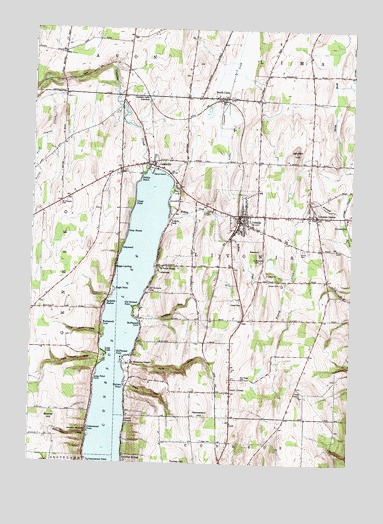
Livonia, NY USGS Topographic Map
Click on map above to begin viewing in our Map Viewer.

This topographic map contains these locations and features:
Feature Name Type Latitude Longitude GNIS ID View Map
Alger CemeteryCemeteryN42.7568°W77.6821°942319View Map
Alpine Manor Home for AdultsBuildingN42.8689°W77.6568°2598847View Map
Atwater Memorial ChurchChurchN42.7592°W77.7267°942684View Map
Booher HillSummitN42.7623°W77.7406°944438View Map
Bronson Hill CemeteryCemeteryN42.8618°W77.6894°2547852View Map
CedarcrestPopulated PlaceN42.8056°W77.7006°946155View Map
Cicero FarmLocaleN42.8025°W77.6625°2548119View Map
Cluny PointPopulated PlaceN42.8251°W77.7094°946939View Map
Conesus Drive-In (historical)LocaleN42.8325°W77.6933°2558429View Map
Conesus Lake Census Designated PlaceCensusN42.7756°W77.7135°2584248View Map
Conesus Lake County Sewer District Wastewater Treatment PlantLocaleN42.8453°W77.7097°2597176View Map
Conesus Lake JunctionPopulated PlaceN42.8556°W77.7056°972338View Map
Conesus Lake Nursing HomeBuildingN42.8273°W77.6864°2598849View Map
Cottonwood CovePopulated PlaceN42.7603°W77.7267°947534View Map
Cottonwood GullyValleyN42.7581°W77.7272°947535View Map
Cottonwood PointPopulated PlaceN42.7506°W77.7264°947536View Map
Culver Manor Mobile Home ParkPopulated PlaceN42.8044°W77.7010°2598830View Map
Denshore GullyValleyN42.7918°W77.7015°948320View Map
Eagle PointPopulated PlaceN42.8001°W77.7172°948937View Map
Excelsior SpringsPopulated PlaceN42.7517°W77.7128°970112View Map
Gray ShoresPopulated PlaceN42.8167°W77.7122°951609View Map
GraywoodPopulated PlaceN42.8123°W77.7147°951615View Map
Harder CemeteryCemeteryN42.7703°W77.6443°952199View Map
Harmony Hill FarmLocaleN42.8281°W77.6428°2548133View Map
Hartson PointPopulated PlaceN42.7726°W77.7128°952314View Map
Henderson HillSummitN42.7645°W77.6828°952589View Map
Honeyhill Organic FarmLocaleN42.7869°W77.6800°2548134View Map
Jakman HillSummitN42.8401°W77.6475°953914View Map
LakevillePopulated PlaceN42.8365°W77.7050°954991View Map
Lakeville AirportAirportN42.8273°W77.7146°978112View Map
Lakeville Census Designated PlaceCensusN42.8368°W77.7032°2584272View Map
Lakeville Estates Mobile Home ParkPopulated PlaceN42.8362°W77.7175°2598835View Map
Lakeville Post OfficePost OfficeN42.8356°W77.7034°2598817View Map
Lakeville Volunteer Fire DepartmentBuildingN42.8363°W77.7041°2734780View Map
LivoniaPopulated PlaceN42.8215°W77.6686°955754View Map
Livonia CenterPopulated PlaceN42.8215°W77.6386°955755View Map
Livonia Center Census Designated PlaceCensusN42.8211°W77.6420°2584275View Map
Livonia Center Post OfficePost OfficeN42.8218°W77.6402°2599645View Map
Livonia Center Presbyterian ChurchChurchN42.8217°W77.6394°2496923View Map
Livonia Community ChurchChurchN42.8200°W77.6656°2496922View Map
Livonia Fire DepartmentBuildingN42.8139°W77.6714°2701077View Map
Livonia Intermediate SchoolSchoolN42.8169°W77.6678°2496921View Map
Livonia Post OfficePost OfficeN42.8214°W77.6678°2598820View Map
Livonia Primary SchoolSchoolN42.8156°W77.6653°2496931View Map
Livonia Public LibraryBuildingN42.8220°W77.6675°2496919View Map
Livonia Senior High SchoolSchoolN42.8114°W77.6664°2496929View Map
Livonia StationLocaleN42.8192°W77.6267°955757View Map
Livonia Town HallBuildingN42.8192°W77.6689°2598875View Map
Livonia United Methodist ChurchChurchN42.8203°W77.6672°2496920View Map
Long Point CovePopulated PlaceN42.7748°W77.7244°955896View Map
Long Point GullyValleyN42.7801°W77.7225°955897View Map
McPherson CovePopulated PlaceN42.7898°W77.7069°956846View Map
McPherson PointPopulated PlaceN42.7801°W77.7136°956848View Map
Mount Pleasant CemeteryCemeteryN42.8245°W77.7394°957882View Map
North Fork Jaycox CreekStreamN42.8540°W77.7497°958783View Map
North GullyValleyN42.7778°W77.7086°958801View Map
Oak Ridge CemeteryCemeteryN42.7742°W77.6661°959154View Map
Old Hickory Golf ClubLocaleN42.8093°W77.6514°2598865View Map
Old Orchard CovePopulated PlaceN42.8009°W77.7039°959299View Map
Old Orchard PointPopulated PlaceN42.7948°W77.7097°959300View Map
Pebble BeachPopulated PlaceN42.8323°W77.7078°960073View Map
Powell CemeteryCemeteryN42.7960°W77.6676°961074View Map
Sacketts HarborPopulated PlaceN42.7965°W77.7208°963171View Map
Saint Josephs Roman Catholic ChurchChurchN42.8228°W77.6675°2496918View Map
Saint Judes ChapelChurchN42.8065°W77.6997°963797View Map
Saint Margarets ChapelChurchN42.7784°W77.7114°963836View Map
Saint Matthew Catholic ChurchChurchN42.8225°W77.6566°2597817View Map
Saint Michael's Roman Catholic ChurchChurchN42.8217°W77.6383°2496924View Map
Saint Michaels CemeteryCemeteryN42.8086°W77.6607°964010View Map
Saint Timothy Lutheran ChurchChurchN42.8233°W77.7455°2597820View Map
Sand PointPopulated PlaceN42.8340°W77.7033°964392View Map
Sand Point GullyValleyN42.7873°W77.7233°964393View Map
School Number 2 (historical)SchoolN42.8425°W77.7378°2108438View Map
School Number 5 (historical)SchoolN42.8681°W77.7386°2108439View Map
School Number 7 (historical)SchoolN42.7939°W77.7394°2108440View Map
Shooting Star FarmLocaleN42.8358°W77.6853°2548131View Map
Sleggs LandingPopulated PlaceN42.8065°W77.7169°965405View Map
South GullyValleyN42.7717°W77.7097°965761View Map
South LimaPopulated PlaceN42.8553°W77.6753°965807View Map
South Lima Census Designated PlaceCensusN42.8574°W77.6760°2584292View Map
South Lima Post OfficePost OfficeN42.8551°W77.6800°2598824View Map
South LivoniaPopulated PlaceN42.7709°W77.6711°965809View Map
South Livonia United Church of ChristChurchN42.7731°W77.6708°2496930View Map
Spring Hill FarmLocaleN42.7689°W77.6403°2548122View Map
Sunny ShoresPopulated PlaceN42.7620°W77.7119°966805View Map
Town of LivoniaCivilN42.8091°W77.6523°979161View Map
Tuxedo ParkPopulated PlaceN42.8198°W77.6967°968012View Map
Union CemeteryCemeteryN42.8110°W77.6414°968160View Map
Village of LivoniaCivilN42.8219°W77.6688°2390947View Map
Wadsworth CovePopulated PlaceN42.7903°W77.7222°968630View Map
Wilkins CreekStreamN42.8242°W77.6975°971278View Map
Willow Cove Mobile Home ParkPopulated PlaceN42.8386°W77.7063°2598846View Map
WYSL-AM (Avon)TowerN42.8545°W77.7106°977568View Map

Note: Coordinates in the location and feature list above are referenced to NAD83 datum.


Copyright (C) 2008-2024 Ryan Niemi / Sunset Dynamics ... All Rights Reserved