TopoQuest Logo
Do you find TopoQuest useful?
Help keep TopoQuest running and adding new maps/features by donating!
Bitcoin:  19c7KJd3qBynnjoSw5npx9KScwjBe4ifkT
Litecoin:  LXs6TkuXGGXo1vDsWCkWVdjQX94eUKd6ui
Home View Maps Find Maps Find Places Resources & Links


Lincoln Park, Georgia Topographic Map

USGS Map Title: Lincoln Park, GA
USGS Map MRC: 32084G3
DRG (GeoTIFF) Download: o32084g3.tif


Neighboring USGS Topographic Map Quads:


  Sunset Village, GA  
32084H4
 

  Thomaston, GA  
32084H3
 

  Yatesville, GA  
32084H2
 

  Roland, GA  
32084G4
 

  Lincoln Park, GA  
32084G3
 

  Logtown, GA  
32084G2
 

  Baldwinville, GA  
32084F4
 

  Prattsburg, GA  
32084F3
 

  Fickling Mill, GA  
32084F2


Map MRC Location:

N33°
W85°
N33°
W84°
H8 H7 H6 H5 H4 H3 H2 H1
G8 G7 G6 G5 G4 G3 G2 G1
F8 F7 F6 F5 F4 F3 F2 F1
E8 E7 E6 E5 E4 E3 E2 E1
D8 D7 D6 D5 D4 D3 D2 D1
C8 C7 C6 C5 C4 C3 C2 C1
B8 B7 B6 B5 B4 B3 B2 B1
A8 A7 A6 A5 A4 A3 A2 A1
N32°
W85°
N32°
W84°

Lincoln Park, GA USGS 1:24K Topographic Map Preview:
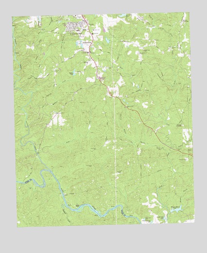
Lincoln Park, GA USGS Topographic Map
Click on map above to begin viewing in our Map Viewer.

This topographic map contains these locations and features:
Feature Name Type Latitude Longitude GNIS ID View Map
Arrowhead LakeReservoirN32.8747°W84.2972°310634View Map
Arrowhead Lake DamDamN32.8740°W84.2949°338383View Map
Bell CreekStreamN32.8299°W84.3613°311047View Map
Birdsong CrossroadsPopulated PlaceN32.8087°W84.2571°354738View Map
Chris Collier BridgeBridgeN32.7762°W84.3702°350811View Map
Clarks ChapelChurchN32.8471°W84.3230°312692View Map
Copper Hill East LakeReservoirN32.8569°W84.3261°338392View Map
Copper Hill East Lake DamDamN32.8568°W84.3266°338391View Map
Copper Hill West LakeReservoirN32.8581°W84.3295°338390View Map
Copper Hill West Lake DamDamN32.8585°W84.3299°338389View Map
Daniel School (historical)SchoolN32.7999°W84.3105°346696View Map
Davis HillSummitN32.8693°W84.2863°331522View Map
Dean CreekStreamN32.7937°W84.3591°313395View Map
Fourth BranchStreamN32.8710°W84.2746°314321View Map
Good Hope CemeteryCemeteryN32.7951°W84.3180°314681View Map
Good Hope Church (historical)ChurchN32.7949°W84.3174°346713View Map
Irvin CreekStreamN32.8615°W84.3741°315943View Map
Jerry Reeves CreekStreamN32.8365°W84.3735°316086View Map
Lanier School (historical)SchoolN32.8615°W84.2571°346722View Map
Lincoln ParkPopulated PlaceN32.8679°W84.3305°332218View Map
Lincoln Park Census Designated PlaceCensusN32.8674°W84.3349°2403234View Map
Lincoln Park Volunteer Fire DepartmentBuildingN32.8685°W84.3358°2604943View Map
Little Swift CreekStreamN32.8376°W84.2608°317217View Map
Mabry CreekStreamN32.8249°W84.3630°317508View Map
Martha Berry School (historical)SchoolN32.8179°W84.2908°346725View Map
Martin CreekStreamN32.7912°W84.2666°317744View Map
Martin School (historical)SchoolN32.7949°W84.2894°346726View Map
Mathis LakeReservoirN32.8408°W84.3321°317791View Map
Mathis Lake DamDamN32.8407°W84.3321°340168View Map
Matthews Country ClubLocaleN32.8660°W84.3180°346727View Map
Mount Olive ChurchChurchN32.8546°W84.2624°318758View Map
New Harmony CemeteryCemeteryN32.8512°W84.2849°346730View Map
New Harmony ChurchChurchN32.8512°W84.2855°319326View Map
Parkers Bridge (historical)BridgeN32.7762°W84.3688°350831View Map
Peaceful Valley ChapelChurchN32.8529°W84.2827°320307View Map
Pleasant Grove ChurchChurchN32.8171°W84.3455°320819View Map
Pleasant Grove School (historical)SchoolN32.8171°W84.3449°346736View Map
Potato CreekStreamN32.7824°W84.3494°321090View Map
Redbone CrossroadsPopulated PlaceN32.8693°W84.2555°332815View Map
Richland CreekStreamN32.7618°W84.3396°356497View Map
Rock Hill Volunteer Fire Department Station 2BuildingN32.8644°W84.2568°2604770View Map
Saint Paul Church (historical)ChurchN32.8243°W84.3733°346744View Map
Shepherd School (historical)SchoolN32.8529°W84.3205°346748View Map
Snipes Grave RockSummitN32.7854°W84.3208°333082View Map
Snipes ShoalsBarN32.7612°W84.3302°323191View Map
Southview CemeteryCemeteryN32.8735°W84.3269°323308View Map
Starling BranchStreamN32.8018°W84.2963°323530View Map
Swift CreekStreamN32.7565°W84.2669°323847View Map
Swift Creek LakeLakeN32.7531°W84.2712°323849View Map
Ten Acre RockSummitN32.7815°W84.3019°333206View Map
Three Acre LakeLakeN32.7530°W84.2852°324140View Map
Tobler CreekStreamN32.7951°W84.2649°324205View Map
Town BranchStreamN32.8501°W84.3521°324243View Map
Upson County Area Vocational SchoolSchoolN32.8637°W84.3188°346760View Map
Upson County Sportsmens Club LakReservoirN32.8568°W84.3083°338405View Map
Watson School (historical)SchoolN32.8324°W84.2519°346767View Map
Welcome Grove ChurchChurchN32.8201°W84.2958°324981View Map
Welcome Grove School (historical)SchoolN32.8199°W84.2960°346768View Map
Wiggam BranchStreamN32.7565°W84.2669°325253View Map
Wiggam Branch LakeReservoirN32.7583°W84.2622°325254View Map
Wiggam Branch Lake DamDamN32.7582°W84.2621°340611View Map
Wolf CreekStreamN32.8110°W84.2688°325485View Map
WSFT-AM (Thomaston)TowerN32.8690°W84.3210°352565View Map
Zion ChapelChurchN32.8524°W84.3205°325670View Map
Zion Chapel CemeteryCemeteryN32.8521°W84.3202°346773View Map

Note: Coordinates in the location and feature list above are referenced to NAD83 datum.


Copyright (C) 2008-2024 Ryan Niemi / Sunset Dynamics ... All Rights Reserved