TopoQuest Logo
Do you find TopoQuest useful?
Help keep TopoQuest running and adding new maps/features by donating!
Bitcoin:  19c7KJd3qBynnjoSw5npx9KScwjBe4ifkT
Litecoin:  LXs6TkuXGGXo1vDsWCkWVdjQX94eUKd6ui
Home View Maps Find Maps Find Places Resources & Links


Liberty, Washington Topographic Map

USGS Map Title: Liberty, WA
USGS Map MRC: 47120C6
DRG (GeoTIFF) Download: o47120c6.tif


Neighboring USGS Topographic Map Quads:


  Enchantment Lakes, WA  
47120D7
 

  Blewett, WA  
47120D6
 

  Tiptop, WA  
47120D5
 

  Red Top Mountain, WA  
47120C7
 

  Liberty, WA  
47120C6
 

  Blewett Pass, WA  
47120C5
 

  Teanaway, WA  
47120B7
 

  Swauk Prairie, WA  
47120B6
 

  Reecer Canyon, WA  
47120B5


Map MRC Location:

N48°
W121°
N48°
W120°
H8 H7 H6 H5 H4 H3 H2 H1
G8 G7 G6 G5 G4 G3 G2 G1
F8 F7 F6 F5 F4 F3 F2 F1
E8 E7 E6 E5 E4 E3 E2 E1
D8 D7 D6 D5 D4 D3 D2 D1
C8 C7 C6 C5 C4 C3 C2 C1
B8 B7 B6 B5 B4 B3 B2 B1
A8 A7 A6 A5 A4 A3 A2 A1
N47°
W121°
N47°
W120°

Liberty, WA USGS 1:24K Topographic Map Preview:
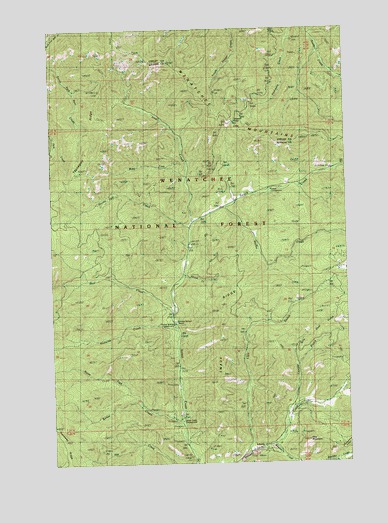
Liberty, WA USGS Topographic Map
Click on map above to begin viewing in our Map Viewer.

This topographic map contains these locations and features:
Feature Name Type Latitude Longitude GNIS ID View Map
Baker CreekStreamN47.2615°W120.6973°1516049View Map
Baker Creek CampgroundLocaleN47.2618°W120.6967°1528405View Map
Billy Goat GulchValleyN47.2776°W120.6487°1516559View Map
Blewett Summit TrailTrailN47.3612°W120.6929°1516651View Map
Blue CreekStreamN47.2929°W120.7001°1516672View Map
Boulder CreekStreamN47.2546°W120.6595°1516835View Map
Cougar GulchValleyN47.2637°W120.6529°1518174View Map
Durst CreekStreamN47.3037°W120.6945°1519019View Map
Flag MountainSummitN47.2560°W120.6387°1519629View Map
Hovey CreekStreamN47.3176°W120.6931°1520985View Map
Hurley CreekStreamN47.3235°W120.6784°1521088View Map
Iron Bear Creek TrailTrailN47.3518°W120.7081°1521233View Map
Iron CreekStreamN47.3198°W120.6942°1528409View Map
LibertyPopulated PlaceN47.2537°W120.6654°1522052View Map
Liberty National Historic DistrictLocaleN47.2540°W120.6651°1529829View Map
Lion GulchValleyN47.2523°W120.6706°1522143View Map
Medicine CreekStreamN47.2879°W120.6984°1522984View Map
Mineral Springs CampgroundLocaleN47.2896°W120.7004°1528406View Map
Mineral Springs ResortSpringN47.2907°W120.6981°1523222View Map
Mountain HomeLocaleN47.3257°W120.6720°1530182View Map
North Fork Baker CreekStreamN47.2660°W120.7129°1523734View Map
Old Blewett PassGapN47.3482°W120.6734°1516650View Map
Park CampgroundLocaleN47.3326°W120.6731°1531827View Map
Swauk CampgroundLocaleN47.3282°W120.6576°1526839View Map
Swauk LodgeLocaleN47.3298°W120.6623°1526841View Map
Swauk RidgeRidgeN47.2898°W120.6804°1531571View Map
Wash Green Sandstone QuarryMineN47.2965°W120.6479°1529243View Map
West Fork CreekStreamN47.3201°W120.6912°1527938View Map

Note: Coordinates in the location and feature list above are referenced to NAD83 datum.


Copyright (C) 2008-2024 Ryan Niemi / Sunset Dynamics ... All Rights Reserved