TopoQuest Logo
Do you find TopoQuest useful?
Help keep TopoQuest running and adding new maps/features by donating!
Bitcoin:  19c7KJd3qBynnjoSw5npx9KScwjBe4ifkT
Litecoin:  LXs6TkuXGGXo1vDsWCkWVdjQX94eUKd6ui
Home View Maps Find Maps Find Places Resources & Links


Leonidas, Michigan Topographic Map

USGS Map Title: Leonidas, MI
USGS Map MRC: 42085A3
DRG (GeoTIFF) Download: o42085a3.tif


Neighboring USGS Topographic Map Quads:


  Adams Park, MI  
42085B4
 

  Climax, MI  
42085B3
 

  East Leroy, MI  
42085B2
 

  Mendon, MI  
42085A4
 

  Leonidas, MI  
42085A3
 

  Union City, MI  
42085A2
 

  Nottawa, MI  
41085H4
 

  Colon, MI  
41085H3
 

  Bronson North, MI  
41085H2


Map MRC Location:

N43°
W86°
N43°
W85°
H8 H7 H6 H5 H4 H3 H2 H1
G8 G7 G6 G5 G4 G3 G2 G1
F8 F7 F6 F5 F4 F3 F2 F1
E8 E7 E6 E5 E4 E3 E2 E1
D8 D7 D6 D5 D4 D3 D2 D1
C8 C7 C6 C5 C4 C3 C2 C1
B8 B7 B6 B5 B4 B3 B2 B1
A8 A7 A6 A5 A4 A3 A2 A1
N42°
W86°
N42°
W85°

Leonidas, MI USGS 1:24K Topographic Map Preview:
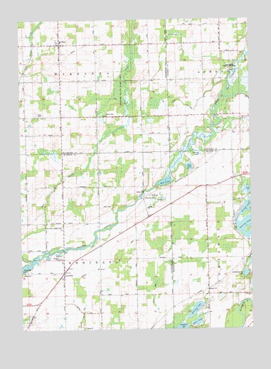
Leonidas, MI USGS Topographic Map
Click on map above to begin viewing in our Map Viewer.

This topographic map contains these locations and features:
Feature Name Type Latitude Longitude GNIS ID View Map
Ashley DrainCanalN42.0092°W85.3022°2112750View Map
Blossom CemeteryCemeteryN42.0158°W85.2739°2109296View Map
Blossom LakeLakeN42.0078°W85.2808°621622View Map
Blossom SchoolSchoolN42.0153°W85.2733°621623View Map
Carpenter SchoolSchoolN42.0859°W85.2742°622769View Map
Culp SchoolSchoolN42.1009°W85.3058°624195View Map
Dane LakeLakeN42.0030°W85.2798°624296View Map
FactoryvillePopulated PlaceN42.0528°W85.3083°2417294View Map
FactoryvillePopulated PlaceN42.0528°W85.3083°2112755View Map
Factoryville CemeteryCemeteryN42.0505°W85.3069°2401233View Map
Factoryville SchoolSchoolN42.0503°W85.3078°1624518View Map
Factoryville Station (historical)LocaleN42.0531°W85.3086°2417292View Map
Faith Bible ChurchChurchN42.0861°W85.3264°2627874View Map
Foote SchoolSchoolN42.0331°W85.3330°1624545View Map
FultonPopulated PlaceN42.1150°W85.3525°626563View Map
Fulton Christian ChurchChurchN42.1150°W85.3508°2627873View Map
Fulton Post OfficePost OfficeN42.1153°W85.3535°2627872View Map
Fulton State Game AreaParkN42.0931°W85.3222°2112757View Map
Harvey LakeLakeN42.0709°W85.2758°627907View Map
Hunt SchoolSchoolN42.0423°W85.3522°1624617View Map
Huron Potawatomi ReservationCivilN42.1045°W85.2629°2109298View Map
Indian CemeteryCemeteryN42.1047°W85.2594°2630221View Map
Kenyon LakeLakeN42.0498°W85.2515°629613View Map
Kirby SchoolSchoolN42.0564°W85.2728°629760View Map
Leatherberry LakeLakeN42.0223°W85.2532°630246View Map
Leggett SchoolSchoolN42.0856°W85.3525°630280View Map
Lehr LakeLakeN42.0560°W85.2515°630286View Map
LeonidasPopulated PlaceN42.0228°W85.3519°1624673View Map
Leonidas CemeteryCemeteryN42.0286°W85.3539°2112753View Map
Leonidas Elementary SchoolSchoolN42.0206°W85.3531°2401034View Map
Leonidas Post OfficePost OfficeN42.0231°W85.3517°2401037View Map
Leonidas SchoolSchoolN42.0012°W85.3025°1624674View Map
Leonidas Station (historical)LocaleN42.0233°W85.3522°2401035View Map
Leonidas Township HallBuildingN42.0231°W85.3519°2401036View Map
Leonidas Volunteer Fire DepartmentBuildingN42.0228°W85.3532°2636136View Map
Level Acres Landing Strip (historical)AirportN42.0411°W85.3569°2112754View Map
Marl LakeLakeN42.0657°W85.2832°631586View Map
McCauley DrainCanalN42.0036°W85.3428°2112752View Map
Mission ChurchChurchN42.1042°W85.2608°2109297View Map
Mud LakeLakeN42.0596°W85.2966°1624767View Map
Oliverda LakeLakeN42.0417°W85.2517°634038View Map
Pine CreekStreamN42.0912°W85.2655°634910View Map
Sherwood Post Office (historical)Post OfficeN42.0603°W85.2597°2435363View Map
Slayton Post Office (historical)Post OfficeN42.0589°W85.3333°2570695View Map
Snyder and Snyder DrainCanalN42.0897°W85.2942°2112756View Map
South Fulton CemeteryCemeteryN42.1119°W85.3519°2627917View Map
South Kalamazoo County Fire Authority Station 3BuildingN42.1154°W85.3531°2635997View Map
Township of LeonidasCivilN42.0280°W85.3519°1626606View Map
Township of WakeshmaCivilN42.1147°W85.3532°1627206View Map
Tutewiter and Town Line DrainCanalN42.0264°W85.3222°2112751View Map
Worden SchoolSchoolN42.0723°W85.3328°1616820View Map

Note: Coordinates in the location and feature list above are referenced to NAD83 datum.


Copyright (C) 2008-2024 Ryan Niemi / Sunset Dynamics ... All Rights Reserved