TopoQuest Logo
Do you find TopoQuest useful?
Help keep TopoQuest running and adding new maps/features by donating!
Bitcoin:  19c7KJd3qBynnjoSw5npx9KScwjBe4ifkT
Litecoin:  LXs6TkuXGGXo1vDsWCkWVdjQX94eUKd6ui
Home View Maps Find Maps Find Places Resources & Links


Lehigh, Oklahoma Topographic Map

USGS Map Title: Lehigh, OK
USGS Map MRC: 34096D2
DRG (GeoTIFF) Download: o34096d2.tif


Neighboring USGS Topographic Map Quads:


  Centrahoma, OK  
34096E3
 

  Coalgate, OK  
34096E2
 

  Coalgate SE, OK  
34096E1
 

  Olney, OK  
34096D3
 

  Lehigh, OK  
34096D2
 

  Stringtown, OK  
34096D1
 

  Boggy Depot, OK  
34096C3
 

  Tushka, OK  
34096C2
 

  Bruno, OK  
34096C1


Map MRC Location:

N35°
W97°
N35°
W96°
H8 H7 H6 H5 H4 H3 H2 H1
G8 G7 G6 G5 G4 G3 G2 G1
F8 F7 F6 F5 F4 F3 F2 F1
E8 E7 E6 E5 E4 E3 E2 E1
D8 D7 D6 D5 D4 D3 D2 D1
C8 C7 C6 C5 C4 C3 C2 C1
B8 B7 B6 B5 B4 B3 B2 B1
A8 A7 A6 A5 A4 A3 A2 A1
N34°
W97°
N34°
W96°

Lehigh, OK USGS 1:24K Topographic Map Preview:
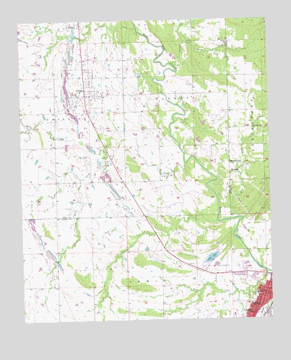
Lehigh, OK USGS Topographic Map
Click on map above to begin viewing in our Map Viewer.

This topographic map contains these locations and features:
Feature Name Type Latitude Longitude GNIS ID View Map
AtokaPopulated PlaceN34.3859°W96.1283°1089746View Map
Atoka County JailBuildingN34.3850°W96.1272°2757802View Map
Atoka County Sheriff's OfficeBuildingN34.3849°W96.1272°2757409View Map
Atoka Elementary SchoolSchoolN34.3856°W96.1327°1790551View Map
Atoka High SchoolSchoolN34.3795°W96.1441°1803834View Map
Atoka LakeLakeN34.4009°W96.1552°1089748View Map
Atoka LakeReservoirN34.4168°W96.1536°1757982View Map
Atoka Lake DamDamN34.4168°W96.1536°1757981View Map
Atoka Middle SchoolSchoolN34.3859°W96.1328°1803835View Map
Atoka Municipal AirportAirportN34.3953°W96.1480°1102365View Map
Atoka Police DepartmentBuildingN34.3935°W96.1463°2757762View Map
Brier CreekStreamN34.4962°W96.1897°1090496View Map
City of AtokaCivilN34.3855°W96.1314°2409750View Map
City of LehighCivilN34.4707°W96.2209°2410817View Map
Coal CreekStreamN34.4401°W96.1669°1091510View Map
Coal Creek CemeteryCemeteryN34.4564°W96.1286°2704466View Map
Coal Creek ChurchChurchN34.4551°W96.1283°1091517View Map
Dunford CreekStreamN34.4818°W96.1722°1092296View Map
Faith Christian SchoolSchoolN34.3755°W96.1393°2713126View Map
Fist Baptist ChurchChurchN34.3870°W96.1269°1778661View Map
French Henry CreekStreamN34.4456°W96.2058°1093046View Map
Green Meadows CemeteryCemeteryN34.3989°W96.1464°2701788View Map
Hickory Hill Strip MineMineN34.4059°W96.2400°1093716View Map
KEOR-AM (Atoka)TowerN34.4190°W96.1903°1102757View Map
KHKC-FM (Atoka)TowerN34.4181°W96.1905°1102786View Map
Kiamichi Technology Center AtokaSchoolN34.3954°W96.1530°1790255View Map
LehighPopulated PlaceN34.4693°W96.2164°1094575View Map
Lehigh CemeteryCemeteryN34.4412°W96.2083°1094576View Map
Lehigh CemeteryCemeteryN34.4776°W96.2319°1094577View Map
Lehigh Fire DepartmentBuildingN34.4706°W96.2172°2657092View Map
Lehigh Strip MineMineN34.4779°W96.2269°1094578View Map
Long CreekStreamN34.4176°W96.1411°1094951View Map
Macedonia CemeteryCemeteryN34.4350°W96.1447°2701799View Map
Macedonia ChurchChurchN34.4362°W96.1447°1095073View Map
Macedonia SchoolSchoolN34.4401°W96.1442°1095076View Map
McCall Middle SchoolSchoolN34.3770°W96.1444°2712808View Map
MidwayLocaleN34.4251°W96.2153°1763589View Map
Old Lehigh CemeteryCemeteryN34.4437°W96.2167°1096242View Map
Presbyterian ChurchChurchN34.3845°W96.1267°1778662View Map
Sand CreekStreamN34.3951°W96.1283°1097732View Map
Sandy CreekStreamN34.4906°W96.1642°1097810View Map
Thunderbird SchoolSchoolN34.3776°W96.1355°1098880View Map
West View CemeteryCemeteryN34.3828°W96.1345°2701795View Map

Note: Coordinates in the location and feature list above are referenced to NAD83 datum.


Copyright (C) 2008-2024 Ryan Niemi / Sunset Dynamics ... All Rights Reserved