TopoQuest Logo
Do you find TopoQuest useful?
Help keep TopoQuest running and adding new maps/features by donating!
Bitcoin:  19c7KJd3qBynnjoSw5npx9KScwjBe4ifkT
Litecoin:  LXs6TkuXGGXo1vDsWCkWVdjQX94eUKd6ui
Home View Maps Find Maps Find Places Resources & Links


Bartlettsville, Indiana Topographic Map

USGS Map Title: Bartlettsville, IN
USGS Map MRC: 38086H4
DRG (GeoTIFF) Download: o38086h4.tif


Neighboring USGS Topographic Map Quads:


  Clear Creek, IN  
39086A5
 

  Allens Creek, IN  
39086A4
 

  Elkinsville, IN  
39086A3
 

  Oolitic, IN  
38086H5
 

  Bartlettsville, IN  
38086H4
 

  Norman, IN  
38086H3
 

  Bedford West, IN  
38086G5
 

  Bedford East, IN  
38086G4
 

  Tunnelton, IN  
38086G3


Map MRC Location:

N39°
W87°
N39°
W86°
H8 H7 H6 H5 H4 H3 H2 H1
G8 G7 G6 G5 G4 G3 G2 G1
F8 F7 F6 F5 F4 F3 F2 F1
E8 E7 E6 E5 E4 E3 E2 E1
D8 D7 D6 D5 D4 D3 D2 D1
C8 C7 C6 C5 C4 C3 C2 C1
B8 B7 B6 B5 B4 B3 B2 B1
A8 A7 A6 A5 A4 A3 A2 A1
N38°
W87°
N38°
W86°

Bartlettsville, IN USGS 1:24K Topographic Map Preview:
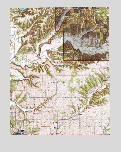
Bartlettsville, IN USGS Topographic Map
Click on map above to begin viewing in our Map Viewer.

This topographic map contains these locations and features:
Feature Name Type Latitude Longitude GNIS ID View Map
Bailey BranchStreamN38.9300°W86.4880°450644View Map
Bailey CemeteryCemeteryN38.9287°W86.4464°450645View Map
BartlettsvillePopulated PlaceN38.9703°W86.4419°450655View Map
Bedford-North Lawrence High SchoolSchoolN38.8812°W86.4444°451704View Map
Bowlen BranchStreamN38.9645°W86.4200°451701View Map
Breckinridge CemeteryCemeteryN38.8814°W86.4886°450706View Map
Brewer BranchStreamN38.9525°W86.4589°450708View Map
Chapel HillPopulated PlaceN38.9984°W86.4492°450765View Map
Covey CemeteryCemeteryN38.9837°W86.4533°450808View Map
CoveyvillePopulated PlaceN38.9734°W86.4725°450809View Map
Dive SchoolSchoolN38.8892°W86.4939°450853View Map
Donica Memorial ChurchChurchN38.9587°W86.4775°433634View Map
Dutch Ridge LakeLakeN38.9784°W86.3905°451697View Map
EriePopulated PlaceN38.8826°W86.3814°450894View Map
Gil Gal ChurchChurchN38.9401°W86.3778°450957View Map
Hawkins CemeteryCemeteryN38.9672°W86.4173°451021View Map
HeltonvillePopulated PlaceN38.9278°W86.3755°451026View Map
Heltonville Elementary SchoolSchoolN38.9309°W86.3753°451749View Map
Henderson CreekStreamN38.9653°W86.3772°451028View Map
Hillenburg CemeteryCemeteryN38.9933°W86.3868°451041View Map
Howe CreekStreamN38.9714°W86.4097°451698View Map
Knob CreekStreamN38.9481°W86.4689°451122View Map
Little Salt CreekStreamN38.9570°W86.4564°451160View Map
Mount Pleasant ChurchChurchN38.9112°W86.4700°439673View Map
Pleasant Run ChurchChurchN38.9264°W86.4414°451346View Map
Pleasant Run Township SchoolSchoolN38.9303°W86.3755°451847View Map
Rainbow LakeReservoirN38.9311°W86.3992°451699View Map
Ramsey RidgeRidgeN38.9487°W86.4292°451705View Map
Ramsey Ridge ChurchChurchN38.9434°W86.4089°451378View Map
ShawswickPopulated PlaceN38.8956°W86.4144°451447View Map
Shawswick Volunteer Fire Department Station 2BuildingN38.8887°W86.4937°2626427View Map
Shawswick Volunteer Fire Department Station 3BuildingN38.8829°W86.3948°2626424View Map
Sipes HollowValleyN38.9671°W86.4144°451700View Map
Tanksley CemeteryCemeteryN38.9384°W86.4092°451538View Map
The Meadows ChurchChurchN38.9695°W86.4005°451556View Map
Wolf CreekStreamN38.9698°W86.4889°451642View Map

Note: Coordinates in the location and feature list above are referenced to NAD83 datum.


Copyright (C) 2008-2024 Ryan Niemi / Sunset Dynamics ... All Rights Reserved