TopoQuest Logo
Do you find TopoQuest useful?
Help keep TopoQuest running and adding new maps/features by donating!
Bitcoin:  19c7KJd3qBynnjoSw5npx9KScwjBe4ifkT
Litecoin:  LXs6TkuXGGXo1vDsWCkWVdjQX94eUKd6ui
Home View Maps Find Maps Find Places Resources & Links


Leatherwood, Kentucky Topographic Map

USGS Map Title: Leatherwood, KY
USGS Map MRC: 37083A2
DRG (GeoTIFF) Download: o37083a2.tif


Neighboring USGS Topographic Map Quads:


  Hyden East, KY  
37083B3
 

  Hazard South, KY  
37083B2
 

  Vicco, KY  
37083B1
 

  Cutshin, KY  
37083A3
 

  Leatherwood, KY  
37083A2
 

  Tilford, KY  
37083A1
 

  Bledsoe, KY  
36083H3
 

  Nolansburg, KY  
36083H2
 

  Louellen, KY  
36083H1


Map MRC Location:

N38°
W84°
N38°
W83°
H8 H7 H6 H5 H4 H3 H2 H1
G8 G7 G6 G5 G4 G3 G2 G1
F8 F7 F6 F5 F4 F3 F2 F1
E8 E7 E6 E5 E4 E3 E2 E1
D8 D7 D6 D5 D4 D3 D2 D1
C8 C7 C6 C5 C4 C3 C2 C1
B8 B7 B6 B5 B4 B3 B2 B1
A8 A7 A6 A5 A4 A3 A2 A1
N37°
W84°
N37°
W83°

Leatherwood, KY USGS 1:24K Topographic Map Preview:
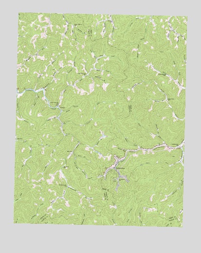
Leatherwood, KY USGS Topographic Map
Click on map above to begin viewing in our Map Viewer.

This topographic map contains these locations and features:
Feature Name Type Latitude Longitude GNIS ID View Map
Bear BranchStreamN37.0779°W83.2352°510447View Map
Beatty BranchStreamN37.0770°W83.2491°510482View Map
Beech Fork (historical)Populated PlaceN37.0807°W83.1442°2556913View Map
Beech Fork SchoolSchoolN37.0751°W83.1391°510520View Map
Beetree ForkStreamN37.0448°W83.1666°510531View Map
Beetree ForkStreamN37.1176°W83.1357°510532View Map
Berean Baptist ChurchChurchN37.0345°W83.1766°2556886View Map
Big ForkPopulated PlaceN37.0501°W83.2488°510653View Map
Big Fork Post Office (historical)Post OfficeN37.0505°W83.2493°2363111View Map
Big RockPopulated PlaceN37.0431°W83.2071°510686View Map
Big Rock Post Office (historical)Post OfficeN37.0348°W83.2140°2363112View Map
Big Rock SchoolSchoolN37.0340°W83.2143°510687View Map
Brushy ForkStreamN37.1220°W83.1511°2556917View Map
Clover ForkStreamN37.0479°W83.1271°511422View Map
Cowhead BranchStreamN37.0637°W83.2188°511604View Map
Cutshin Volunteer Fire and Rescue Station 3BuildingN37.0627°W83.2175°2637343View Map
Engle ForkStreamN37.1173°W83.2082°512074View Map
Eugene Post Office (historical)Post OfficeN37.0224°W83.1671°2339037View Map
Grave BranchStreamN37.0503°W83.1257°2556898View Map
Guthrie BranchStreamN37.0459°W83.1924°512487View Map
Hayes Lewis School (historical)SchoolN37.0791°W83.2352°2363140View Map
Hilton Post Office (historical)Post OfficeN37.0780°W83.2346°2363145View Map
Hogtrough HollowValleyN37.0861°W83.1565°512736View Map
Indian Grave BranchStreamN37.0448°W83.1605°2556893View Map
Jerrys ForkStreamN37.1243°W83.1513°512999View Map
Jim Hill Railroad Station (historical)LocaleN37.0516°W83.1254°2556899View Map
Kate Post Office (historical)Post OfficeN37.0226°W83.2101°2362739View Map
Laurel ForkStreamN37.0601°W83.2152°513248View Map
LeatherwoodPopulated PlaceN37.0329°W83.1724°513280View Map
Leatherwood Post Office (historical)Post OfficeN37.0402°W83.1709°2556896View Map
Leatherwood SchoolSchoolN37.0476°W83.1296°513286View Map
Left Fork Trace ForkStreamN37.0929°W83.1930°513328View Map
Little BranchStreamN37.1115°W83.1564°2556916View Map
Livingston SchoolSchoolN37.0279°W83.1741°513550View Map
Long BranchStreamN37.0793°W83.2377°513590View Map
Low Gap BranchStreamN37.0423°W83.2068°513664View Map
Lower Trace Fork SchoolSchoolN37.0706°W83.2191°517322View Map
Lynn CreekStreamN37.0369°W83.1334°2556866View Map
Lynn ForkStreamN37.0390°W83.1271°513741View Map
Mudlick BranchStreamN37.0798°W83.2302°514145View Map
Narrow BranchStreamN37.0831°W83.2107°514191View Map
Old Rock BranchStreamN37.1089°W83.1604°2556915View Map
Oldhouse BranchStreamN37.0495°W83.2491°514345View Map
Owens Branch SchoolSchoolN37.0904°W83.1396°514392View Map
Persimmon ForkStreamN37.0223°W83.2102°514500View Map
Persimmon Fork SchoolSchoolN37.0226°W83.2107°514501View Map
Pigeonroost BranchStreamN37.0890°W83.1980°514555View Map
Pine ForkStreamN37.1145°W83.1310°500676View Map
Pine Stump BranchStreamN37.0380°W83.1727°2556892View Map
Pratt ForkStreamN37.1145°W83.1310°501287View Map
Rhone ForkStreamN37.0531°W83.2132°501761View Map
Right Fork Clover ForkStreamN37.0493°W83.1393°501875View Map
Right Fork Cutshin CreekStreamN37.0487°W83.2030°514939View Map
Right Fork Owens BranchStreamN37.0868°W83.1316°514952View Map
Right Fork Trace ForkStreamN37.0929°W83.1930°514959View Map
Rocky BranchStreamN37.0673°W83.2163°515054View Map
Saddle ForkStreamN37.0462°W83.1574°515168View Map
School Number Thirteen (historical)SchoolN37.0779°W83.2464°2362766View Map
Shop ForkStreamN37.0990°W83.1896°515371View Map
Short BranchStreamN37.1229°W83.1807°515374View Map
Short ForkStreamN37.0409°W83.2049°515386View Map
Stonecoal BranchStreamN37.0545°W83.1446°515728View Map
Stratton ForkStreamN37.1176°W83.2085°515752View Map
Stratton SchoolSchoolN37.1209°W83.1793°515754View Map
Trace ForkStreamN37.0701°W83.2188°516012View Map
Trace Fork Post Office (historical)Post OfficeN37.0703°W83.2197°2362781View Map
Trace Fork School (historical)SchoolN37.0831°W83.2116°2362782View Map
Turkey BranchStreamN37.0756°W83.1379°516040View Map
Upper Polls Creek SchoolSchoolN37.1181°W83.2080°516146View Map
Upper Trace Fork SchoolSchoolN37.0884°W83.1985°516155View Map
White Oak ForkStreamN37.1193°W83.2124°516540View Map
YeaddissPopulated PlaceN37.0687°W83.2177°516500View Map
Yeaddiss Post OfficePost OfficeN37.0690°W83.2179°2362791View Map

Note: Coordinates in the location and feature list above are referenced to NAD83 datum.


Copyright (C) 2008-2024 Ryan Niemi / Sunset Dynamics ... All Rights Reserved