TopoQuest Logo
Do you find TopoQuest useful?
Help keep TopoQuest running and adding new maps/features by donating!
Bitcoin:  19c7KJd3qBynnjoSw5npx9KScwjBe4ifkT
Litecoin:  LXs6TkuXGGXo1vDsWCkWVdjQX94eUKd6ui
Home View Maps Find Maps Find Places Resources & Links


Langlade, Wisconsin Topographic Map

USGS Map Title: Langlade, WI
USGS Map MRC: 45088B6
DRG (GeoTIFF) Download: o45088b6.tif


Neighboring USGS Topographic Map Quads:


  Lily, WI  
45088C7
 

  Reservoir Pond, WI  
45088C6
 

  Townsend, WI  
45088C5
 

  White Lake, WI  
45088B7
 

  Langlade, WI  
45088B6
 

  Shadow Lake, WI  
45088B5
 

  Perote Lake, WI  
45088A7
 

  Markton, WI  
45088A6
 

  Fredenberg Lake, WI  
45088A5


Map MRC Location:

N46°
W89°
N46°
W88°
H8 H7 H6 H5 H4 H3 H2 H1
G8 G7 G6 G5 G4 G3 G2 G1
F8 F7 F6 F5 F4 F3 F2 F1
E8 E7 E6 E5 E4 E3 E2 E1
D8 D7 D6 D5 D4 D3 D2 D1
C8 C7 C6 C5 C4 C3 C2 C1
B8 B7 B6 B5 B4 B3 B2 B1
A8 A7 A6 A5 A4 A3 A2 A1
N45°
W89°
N45°
W88°

Langlade, WI USGS 1:24K Topographic Map Preview:
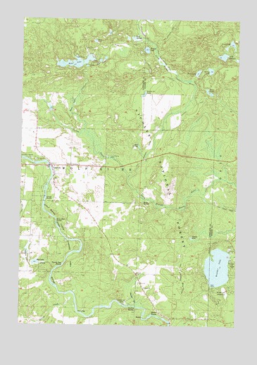
Langlade, WI USGS Topographic Map
Click on map above to begin viewing in our Map Viewer.

This topographic map contains these locations and features:
Feature Name Type Latitude Longitude GNIS ID View Map
Boulder LakeLakeN45.1490°W88.6354°1578848View Map
Boulder Lake CampgroundLocaleN45.1403°W88.6284°1578850View Map
Boulder Lake Lookout Tower (historical)TowerN45.1294°W88.6340°1843939View Map
Crowle RapidsRapidsN45.1775°W88.7351°1579067View Map
Dalton CreekStreamN45.1855°W88.6871°1579080View Map
Demster CreekStreamN45.1330°W88.6834°1579116View Map
Diene LakeLakeN45.2411°W88.7079°1579128View Map
Gardner Dam CampLocaleN45.1341°W88.6901°1579310View Map
Garfield RapidsRapidsN45.1330°W88.6846°1579311View Map
Hanson RapidsRapidsN45.1291°W88.6718°1579386View Map
Heinz SpringsSpringN45.1752°W88.6787°1579423View Map
Horse Race RapidsRapidsN45.1677°W88.7290°1579480View Map
Lake KathleenLakeN45.2352°W88.6338°1579565View Map
LangladePopulated PlaceN45.1900°W88.7323°1579627View Map
Little Rose LakesLakeN45.2332°W88.7050°1579709View Map
Marktown Post Office (historical)Post OfficeN45.1464°W88.6809°1840787View Map
Mud LakeLakeN45.1504°W88.7414°1579945View Map
Oconto Seed OrchardsLocaleN45.2172°W88.6690°1580954View Map
Perch LakeLakeN45.2285°W88.6485°1580108View Map
Popple Ridge Snowmobile TrailTrailN45.1441°W88.6557°1580191View Map
Roix SpringsSpringN45.1980°W88.6812°1580283View Map
Rose LakeLakeN45.2323°W88.7193°1580287View Map
Rose Lake CreekStreamN45.2050°W88.7132°1580288View Map
Saint Stanislaus ChurchChurchN45.1905°W88.7215°1580332View Map
Saul SpringSpringN45.2425°W88.6843°1580345View Map
Section Thirty LakeLakeN45.2196°W88.6796°1580375View Map
Spring CreekStreamN45.1341°W88.7176°1580489View Map
Spring LakeLakeN45.1609°W88.6509°1580493View Map
Spruce LakeLakeN45.2294°W88.6411°1580508View Map
The LedgeCliffN45.1300°W88.7154°1580597View Map
Town of Wolf RiverCivilN45.2408°W88.7327°1584468View Map
Trout LakeLakeN45.2399°W88.6294°1580651View Map
Twenty Day RapidsRapidsN45.1486°W88.7279°1580668View Map
Twin LakesLakeN45.2211°W88.6429°1580674View Map
White Lake CreekStreamN45.1475°W88.7298°1580777View Map
Wichser LakeLakeN45.2376°W88.6783°1580783View Map
Wolf River Volunteer Fire DepartmentBuildingN45.1861°W88.7305°2696983View Map

Note: Coordinates in the location and feature list above are referenced to NAD83 datum.


Copyright (C) 2008-2024 Ryan Niemi / Sunset Dynamics ... All Rights Reserved