TopoQuest Logo
Do you find TopoQuest useful?
Help keep TopoQuest running and adding new maps/features by donating!
Bitcoin:  19c7KJd3qBynnjoSw5npx9KScwjBe4ifkT
Litecoin:  LXs6TkuXGGXo1vDsWCkWVdjQX94eUKd6ui
Home View Maps Find Maps Find Places Resources & Links


Lamasco, Texas Topographic Map

USGS Map Title: Lamasco, TX
USGS Map MRC: 33096F1
DRG (GeoTIFF) Download: o33096f1.tif


Neighboring USGS Topographic Map Quads:


  Yuba, OK  
33096G2
 

  Telephone, TX  
33096G1
 

  Monkstown, TX  
33095G8
 

  Lake Bonham, TX  
33096F2
 

  Lamasco, TX  
33096F1
 

  Selfs, TX  
33095F8
 

  Bonham, TX  
33096E2
 

  Dodd City, TX  
33096E1
 

  Honey Grove, TX  
33095E8


Map MRC Location:

N34°
W97°
N34°
W96°
H8 H7 H6 H5 H4 H3 H2 H1
G8 G7 G6 G5 G4 G3 G2 G1
F8 F7 F6 F5 F4 F3 F2 F1
E8 E7 E6 E5 E4 E3 E2 E1
D8 D7 D6 D5 D4 D3 D2 D1
C8 C7 C6 C5 C4 C3 C2 C1
B8 B7 B6 B5 B4 B3 B2 B1
A8 A7 A6 A5 A4 A3 A2 A1
N33°
W97°
N33°
W96°

Lamasco, TX USGS 1:24K Topographic Map Preview:
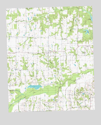
Lamasco, TX USGS Topographic Map
Click on map above to begin viewing in our Map Viewer.

This topographic map contains these locations and features:
Feature Name Type Latitude Longitude GNIS ID View Map
Briscoe BranchStreamN33.7473°W96.0197°1381515View Map
Bullard CreekStreamN33.6545°W96.0461°1381551View Map
Burns BranchStreamN33.6523°W96.0725°1383050View Map
CarsonPopulated PlaceN33.7020°W96.0058°1381600View Map
Center Grove CemeteryCemeteryN33.6829°W96.0875°1381614View Map
Coffee Mill CreekStreamN33.7376°W96.0019°1383066View Map
Cross CemeteryCemeteryN33.6384°W96.0569°1381721View Map
DannerPopulated PlaceN33.6754°W96.1136°1381738View Map
DotsonPopulated PlaceN33.7393°W96.0358°1381784View Map
Dry ForkStreamN33.7451°W96.0530°1381797View Map
Gum Springs CemeteryCemeteryN33.6940°W96.0122°1383362View Map
Gum Springs ChurchChurchN33.6948°W96.0122°1381953View Map
HudsonvillePopulated PlaceN33.7109°W96.0400°1382044View Map
Lake Quail HavenReservoirN33.7194°W96.0089°1383385View Map
Lake Quail Haven DamDamN33.7184°W96.0053°1855023View Map
LamascoPopulated PlaceN33.6951°W96.0666°1382119View Map
Lone ElmLocaleN33.6387°W96.0075°1383364View Map
New Hope ChurchChurchN33.7484°W96.1244°1382388View Map
Onstott BranchStreamN33.6384°W96.1100°1382440View Map
Orphanage CemeteryCemeteryN33.7135°W96.0452°1382442View Map
Owens CemeteryCemeteryN33.6745°W96.1083°1383358View Map
PettigrewPopulated PlaceN33.6457°W96.0194°1382486View Map
Pettigrew BranchStreamN33.6620°W96.0255°1382487View Map
Pilgrims Rest CemeteryCemeteryN33.7337°W96.0641°1382502View Map
Post OakPopulated PlaceN33.7145°W96.0839°1382556View Map
Sandy BranchStreamN33.6520°W96.1239°1382704View Map
Sandy CreekStreamN33.6570°W96.0441°1382712View Map
Smith Family CemeteryCemeteryN33.6371°W96.0140°1382776View Map
Stancel CemeteryCemeteryN33.6572°W96.1066°1382804View Map
Tanbark CreekStreamN33.7329°W96.0914°1382842View Map
Thomas BranchStreamN33.6518°W96.0750°1382856View Map
Timber CreekStreamN33.6443°W96.0978°1382868View Map
Umble CemeteryCemeteryN33.6437°W96.0039°1383363View Map
White CemeteryCemeteryN33.6829°W96.0275°1382947View Map
Wild Horse BranchStreamN33.7445°W96.0444°1382962View Map

Note: Coordinates in the location and feature list above are referenced to NAD83 datum.


Copyright (C) 2008-2024 Ryan Niemi / Sunset Dynamics ... All Rights Reserved