TopoQuest Logo
Do you find TopoQuest useful?
Help keep TopoQuest running and adding new maps/features by donating!
Bitcoin:  19c7KJd3qBynnjoSw5npx9KScwjBe4ifkT
Litecoin:  LXs6TkuXGGXo1vDsWCkWVdjQX94eUKd6ui
Home View Maps Find Maps Find Places Resources & Links


Lake Mathews, California Topographic Map

USGS Map Title: Lake Mathews, CA
USGS Map MRC: 33117G4
DRG (GeoTIFF) Download: o33117g4.tif


Neighboring USGS Topographic Map Quads:


  Corona North, CA  
33117H5
 

  Riverside West, CA  
33117H4
 

  Riverside East, CA  
33117H3
 

  Corona South, CA  
33117G5
 

  Lake Mathews, CA  
33117G4
 

  Steele Peak, CA  
33117G3
 

  Santiago Peak, CA  
33117F5
 

  Alberhill, CA  
33117F4
 

  Lake Elsinore, CA  
33117F3


Map MRC Location:

N34°
W118°
N34°
W117°
H8 H7 H6 H5 H4 H3 H2 H1
G8 G7 G6 G5 G4 G3 G2 G1
F8 F7 F6 F5 F4 F3 F2 F1
E8 E7 E6 E5 E4 E3 E2 E1
D8 D7 D6 D5 D4 D3 D2 D1
C8 C7 C6 C5 C4 C3 C2 C1
B8 B7 B6 B5 B4 B3 B2 B1
A8 A7 A6 A5 A4 A3 A2 A1
N33°
W118°
N33°
W117°

Lake Mathews, CA USGS 1:24K Topographic Map Preview:
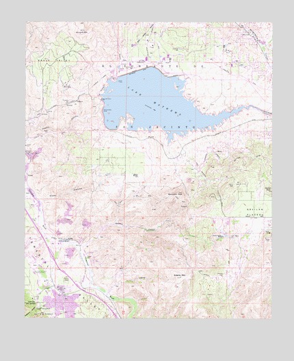
Lake Mathews, CA USGS Topographic Map
Click on map above to begin viewing in our Map Viewer.

This topographic map contains these locations and features:
Feature Name Type Latitude Longitude GNIS ID View Map
ArcillaPopulated PlaceN33.7834°W117.4795°1660263View Map
Arlington MountainSummitN33.8712°W117.4714°269571View Map
Black RocksSummitN33.8095°W117.4434°269899View Map
Blarney Stone QuarryMineN33.8189°W117.4964°2674945View Map
Cajalco CanyonValleyN33.8261°W117.4992°270149View Map
Cajalco Tin MineMineN33.8475°W117.4806°270150View Map
Cajalco TunnelTunnelN33.8503°W117.4625°270151View Map
California Ranch SchoolSchoolN33.8007°W117.4012°2455899View Map
Coldwater CanyonValleyN33.7553°W117.4934°270553View Map
Dawson CanyonValleyN33.7811°W117.4709°270768View Map
Diamond B RanchLocaleN33.7861°W117.3878°1701107View Map
Diamond L Ranch (historical)LocaleN33.7639°W117.4050°1701108View Map
Eagle ValleyBasinN33.8575°W117.4864°270973View Map
El Sobrante Census Designated PlaceCensusN33.8725°W117.4625°2583009View Map
El Sobrante de San JacintoCivilN33.8453°W117.4162°271039View Map
Estelle MountainSummitN33.7675°W117.4217°271080View Map
Gavilan PeakSummitN33.8045°W117.3759°271282View Map
Gavilan PlateauPlainN33.7950°W117.3784°271283View Map
Gavilan Springs RanchLocaleN33.7847°W117.4009°271284View Map
Glen Ivy Hot SpringsLocaleN33.7567°W117.4942°271308View Map
Glen Ivy Hot Springs Water Treatment PlantLocaleN33.7589°W117.4844°2455838View Map
Glen Ivy Recreational Vehicle ParkLocaleN33.7628°W117.4895°277082View Map
Glen Ivy SubstationLocaleN33.7603°W117.4817°1654651View Map
Indian Pictographs Historical MarkerParkN33.7839°W117.4842°271717View Map
Interchange 88CrossingN33.7767°W117.4873°2455501View Map
Lake MathewsReservoirN33.8405°W117.4357°271966View Map
Lake Mathews Airport (historical)AirportN33.8530°W117.4287°1653889View Map
Lake Mathews DivisionCivilN33.8060°W117.3937°1935158View Map
Lake Mathews Ecological ReserveParkN33.8406°W117.3773°1848978View Map
Lee Lake 818-002 DamDamN33.7500°W117.4453°1664076View Map
Maitri Road PitMineN33.7572°W117.4881°2678967View Map
Mathews DamDamN33.8375°W117.4612°272367View Map
Mathews DikeLeveeN33.8545°W117.4434°272368View Map
Monument PeakSummitN33.8031°W117.4231°272544View Map
Moore Ranch (historical)LocaleN33.7747°W117.3884°1701114View Map
Olsen CanyonValleyN33.8000°W117.4928°272794View Map
Riverside County Fire Department Station 64 - Sycamore CreekBuildingN33.7519°W117.4571°2665371View Map
Riverside County Fire Department Station 82 - Lake HillsBuildingN33.8662°W117.4578°2664989View Map
Saint Joseph of Arimathea SchoolSchoolN33.8705°W117.4359°2455772View Map
SCE Palm Springs District HeliportAirportN33.7864°W117.4661°1653325View Map
Site of the First House in Riverside CountyLocaleN33.7692°W117.4903°273728View Map
TemescalPopulated PlaceN33.7628°W117.4853°1701119View Map
Temescal StationLocaleN33.7622°W117.4834°274060View Map
Temescal Valley Census Designated PlaceCensusN33.7581°W117.4677°2629134View Map
WeiselPopulated PlaceN33.8100°W117.4998°1661659View Map

Note: Coordinates in the location and feature list above are referenced to NAD83 datum.


Copyright (C) 2008-2024 Ryan Niemi / Sunset Dynamics ... All Rights Reserved