TopoQuest Logo
Do you find TopoQuest useful?
Help keep TopoQuest running and adding new maps/features by donating!
Bitcoin:  19c7KJd3qBynnjoSw5npx9KScwjBe4ifkT
Litecoin:  LXs6TkuXGGXo1vDsWCkWVdjQX94eUKd6ui
Home View Maps Find Maps Find Places Resources & Links


Lake Leon, Texas Topographic Map

USGS Map Title: Lake Leon, TX
USGS Map MRC: 31095D7
DRG (GeoTIFF) Download: o31095d7.tif


Neighboring USGS Topographic Map Quads:


  Keechi, TX  
31095E8
 

  Oakwood, TX  
31095E7
 

  Indian Lake, TX  
31095E6
 

  Flo, TX  
31095D8
 

  Lake Leon, TX  
31095D7
 

  Stanmire Lake, TX  
31095D6
 

  Centerville, TX  
31095C8
 

  Eunice, TX  
31095C7
 

  Halls Bluff, TX  
31095C6


Map MRC Location:

N32°
W96°
N32°
W95°
H8 H7 H6 H5 H4 H3 H2 H1
G8 G7 G6 G5 G4 G3 G2 G1
F8 F7 F6 F5 F4 F3 F2 F1
E8 E7 E6 E5 E4 E3 E2 E1
D8 D7 D6 D5 D4 D3 D2 D1
C8 C7 C6 C5 C4 C3 C2 C1
B8 B7 B6 B5 B4 B3 B2 B1
A8 A7 A6 A5 A4 A3 A2 A1
N31°
W96°
N31°
W95°

Lake Leon, TX USGS 1:24K Topographic Map Preview:
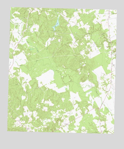
Lake Leon, TX USGS Topographic Map
Click on map above to begin viewing in our Map Viewer.

This topographic map contains these locations and features:
Feature Name Type Latitude Longitude GNIS ID View Map
Birch CreekStreamN31.4499°W95.8294°1372582View Map
Buffalo CreekStreamN31.4371°W95.8188°1372807View Map
Crow DamDamN31.4768°W95.8219°1859064View Map
George Memorial LibraryBuildingN31.3966°W95.7583°2014960View Map
Katy LibraryBuildingN31.4293°W95.7663°2014892View Map
Keechi Creek Wildlife Management AreaParkN31.4355°W95.8177°2029033View Map
Lake Elverda DamDamN31.4452°W95.8736°1859066View Map
Lake LeonReservoirN31.4823°W95.8222°1374504View Map
Lamon CemeteryCemeteryN31.4963°W95.7558°1374457View Map
Mount Pilgrim ChurchChurchN31.4438°W95.7527°1375027View Map
NinevehPopulated PlaceN31.3835°W95.8061°1380893View Map
North CreekStreamN31.4085°W95.7663°1375155View Map
North Creek CemeteryCemeteryN31.3777°W95.8255°1375156View Map
Oakwood Oil FieldOilfieldN31.4855°W95.8630°1375255View Map
Red BranchStreamN31.4991°W95.8225°1375662View Map
Resaca CreekStreamN31.4377°W95.8522°1375701View Map
RussellPopulated PlaceN31.3774°W95.8502°1380909View Map
Serasca CreekStreamN31.4455°W95.8727°1376066View Map
Tubbs CemeteryCemeteryN31.3777°W95.7616°1376512View Map

Note: Coordinates in the location and feature list above are referenced to NAD83 datum.


Copyright (C) 2008-2024 Ryan Niemi / Sunset Dynamics ... All Rights Reserved