TopoQuest Logo
Do you find TopoQuest useful?
Help keep TopoQuest running and adding new maps/features by donating!
Bitcoin:  19c7KJd3qBynnjoSw5npx9KScwjBe4ifkT
Litecoin:  LXs6TkuXGGXo1vDsWCkWVdjQX94eUKd6ui
Home View Maps Find Maps Find Places Resources & Links


Lake Isabella North, California Topographic Map

USGS Map Title: Lake Isabella North, CA
USGS Map MRC: 35118F4
DRG (GeoTIFF) Download: o35118f4.tif


Neighboring USGS Topographic Map Quads:


  Tobias Peak, CA  
35118G5
 

  Kernville, CA  
35118G4
 

  Cannell Peak, CA  
35118G3
 

  Alta Sierra, CA  
35118F5
 

  Lake Isabella North, CA  
35118F4
 

  Weldon, CA  
35118F3
 

  Miracle Hot Springs, CA  
35118E5
 

  Lake Isabella South, CA  
35118E4
 

  Woolstalf Creek, CA  
35118E3


Map MRC Location:

N36°
W119°
N36°
W118°
H8 H7 H6 H5 H4 H3 H2 H1
G8 G7 G6 G5 G4 G3 G2 G1
F8 F7 F6 F5 F4 F3 F2 F1
E8 E7 E6 E5 E4 E3 E2 E1
D8 D7 D6 D5 D4 D3 D2 D1
C8 C7 C6 C5 C4 C3 C2 C1
B8 B7 B6 B5 B4 B3 B2 B1
A8 A7 A6 A5 A4 A3 A2 A1
N35°
W119°
N35°
W118°

Lake Isabella North, CA USGS 1:24K Topographic Map Preview:
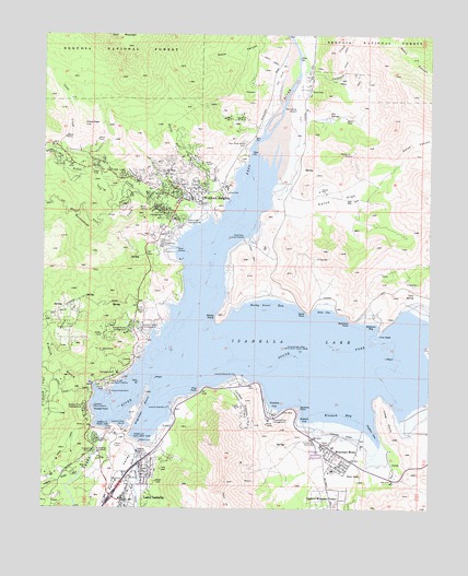
Lake Isabella North, CA USGS Topographic Map
Click on map above to begin viewing in our Map Viewer.

This topographic map contains these locations and features:
Feature Name Type Latitude Longitude GNIS ID View Map
Auxiliary Dam CampgroundLocaleN35.6441°W118.4620°1835934View Map
Big Blue Mill (historical)LocaleN35.7291°W118.4276°1670213View Map
Big Blue MineMineN35.7277°W118.4348°269811View Map
Boulder Gulch CampgroundLocaleN35.6725°W118.4701°269984View Map
Caldwell CreekStreamN35.7402°W118.4162°270159View Map
Camp NineLocaleN35.6983°W118.4301°275107View Map
Cane CreekStreamN35.7144°W118.4845°270273View Map
Cane PeakSummitN35.7261°W118.4879°270275View Map
Cane SpringSpringN35.6815°W118.3811°270276View Map
Commonwealth MineMineN35.7497°W118.4309°240833View Map
Cyrus CanyonValleyN35.7161°W118.3868°270738View Map
Cyrus FlatFlatN35.7069°W118.4065°270739View Map
Doyle Ranch (historical)LocaleN35.6522°W118.4151°1670221View Map
East Side Camp GroundLocaleN35.6925°W118.4273°1835938View Map
East Side Launch RampLocaleN35.6963°W118.4362°271010View Map
Engineer PointCapeN35.6513°W118.4695°271064View Map
Freear ParkParkN35.7008°W118.4451°1835940View Map
French GulchValleyN35.6586°W118.4856°271228View Map
French Gulch Lake Patrol StationLocaleN35.6577°W118.4795°271230View Map
French Gulch MarinaLocaleN35.6558°W118.4787°1835941View Map
Gautche PointCapeN35.6513°W118.4181°271280View Map
Grandad MineMineN35.6977°W118.3851°275108View Map
Hogeye GulchValleyN35.6322°W118.4909°271601View Map
Hot SpringsSpringN35.7291°W118.4091°271670View Map
Hungry Gulch CampgroundLocaleN35.6719°W118.4731°271687View Map
Isabella (historical)Populated PlaceN35.6555°W118.4612°1670224View Map
Isabella Auxiliary DamDamN35.6422°W118.4695°271736View Map
Isabella LakeReservoirN35.6699°W118.4278°271737View Map
Isabella Main DamDamN35.6460°W118.4822°271738View Map
Isabella Marina Number TwoLocaleN35.6516°W118.4843°271739View Map
Isabella Point Boat RampLocaleN35.6486°W118.4720°1835942View Map
Joughin CoveBayN35.6455°W118.3937°271827View Map
Kern County Airport (historical)AirportN35.7052°W118.4065°1701975View Map
Kern County Sheriff's OfficeBuildingN35.6369°W118.4674°2756235View Map
Kern River Valley CemeteryCemeteryN35.7201°W118.4354°271880View Map
Kern Valley AirportAirportN35.7307°W118.4194°1653575View Map
Kern Valley AirportLocaleN35.7302°W118.4287°275125View Map
Kern Valley HospitalHospitalN35.6349°W118.4073°1835946View Map
Kern Valley MarinaLocaleN35.6541°W118.4565°1835947View Map
Kernville (historical)Populated PlaceN35.7141°W118.4368°1670225View Map
Kernville HeliportAirportN35.7191°W118.4201°275124View Map
Kissack BayBayN35.6500°W118.4040°271908View Map
Kissack CoveBayN35.6494°W118.4156°271909View Map
Kissack Cove Boat RampLocaleN35.6477°W118.4165°1835948View Map
KVLI-AM (Lake Isabella)TowerN35.6388°W118.4737°1662636View Map
Lake Isabella Census Designated PlaceCensusN35.6378°W118.4819°2408538View Map
Lake Isabella Post OfficePost OfficeN35.6301°W118.4738°2769438View Map
Launch Area Number NineteenLocaleN35.6463°W118.4748°271988View Map
Launch Area Number SeventeenLocaleN35.6516°W118.4601°271987View Map
Launch Area Number TwoLocaleN35.6555°W118.4790°271989View Map
Launch Ramp Number SixteenLocaleN35.6602°W118.4384°271990View Map
Lime DykeBarN35.6711°W118.3926°272040View Map
Lime PointCapeN35.6477°W118.3895°272041View Map
Live Oak CampgroundLocaleN35.7027°W118.4620°272135View Map
Main Dam CampgroundLocaleN35.6427°W118.4843°272316View Map
Mountain MesaPopulated PlaceN35.6394°W118.4056°1661074View Map
Mountain Mesa Census Designated PlaceCensusN35.6411°W118.4046°2408881View Map
Mountain Mesa ParkParkN35.6366°W118.4084°1835951View Map
Nellie Dent CreekStreamN35.7058°W118.4423°272633View Map
North Fork MarinaLocaleN35.7013°W118.4506°1835952View Map
Noyer CanyonValleyN35.7494°W118.4223°272718View Map
Paradise CoveBayN35.6527°W118.4256°272869View Map
Paradise Cove Boat RampLocaleN35.6513°W118.4265°1835953View Map
Paradise Cove CampgroundLocaleN35.6491°W118.4259°272870View Map
Pine PointCapeN35.6563°W118.4501°273001View Map
Pioneer PointCapeN35.6508°W118.4848°273022View Map
Pioneer Point CampgroundLocaleN35.6516°W118.4870°273023View Map
Rattlesnake CreekStreamN35.6969°W118.4562°273217View Map
Raymond MineMineN35.7186°W118.4018°273231View Map
Regan MineMineN35.7230°W118.4940°273262View Map
Robinson BayBayN35.6725°W118.3948°273300View Map
Robinson PointCapeN35.6747°W118.4012°273302View Map
Rocky GulchValleyN35.6713°W118.4998°273324View Map
Rocky PointSummitN35.6761°W118.4426°273327View Map
Rocky Point BayBayN35.6780°W118.4279°273328View Map
Shirley CreekStreamN35.7152°W118.4937°273679View Map
Short CanyonValleyN35.7500°W118.3948°273683View Map
Slippery Rock Picnic AreaLocaleN35.6400°W118.4837°273752View Map
South Fork Kern RiverStreamN35.6594°W118.4643°273825View Map
South Fork Picnic AreaLocaleN35.6588°W118.4359°275106View Map
Stine CoveBayN35.6766°W118.4101°273903View Map
Stine PointCapeN35.6769°W118.4151°273904View Map
Tillie CreekStreamN35.7027°W118.4468°274135View Map
Tillie Creek Boat RampLocaleN35.6936°W118.4579°1835955View Map
Tillie Creek CampgroundLocaleN35.7013°W118.4554°274136View Map
Willow FlatFlatN35.6755°W118.4923°274519View Map
Woffard Heights Post OfficePost OfficeN35.7039°W118.4574°2769557View Map
Wofford HeightsPopulated PlaceN35.7069°W118.4562°1661706View Map
Wofford Heights Census Designated PlaceCensusN35.7127°W118.4731°2409619View Map
Wofford Heights ParkParkN35.7055°W118.4495°1835956View Map
Woodford Ranch (historical)LocaleN35.7011°W118.4590°1670238View Map
Yankee CanyonValleyN35.6586°W118.4418°274585View Map

Note: Coordinates in the location and feature list above are referenced to NAD83 datum.


Copyright (C) 2008-2024 Ryan Niemi / Sunset Dynamics ... All Rights Reserved