TopoQuest Logo
Do you find TopoQuest useful?
Help keep TopoQuest running and adding new maps/features by donating!
Bitcoin:  19c7KJd3qBynnjoSw5npx9KScwjBe4ifkT
Litecoin:  LXs6TkuXGGXo1vDsWCkWVdjQX94eUKd6ui
Home View Maps Find Maps Find Places Resources & Links


Lake Bronson, Minnesota Topographic Map

USGS Map Title: Lake Bronson, MN
USGS Map MRC: 48096F6
DRG (GeoTIFF) Download: o48096f6.tif


Neighboring USGS Topographic Map Quads:


  Lancaster, MN  
48096G7
 

  Skull Lake SW, MN  
48096G6
 

  Skull Lake SE, MN  
48096G5
 

  Enok, MN  
48096F7
 

  Lake Bronson, MN  
48096F6
 

  Halma, MN  
48096F5
 

  Kennedy SE, MN  
48096E7
 

  Karlstad SW, MN  
48096E6
 

  Karlstad, MN  
48096E5


Map MRC Location:

N49°
W97°
N49°
W96°
H8 H7 H6 H5 H4 H3 H2 H1
G8 G7 G6 G5 G4 G3 G2 G1
F8 F7 F6 F5 F4 F3 F2 F1
E8 E7 E6 E5 E4 E3 E2 E1
D8 D7 D6 D5 D4 D3 D2 D1
C8 C7 C6 C5 C4 C3 C2 C1
B8 B7 B6 B5 B4 B3 B2 B1
A8 A7 A6 A5 A4 A3 A2 A1
N48°
W97°
N48°
W96°

Lake Bronson, MN USGS 1:24K Topographic Map Preview:
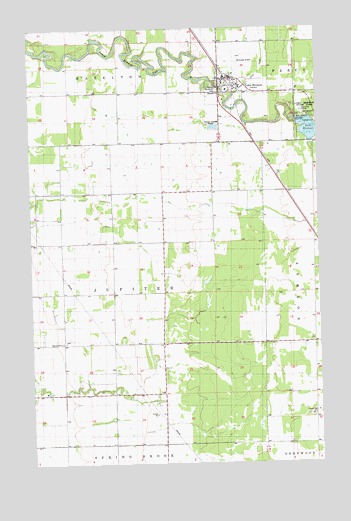
Lake Bronson, MN USGS Topographic Map
Click on map above to begin viewing in our Map Viewer.

This topographic map contains these locations and features:
Feature Name Type Latitude Longitude GNIS ID View Map
Bronson Lake DamDamN48.7233°W96.6337°1775909View Map
City of Lake BronsonCivilN48.7323°W96.6636°2395587View Map
Community Covenant ChurchChurchN48.7356°W96.6669°2106336View Map
East Emmaus CemeteryCemeteryN48.6611°W96.7343°2105844View Map
East Emmaus ChurchChurchN48.6600°W96.7356°643070View Map
Johansson CemeteryCemeteryN48.7000°W96.7491°2575842View Map
Kittson County Historical MuseumBuildingN48.7356°W96.6625°2106338View Map
Lake BronsonPopulated PlaceN48.7355°W96.6628°646332View Map
Lake Bronson AirportAirportN48.7400°W96.6635°660241View Map
Lake Bronson Fire DepartmentBuildingN48.7353°W96.6624°2666359View Map
Lake Bronson Post OfficePost OfficeN48.7358°W96.6634°2105936View Map
Mandie Johnson Farm BurialsCemeteryN48.6929°W96.7474°2575844View Map
Riverside CemeteryCemeteryN48.7321°W96.6686°1815216View Map
Township of JupiterCivilN48.6740°W96.7145°664591View Map
Vagle CemeteryCemeteryN48.6944°W96.6931°2105842View Map
Zion Lutheran ChurchChurchN48.7331°W96.6669°2106337View Map

Note: Coordinates in the location and feature list above are referenced to NAD83 datum.


Copyright (C) 2008-2024 Ryan Niemi / Sunset Dynamics ... All Rights Reserved