TopoQuest Logo
Do you find TopoQuest useful?
Help keep TopoQuest running and adding new maps/features by donating!
Bitcoin:  19c7KJd3qBynnjoSw5npx9KScwjBe4ifkT
Litecoin:  LXs6TkuXGGXo1vDsWCkWVdjQX94eUKd6ui
Home View Maps Find Maps Find Places Resources & Links


Barnabus, West Virginia Topographic Map

USGS Map Title: Barnabus, WV
USGS Map MRC: 37082F1
DRG (GeoTIFF) Download: o37082f1.tif


Neighboring USGS Topographic Map Quads:


  Myrtle, WV  
37082G2
 

  Holden, WV  
37082G1
 

  Logan, WV  
37081G8
 

  Delbarton, WV  
37082F2
 

  Barnabus, WV  
37082F1
 

  Man, WV  
37081F8
 

  Matewan, WV  
37082E2
 

  Majestic, KY  
37082E1
 

  Wharncliffe, WV  
37081E8


Map MRC Location:

N38°
W83°
N38°
W82°
H8 H7 H6 H5 H4 H3 H2 H1
G8 G7 G6 G5 G4 G3 G2 G1
F8 F7 F6 F5 F4 F3 F2 F1
E8 E7 E6 E5 E4 E3 E2 E1
D8 D7 D6 D5 D4 D3 D2 D1
C8 C7 C6 C5 C4 C3 C2 C1
B8 B7 B6 B5 B4 B3 B2 B1
A8 A7 A6 A5 A4 A3 A2 A1
N37°
W83°
N37°
W82°

Barnabus, WV USGS 1:24K Topographic Map Preview:
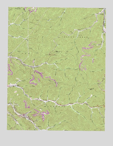
Barnabus, WV USGS Topographic Map
Click on map above to begin viewing in our Map Viewer.

This topographic map contains these locations and features:
Feature Name Type Latitude Longitude GNIS ID View Map
Appalachian Regional AirportAirportN37.6815°W82.1186°2717119View Map
Ashcamp HollowValleyN37.6895°W82.0615°1535055View Map
BarnabusPopulated PlaceN37.7440°W82.0093°1535254View Map
Bearwallow BranchStreamN37.6846°W82.0343°1535427View Map
Big Muncy BranchStreamN37.6521°W82.0448°1535888View Map
Big Pigeonroost BranchStreamN37.6995°W82.1246°1535893View Map
Big South BranchStreamN37.6929°W82.0660°1535968View Map
Bird BranchStreamN37.6673°W82.1060°1536034View Map
Browning CemeteryCemeteryN37.6490°W82.0085°1536422View Map
CalicoPopulated PlaceN37.6404°W82.0037°1728744View Map
Chafin BranchStreamN37.6384°W82.1024°1537178View Map
Chafin Branch DamDamN37.6368°W82.1065°1559118View Map
Chafin CemeteryCemeteryN37.6262°W82.0832°1537179View Map
Chafin School (historical)SchoolN37.6315°W82.0890°1728749View Map
Cow CreekStreamN37.7473°W82.0026°1537737View Map
Cow Creek ChurchChurchN37.7273°W82.0357°1537739View Map
Curry CemeteryCemeteryN37.7126°W82.0623°1537928View Map
Cynthia BranchStreamN37.6257°W82.0840°1537956View Map
Delbarton Fire Station Substation 2BuildingN37.6530°W82.0393°2577775View Map
Double Camp ForkStreamN37.6254°W82.0824°1538288View Map
Duty BranchStreamN37.6890°W82.0904°1538473View Map
Duty CemeteryCemeteryN37.6898°W82.0912°1538477View Map
Farley CemeteryCemeteryN37.7279°W82.0293°1538895View Map
Ferrell CemeteryCemeteryN37.6543°W82.0237°1538936View Map
Ferrell School (historical)SchoolN37.6490°W82.0146°1728769View Map
Grant BranchStreamN37.6532°W82.0362°1539590View Map
Hall ForkStreamN37.7120°W82.0390°1539863View Map
Hatfield CemeteryCemeteryN37.6332°W82.0907°1540060View Map
Hatfield CemeteryCemeteryN37.6573°W82.0843°1540061View Map
Hatfield CemeteryCemeteryN37.6593°W82.0971°1540062View Map
Hatfield CemeteryCemeteryN37.6637°W82.1029°1540063View Map
Horse Road ForkStreamN37.6271°W82.0715°1540492View Map
Island Creek School (historical)SchoolN37.6676°W82.0057°1742545View Map
Kennedy CemeteryCemeteryN37.6321°W82.0015°1541151View Map
Left Fork Cow CreekStreamN37.7265°W82.0337°1541645View Map
Left Fork Pine CreekStreamN37.7368°W82.0732°1541702View Map
Left Fork Rockhouse ForkStreamN37.6846°W82.0343°1541714View Map
Little Laurel BranchStreamN37.6551°W82.0726°1542139View Map
Little Muncy BranchStreamN37.6518°W82.0465°1542179View Map
Littles CreekStreamN37.7259°W82.0012°1542265View Map
Loggy BranchStreamN37.7323°W82.1104°1542317View Map
Longtail Lick BranchStreamN37.6543°W82.0757°1542441View Map
Mahon CemeteryCemeteryN37.6993°W82.1132°1542695View Map
Marks BranchStreamN37.6284°W82.0857°1542766View Map
Meador BranchStreamN37.6557°W82.0837°1543046View Map
Meador CemeteryCemeteryN37.6254°W82.0515°1543047View Map
Muncy Valley ChurchChurchN37.6521°W82.0410°1544003View Map
MusickPopulated PlaceN37.6551°W82.0749°1555185View Map
Musick CemeteryCemeteryN37.6546°W82.0637°1544021View Map
Musick CemeteryCemeteryN37.6679°W82.1060°1544022View Map
National Refuse Dump Number 25ReservoirN37.6834°W82.0832°1559115View Map
National Refuse Dump Number 25 DamDamN37.6834°W82.0832°1559114View Map
NewtownPopulated PlaceN37.6279°W82.0857°1555218View Map
Newtown Post OfficePost OfficeN37.6318°W82.0904°1728824View Map
Nighway BranchStreamN37.6532°W82.0254°1544174View Map
OilvillePopulated PlaceN37.7279°W82.0371°1742588View Map
Oldfield BranchStreamN37.6693°W82.1137°1544380View Map
Oldhouse BranchStreamN37.7429°W82.0121°1544387View Map
Pats BranchStreamN37.6321°W82.0910°1544619View Map
PiePopulated PlaceN37.6534°W82.0257°1555339View Map
Ragland ChurchChurchN37.6968°W82.1107°1545382View Map
Red Jacket ImpoundmentReservoirN37.6368°W82.1065°1559119View Map
Red Jacket School (historical)SchoolN37.6512°W82.1237°1728846View Map
Rover BranchStreamN37.6534°W82.0635°1546118View Map
Sang BranchStreamN37.7301°W82.0201°1546420View Map
Sizemore CemeteryCemeteryN37.6726°W82.0090°1546855View Map
Slick Rock BranchStreamN37.6521°W82.0612°1546940View Map
Spice BranchStreamN37.6559°W82.0943°1547134View Map
Spring BranchStreamN37.6887°W82.0918°1547176View Map
Spring BranchStreamN37.7129°W82.0054°1547177View Map
StirratPopulated PlaceN37.7265°W82.0023°1555715View Map
Stirrat School (historical)SchoolN37.7318°W82.0040°1547431View Map
Thacker ForkStreamN37.6482°W82.0171°1547993View Map
Timothy BranchStreamN37.6868°W82.0537°1548099View Map
Tom BranchStreamN37.7326°W82.1196°1548117View Map
Twin BranchStreamN37.7415°W82.0571°1548399View Map
VarneyPopulated PlaceN37.6693°W82.1221°1548630View Map
Varney CemeteryCemeteryN37.6557°W82.0740°1548634View Map
Varney CemeteryCemeteryN37.6754°W82.1107°1549524View Map
Varney Elementary School (historical)SchoolN37.6704°W82.1215°1728874View Map
Varney Post OfficePost OfficeN37.6703°W82.1177°1728875View Map

Note: Coordinates in the location and feature list above are referenced to NAD83 datum.


Copyright (C) 2008-2024 Ryan Niemi / Sunset Dynamics ... All Rights Reserved