TopoQuest Logo
Do you find TopoQuest useful?
Help keep TopoQuest running and adding new maps/features by donating!
Bitcoin:  19c7KJd3qBynnjoSw5npx9KScwjBe4ifkT
Litecoin:  LXs6TkuXGGXo1vDsWCkWVdjQX94eUKd6ui
Home View Maps Find Maps Find Places Resources & Links


Lafayette, Tennessee Topographic Map

USGS Map Title: Lafayette, TN
USGS Map MRC: 36086E1
DRG (GeoTIFF) Download: o36086e1.tif


Neighboring USGS Topographic Map Quads:


  Petroleum, KY  
36086F2
 

  Holland, KY  
36086F1
 

  Fountain Run, KY  
36085F8
 

  Westmoreland, TN  
36086E2
 

  Lafayette, TN  
36086E1
 

  Galen, TN  
36085E8
 

  Hartsville, TN  
36086D2
 

  Hillsdale, TN  
36086D1
 

  Pleasant Shade, TN  
36085D8


Map MRC Location:

N37°
W87°
N37°
W86°
H8 H7 H6 H5 H4 H3 H2 H1
G8 G7 G6 G5 G4 G3 G2 G1
F8 F7 F6 F5 F4 F3 F2 F1
E8 E7 E6 E5 E4 E3 E2 E1
D8 D7 D6 D5 D4 D3 D2 D1
C8 C7 C6 C5 C4 C3 C2 C1
B8 B7 B6 B5 B4 B3 B2 B1
A8 A7 A6 A5 A4 A3 A2 A1
N36°
W87°
N36°
W86°

Lafayette, TN USGS 1:24K Topographic Map Preview:
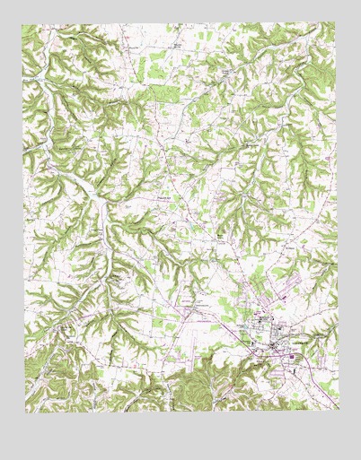
Lafayette, TN USGS Topographic Map
Click on map above to begin viewing in our Map Viewer.

This topographic map contains these locations and features:
Feature Name Type Latitude Longitude GNIS ID View Map
Bass Brockett CemeteryCemeteryN36.5419°W86.0889°2084465View Map
Bradley CemeteryCemeteryN36.5255°W86.0192°2084462View Map
BrattontownPopulated PlaceN36.5331°W86.0569°1305402View Map
Central SchoolSchoolN36.5312°W86.0330°1316333View Map
Chamberlain - Carter CemeteryCemeteryN36.5205°W86.0225°2084495View Map
City of LafayetteCivilN36.5243°W86.0316°2404852View Map
Clifty CreekStreamN36.5873°W86.1155°1280736View Map
Cold SpringSpringN36.5850°W86.1042°1280894View Map
Cold Spring HollowValleyN36.5878°W86.1141°1280902View Map
Cold Springs CemeteryCemeteryN36.5833°W86.1033°2084505View Map
Commissioner District 10CivilN36.5281°W86.0378°2464316View Map
Commissioner District 13CivilN36.5472°W86.0556°2464373View Map
Commissioner District 14CivilN36.5254°W86.0272°2464381View Map
Commissioner District 16CivilN36.5317°W86.0756°2464395View Map
Commissioner District 17CivilN36.5501°W86.0254°2464402View Map
Commissioner District 18CivilN36.5264°W86.0073°2464409View Map
Commissioner District 8CivilN36.5935°W86.0626°2464687View Map
Commissioner District 9CivilN36.5472°W86.0333°2464733View Map
Copeland HollowValleyN36.5765°W86.1103°1281250View Map
Crowder CemeteryCemeteryN36.5353°W86.0558°1281746View Map
David Blankenship CemeteryCemeteryN36.5836°W86.0208°2084461View Map
Dick HollowValleyN36.5424°W86.0928°1282427View Map
Doctor HollowValleyN36.5680°W86.0923°1282548View Map
Doss HollowValleyN36.5516°W86.0919°1282664View Map
Draper CemeteryCemeteryN36.5664°W86.0839°1282783View Map
Drurys CemeteryCemeteryN36.5062°W86.0689°1282817View Map
Elijah Adams CemeteryCemeteryN36.5328°W86.1056°2084364View Map
Fairlane Elementary SchoolSchoolN36.5217°W86.0339°1648321View Map
Fishburn CemeteryCemeteryN36.5964°W86.0419°1284309View Map
Fishburn HollowValleyN36.5595°W86.0838°1284310View Map
Fletcher Cliburn CemeteryCemeteryN36.5884°W86.1153°1280712View Map
Freeman CemeteryCemeteryN36.5403°W86.0408°2084528View Map
Galbraith - Meador CemeteryCemeteryN36.5092°W86.0294°2084530View Map
Gap of the RidgePopulated PlaceN36.5267°W86.1111°1285139View Map
Green ValleyPopulated PlaceN36.6098°W86.0403°1315153View Map
Haley CemeteryCemeteryN36.5022°W86.0097°2084533View Map
Harper CemeteryCemeteryN36.6020°W86.1053°1286916View Map
HaysvillePopulated PlaceN36.6167°W86.0833°1287250View Map
Haysville School (historical)SchoolN36.6175°W86.0828°1320133View Map
Haysville United Methodist ChurchChurchN36.6173°W86.0842°1644067View Map
Holland - Cothron CemeteryCemeteryN36.5267°W86.0461°2084537View Map
Hughes CemeteryCemeteryN36.5464°W86.1214°2084547View Map
J M Marshall CemeteryCemeteryN36.5297°W86.0544°2084569View Map
Jent CemeteryCemeteryN36.5909°W86.0514°1289389View Map
Jesse West CemeteryCemeteryN36.5192°W86.0258°1274145View Map
Joe Wilson Meador CemeteryCemeteryN36.5130°W86.0153°2084575View Map
Johns CreekStreamN36.5628°W86.0919°1289513View Map
Jonas Meador CemeteryCemeteryN36.5634°W86.0975°1293481View Map
Jones Family CemeteryCemeteryN36.5050°W86.0697°2084550View Map
Joseph Harrison White CemeteryCemeteryN36.5500°W86.0711°1274360View Map
Keystone SchoolSchoolN36.5237°W86.1083°1290135View Map
King CemeteryCemeteryN36.5798°W86.0380°1290214View Map
King CemeteryCemeteryN36.5828°W86.0616°1290215View Map
King CemeteryCemeteryN36.5838°W86.0201°2084551View Map
LafayettePopulated PlaceN36.5212°W86.0264°1290467View Map
Lafayette City CemeteryCemeteryN36.5217°W86.0200°2084554View Map
Lafayette City HallBuildingN36.5217°W86.0244°1316342View Map
Lafayette Division (historical)CensusN36.5331°W86.0300°1648850View Map
Lafayette Fire DepartmentBuildingN36.5201°W86.0197°2654482View Map
Lafayette First Baptist ChurchChurchN36.5228°W86.0330°1644068View Map
Lafayette Industrial ParkLocaleN36.5362°W86.0208°1316343View Map
Lafayette Municipal AirportAirportN36.5184°W86.0583°1301433View Map
Lafayette Police DepartmentBuildingN36.5212°W86.0245°2765953View Map
Lafayette Post OfficePost OfficeN36.5236°W86.0377°1650408View Map
Lick BranchStreamN36.5923°W86.0214°1291189View Map
Little Puncheon CreekStreamN36.6201°W86.0116°1291630View Map
Livingston - Adams CemeteryCemeteryN36.5228°W86.1075°2084556View Map
Long CreekPopulated PlaceN36.5573°W86.0930°1315431View Map
Long Creek Baptist ChurchChurchN36.5570°W86.0944°1644071View Map
Long Creek CemeteryCemeteryN36.5575°W86.0908°2084557View Map
Lyles CemeteryCemeteryN36.6164°W86.1069°1292328View Map
Macon CountyCivilN36.5320°W86.0073°1639768View Map
Macon County CourthouseBuildingN36.5206°W86.0258°1316345View Map
Macon County EMSBuildingN36.5186°W86.0322°2697424View Map
Macon County General HospitalHospitalN36.5195°W86.0263°1316353View Map
Macon County Golf CourseLocaleN36.5359°W86.0611°1316346View Map
Macon County High SchoolSchoolN36.5287°W86.0311°1316347View Map
Macon County ParkParkN36.5167°W86.0172°1292462View Map
Macon County Sheriff's OfficeBuildingN36.5015°W86.0027°2765841View Map
Malden BranchStreamN36.6075°W86.1178°1292524View Map
Maple GrovePopulated PlaceN36.5551°W86.0483°1292618View Map
Maple Grove CemeteryCemeteryN36.5517°W86.0491°1292619View Map
Maple Grove School (historical)SchoolN36.5551°W86.0475°1320135View Map
Marshall - Selley CemeteryCemeteryN36.5228°W86.0261°2084570View Map
McCrary CemeteryCemeteryN36.5130°W86.0069°2084562View Map
Meador - Ferguson CemeteryCemeteryN36.5039°W86.0267°2084572View Map
Meetinghouse HollowValleyN36.5555°W86.0932°1293548View Map
Mooningham - White - Robertson CemeteryCemeteryN36.5150°W86.0933°2084581View Map
Mooningham BranchStreamN36.5270°W86.0867°1294235View Map
Negro HollowValleyN36.6225°W86.1114°1295343View Map
New Bethel CemeteryCemeteryN36.5425°W86.0908°2084584View Map
New Bethel ChurchChurchN36.5428°W86.0908°1295441View Map
Nunley HollowValleyN36.5992°W86.0200°1296018View Map
OakdalePopulated PlaceN36.5645°W86.1225°1315631View Map
Oakdale ChurchChurchN36.5645°W86.1219°1644075View Map
Oakdale School (historical)SchoolN36.5639°W86.1219°1644076View Map
Pirtle CemeteryCemeteryN36.5642°W86.0194°1298709View Map
Pleasant HillPopulated PlaceN36.5684°W86.0719°1297847View Map
Roark CemeteryCemeteryN36.5178°W86.0339°1299579View Map
Sanders CemeteryCemeteryN36.5342°W86.0800°1300694View Map
Shoemake HollowValleyN36.6028°W86.1128°1270146View Map
Speakman HollowValleyN36.6028°W86.0150°1270963View Map
Spring CreekStreamN36.5887°W86.0278°1271073View Map
Spring Creek ChurchChurchN36.5859°W86.0361°1303761View Map
Stratton BranchStreamN36.5714°W86.0997°1271577View Map
Sulphur Spring HollowValleyN36.5122°W86.0385°1271815View Map
Testament Baptist ChurchChurchN36.5231°W86.1080°1644083View Map
Threefork HollowValleyN36.5708°W86.0958°1272586View Map
Vester Crowder CemeteryCemeteryN36.5353°W86.0567°2084516View Map
Walden CemeteryCemeteryN36.5759°W86.0586°1273547View Map
WEEN-AM (Lafayette)TowerN36.5351°W86.0075°1639999View Map
Wesley Crowder CemeteryCemeteryN36.5838°W86.0201°2084517View Map
West Fork Long CreekStreamN36.6075°W86.1183°1274182View Map
Wheeler SpringSpringN36.6175°W86.0639°1274293View Map
Wildcat HollowValleyN36.6213°W86.1028°1274550View Map
WilliamsPopulated PlaceN36.5531°W86.0208°1274623View Map
Williams School (historical)SchoolN36.5537°W86.0203°1320142View Map
Wiseman HollowValleyN36.5319°W86.0910°1274907View Map

Note: Coordinates in the location and feature list above are referenced to NAD83 datum.


Copyright (C) 2008-2024 Ryan Niemi / Sunset Dynamics ... All Rights Reserved