TopoQuest Logo
Do you find TopoQuest useful?
Help keep TopoQuest running and adding new maps/features by donating!
Bitcoin:  19c7KJd3qBynnjoSw5npx9KScwjBe4ifkT
Litecoin:  LXs6TkuXGGXo1vDsWCkWVdjQX94eUKd6ui
Home View Maps Find Maps Find Places Resources & Links


Lafayette, Illinois Topographic Map

USGS Map Title: Lafayette, IL
USGS Map MRC: 41089A8
DRG (GeoTIFF) Download: o41089a8.tif


Neighboring USGS Topographic Map Quads:


  Galva, IL  
41090B1
 

  Kewanee South, IL  
41089B8
 

  Elmira, IL  
41089B7
 

  Victoria, IL  
41090A1
 

  Lafayette, IL  
41089A8
 

  Wyoming, IL  
41089A7
 

  Williamsfield, IL  
40090H1
 

  Laura, IL  
40089H8
 

  Princeville, IL  
40089H7


Map MRC Location:

N42°
W90°
N42°
W89°
H8 H7 H6 H5 H4 H3 H2 H1
G8 G7 G6 G5 G4 G3 G2 G1
F8 F7 F6 F5 F4 F3 F2 F1
E8 E7 E6 E5 E4 E3 E2 E1
D8 D7 D6 D5 D4 D3 D2 D1
C8 C7 C6 C5 C4 C3 C2 C1
B8 B7 B6 B5 B4 B3 B2 B1
A8 A7 A6 A5 A4 A3 A2 A1
N41°
W90°
N41°
W89°

Lafayette, IL USGS 1:24K Topographic Map Preview:
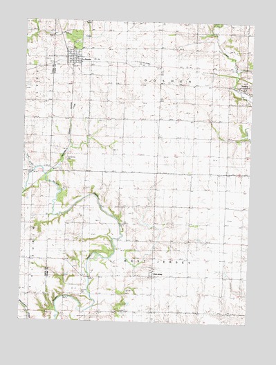
Lafayette, IL USGS Topographic Map
Click on map above to begin viewing in our Map Viewer.

This topographic map contains these locations and features:
Feature Name Type Latitude Longitude GNIS ID View Map
Bumble Bee School (historical)SchoolN41.0400°W89.9646°405185View Map
Fitch CreekStreamN41.0631°W89.9932°408409View Map
Goshen School (historical)SchoolN41.1064°W89.9259°409206View Map
Hamilton School (historical)SchoolN41.0625°W89.8782°409698View Map
Hickory Grove School (historical)SchoolN41.0467°W89.9432°410161View Map
LafayettePopulated PlaceN41.1081°W89.9715°411684View Map
LaFayette CemeteryCemeteryN41.1064°W89.9837°1866782View Map
Lafayette Fire DepartmentBuildingN41.1104°W89.9723°2640933View Map
Lawndale School (historical)SchoolN41.0911°W89.8976°411865View Map
Mason CreekStreamN41.0623°W89.9840°413100View Map
McClenahan CemeteryCemeteryN41.0675°W89.9763°413201View Map
Morgan - Richey Jersey FarmLocaleN41.0983°W89.9153°2628340View Map
Nicholson School (historical)SchoolN41.1211°W89.8787°414515View Map
Pleasant View School (historical)SchoolN41.0189°W89.8896°415940View Map
Quinn School (historical)SchoolN41.0761°W89.9265°416322View Map
Shockley CemeteryCemeteryN41.0122°W89.9658°418449View Map
Township of GoshenCivilN41.1058°W89.9267°429063View Map
Township of West JerseyCivilN41.0186°W89.9272°429918View Map
Village of La FayetteCivilN41.1096°W89.9735°2398364View Map
Vinegar Hill School (historical)SchoolN41.0325°W89.9087°420322View Map
West JerseyPopulated PlaceN41.0189°W89.9271°420857View Map
West Jersey Methodist ChurchyardCemeteryN41.0214°W89.9284°1866786View Map
Winans School (historical)SchoolN41.0836°W89.9648°421312View Map

Note: Coordinates in the location and feature list above are referenced to NAD83 datum.


Copyright (C) 2008-2024 Ryan Niemi / Sunset Dynamics ... All Rights Reserved