TopoQuest Logo
Do you find TopoQuest useful?
Help keep TopoQuest running and adding new maps/features by donating!
Bitcoin:  19c7KJd3qBynnjoSw5npx9KScwjBe4ifkT
Litecoin:  LXs6TkuXGGXo1vDsWCkWVdjQX94eUKd6ui
Home View Maps Find Maps Find Places Resources & Links


Ladner SE, South Dakota Topographic Map

USGS Map Title: Ladner SE, SD
USGS Map MRC: 45103G5
DRG (GeoTIFF) Download: o45103g5.tif


Neighboring USGS Topographic Map Quads:


  Table Mountain, SD  
45103H6
 

  Ladner NE, SD  
45103H5
 

  Eagles Nest Butte, SD  
45103H4
 

  Ladner, SD  
45103G6
 

  Ladner SE, SD  
45103G5
 

  Ludlow, SD  
45103G4
 

  Lahti Butte, SD  
45103F6
 

  McKenzie Butte, SD  
45103F5
 

  Hay Creek, SD  
45103F4


Map MRC Location:

N46°
W104°
N46°
W103°
H8 H7 H6 H5 H4 H3 H2 H1
G8 G7 G6 G5 G4 G3 G2 G1
F8 F7 F6 F5 F4 F3 F2 F1
E8 E7 E6 E5 E4 E3 E2 E1
D8 D7 D6 D5 D4 D3 D2 D1
C8 C7 C6 C5 C4 C3 C2 C1
B8 B7 B6 B5 B4 B3 B2 B1
A8 A7 A6 A5 A4 A3 A2 A1
N45°
W104°
N45°
W103°

Ladner SE, SD USGS 1:24K Topographic Map Preview:
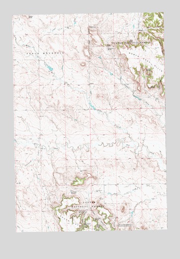
Ladner SE, SD USGS Topographic Map
Click on map above to begin viewing in our Map Viewer.

This topographic map contains these locations and features:
Feature Name Type Latitude Longitude GNIS ID View Map
Alice SpringSpringN45.8590°W103.5263°1253613View Map
Castle RockPillarN45.8672°W103.5619°1254269View Map
Cottonwood CreekStreamN45.7981°W103.6032°1254485View Map
Craig PassGapN45.8561°W103.5480°1254530View Map
Craig Pass SpringSpringN45.8553°W103.5470°1254531View Map
Devils CanyonValleyN45.8593°W103.5039°1254675View Map
Dry Creek ReservoirReservoirN45.7731°W103.5795°1254765View Map
Dry Creek SpringSpringN45.7571°W103.5603°1254766View Map
East Clarkson WellWellN45.7728°W103.5591°1254829View Map
Ewing County (historical)CivilN45.8417°W103.5005°1265801View Map
Icebox CanyonValleyN45.8297°W103.5073°1255731View Map
J B Clarkson Spring Number TwoSpringN45.7537°W103.5699°1255796View Map
J C SpringSpringN45.7689°W103.5562°1255799View Map
J Clarkson RanchLocaleN45.8000°W103.6032°1259372View Map
Johnny Pocket Spring Number OneSpringN45.7526°W103.5417°1255850View Map
Johnny Pocket Spring Number TwoSpringN45.7529°W103.5417°1255851View Map
Johnnys PocketBasinN45.7553°W103.5435°1255852View Map
Lane CanyonValleyN45.7624°W103.5665°1256053View Map
M Clarkson RanchLocaleN45.8667°W103.5227°1259373View Map
Middle CreekStreamN45.7992°W103.5266°1253577View Map
North Bull CreekStreamN45.8011°W103.6216°1256733View Map
North Clarkson WellWellN45.7847°W103.5719°1256737View Map
Peterson CanyonValleyN45.7698°W103.5652°1257023View Map
Sawmill CanyonValleyN45.8661°W103.5187°1257819View Map
Schleichart DrawValleyN45.8157°W103.5049°1257834View Map
South Bull CreekStreamN45.8011°W103.6216°1258168View Map
Timber CanyonValleyN45.7554°W103.5554°1258553View Map
Travers SpringSpringN45.8420°W103.5159°1258597View Map
Travers Spring Number OneSpringN45.8324°W103.5085°1258598View Map
W J Johnson RanchLocaleN45.7708°W103.5213°1259367View Map

Note: Coordinates in the location and feature list above are referenced to NAD83 datum.


Copyright (C) 2008-2024 Ryan Niemi / Sunset Dynamics ... All Rights Reserved