TopoQuest Logo
Do you find TopoQuest useful?
Help keep TopoQuest running and adding new maps/features by donating!
Bitcoin:  19c7KJd3qBynnjoSw5npx9KScwjBe4ifkT
Litecoin:  LXs6TkuXGGXo1vDsWCkWVdjQX94eUKd6ui
Home View Maps Find Maps Find Places Resources & Links


La Union, New Mexico Topographic Map

USGS Map Title: La Union, NM
USGS Map MRC: 31106H6
DRG (GeoTIFF) Download: o31106h6.tif


Neighboring USGS Topographic Map Quads:


  Little Black Mountain, NM  
32106A7
 

  La Mesa, NM  
32106A6
 

  Anthony, NM  
32106A5
 

  Lanark, NM  
31106H7
 

  La Union, NM  
31106H6
 

  Canutillo, TX  
31106H5
 

  Noria, NM  
31106G7
 

  Strauss, NM  
31106G6
 

  Smeltertown, TX  
31106G5


Map MRC Location:

N32°
W107°
N32°
W106°
H8 H7 H6 H5 H4 H3 H2 H1
G8 G7 G6 G5 G4 G3 G2 G1
F8 F7 F6 F5 F4 F3 F2 F1
E8 E7 E6 E5 E4 E3 E2 E1
D8 D7 D6 D5 D4 D3 D2 D1
C8 C7 C6 C5 C4 C3 C2 C1
B8 B7 B6 B5 B4 B3 B2 B1
A8 A7 A6 A5 A4 A3 A2 A1
N31°
W107°
N31°
W106°

La Union, NM USGS 1:24K Topographic Map Preview:
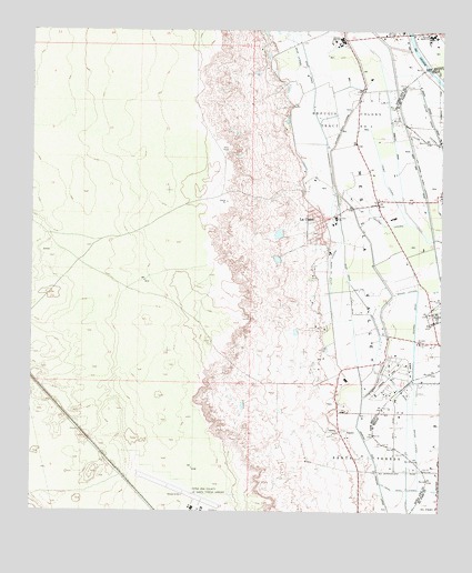
La Union, NM USGS Topographic Map
Click on map above to begin viewing in our Map Viewer.

This topographic map contains these locations and features:
Feature Name Type Latitude Longitude GNIS ID View Map
10128 Water WellWellN31.9912°W106.6367°918925View Map
10129 Water WellWellN31.9884°W106.6542°918924View Map
10130 Water WellWellN31.9770°W106.6742°918923View Map
10131 Water WellWellN31.9765°W106.6742°918922View Map
10135 Water WellWellN31.9443°W106.6350°919470View Map
10139 Water WellWellN31.8884°W106.6458°919585View Map
10162 Water WellWellN31.8773°W106.6569°919584View Map
Baker LateralCanalN31.9112°W106.6336°886005View Map
Baker LateralCanalN31.8940°W106.6330°1351435View Map
Central DrainCanalN31.9259°W106.6330°887382View Map
Central LateralCanalN31.9495°W106.6417°887386View Map
Central SchoolSchoolN31.9190°W106.6328°887387View Map
Cielo Dorado Estates AirportAirportN31.9118°W106.6393°2717073View Map
Dona Ana County Airport at Santa TeresaAirportN31.8770°W106.6930°937021View Map
Gadsden High SchoolSchoolN31.9982°W106.6572°934218View Map
Gadsden Junior and Senior High SchoolSchoolN31.9982°W106.6572°889276View Map
Gadsden Junior High SchoolSchoolN31.9982°W106.6572°934219View Map
La UnionPopulated PlaceN31.9507°W106.6617°920626View Map
La Union Census Designated PlaceCensusN31.9508°W106.6621°2584137View Map
La Union East LateralCanalN31.9548°W106.6297°890841View Map
La Union Fire DepartmentBuildingN31.9481°W106.6652°2657834View Map
La Union Test Water WellWellN31.9557°W106.6994°919441View Map
La Union ViejaPopulated PlaceN31.9409°W106.6694°929284View Map
La Union West LateralCanalN31.8809°W106.6283°1374426View Map
La Union West LateralCanalN31.9698°W106.6592°890843View Map
Little La Union LateralCanalN31.9384°W106.6597°891153View Map
NM 4903-907 Water WellWellN31.9007°W106.6505°919452View Map
NM 4903611 Water WellWellN31.9532°W106.6292°919360View Map
NM 4903614 Water WellWellN31.9251°W106.6430°919445View Map
NM4903307 Water WellWellN31.9957°W106.6544°919436View Map
Q 111 Water WellWellN31.8940°W106.6333°919449View Map
Q 46 Water WellWellN31.9743°W106.6500°919362View Map
Q 9 Water WellWellN31.9920°W106.6394°919435View Map
Q-1 Water WellWellN31.9976°W106.6614°919438View Map
Q-100 Water WellWellN31.9201°W106.6589°919355View Map
Q-101 Water WellWellN31.9148°W106.6617°919353View Map
Q-103 Water WellWellN31.9145°W106.6511°919453View Map
Q-141 Water WellWellN31.8762°W106.6417°919352View Map
Q-164 Water WellWellN31.9862°W106.6542°919365View Map
Q-184 Water WellWellN31.9209°W106.6583°919356View Map
Q-41 Water WellWellN31.9754°W106.6367°919363View Map
Q-42 Water WellWellN31.9784°W106.6378°919364View Map
Q-48 Water WellWellN31.9673°W106.6428°919361View Map
Q-55 Water WellWellN31.9365°W106.6444°919448View Map
Q-59 Water WellWellN31.9526°W106.6603°919359View Map
Q-6 Water WellWellN31.9968°W106.6569°919437View Map
Q-96 Water WellWellN31.9318°W106.6394°919447View Map
Q-98 Water WellWellN31.9251°W106.6522°919446View Map
Saint Lukes ChurchChurchN31.9187°W106.6319°894279View Map
T-7 Water WellWellN31.8968°W106.6555°919451View Map
Talbot LateralCanalN31.9632°W106.6439°895492View Map
West DrainCanalN31.9376°W106.6547°896355View Map
X-7 Water WellWellN31.8965°W106.6472°919450View Map

Note: Coordinates in the location and feature list above are referenced to NAD83 datum.


Copyright (C) 2008-2024 Ryan Niemi / Sunset Dynamics ... All Rights Reserved