TopoQuest Logo
Do you find TopoQuest useful?
Help keep TopoQuest running and adding new maps/features by donating!
Bitcoin:  19c7KJd3qBynnjoSw5npx9KScwjBe4ifkT
Litecoin:  LXs6TkuXGGXo1vDsWCkWVdjQX94eUKd6ui
Home View Maps Find Maps Find Places Resources & Links


La Rue, Ohio Topographic Map

USGS Map Title: La Rue, OH
USGS Map MRC: 40083E4
DRG (GeoTIFF) Download: o40083e4.tif


Neighboring USGS Topographic Map Quads:


  Kenton, OH  
40083F5
 

  Marseilles, OH  
40083F4
 

  Meeker, OH  
40083F3
 

  Mount Victory, OH  
40083E5
 

  La Rue, OH  
40083E4
 

  New Bloomington, OH  
40083E3
 

  West Mansfield, OH  
40083D5
 

  York Center, OH  
40083D4
 

  Richwood, OH  
40083D3


Map MRC Location:

N41°
W84°
N41°
W83°
H8 H7 H6 H5 H4 H3 H2 H1
G8 G7 G6 G5 G4 G3 G2 G1
F8 F7 F6 F5 F4 F3 F2 F1
E8 E7 E6 E5 E4 E3 E2 E1
D8 D7 D6 D5 D4 D3 D2 D1
C8 C7 C6 C5 C4 C3 C2 C1
B8 B7 B6 B5 B4 B3 B2 B1
A8 A7 A6 A5 A4 A3 A2 A1
N40°
W84°
N40°
W83°

La Rue, OH USGS 1:24K Topographic Map Preview:
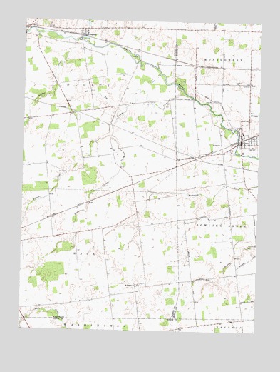
La Rue, OH USGS Topographic Map
Click on map above to begin viewing in our Map Viewer.

This topographic map contains these locations and features:
Feature Name Type Latitude Longitude GNIS ID View Map
Allen School (historical)SchoolN40.5467°W83.3894°1049627View Map
Ash RunStreamN40.5909°W83.4452°1037513View Map
Bonner CemeteryCemeteryN40.5759°W83.3949°1038191View Map
Crandall CemeteryCemeteryN40.6009°W83.3877°1039446View Map
Elgin West Elementary SchoolSchoolN40.5803°W83.3835°1049630View Map
Fairview School (historical)SchoolN40.6064°W83.4099°1049629View Map
Fisher CemeteryCemeteryN40.5709°W83.4663°1040465View Map
Hampton School (historical)SchoolN40.5528°W83.4849°1055427View Map
HepburnPopulated PlaceN40.6214°W83.4696°1048832View Map
Hepburn Post Office (historical)Post OfficeN40.6209°W83.4694°1992743View Map
La RuePopulated PlaceN40.5764°W83.3846°1058187View Map
La Rue Post OfficePost OfficeN40.5767°W83.3849°2035964View Map
La Rue United Methodist ChurchChurchN40.5784°W83.3841°1079563View Map
LaRue CemeteryCemeteryN40.5992°W83.3785°1042359View Map
Lee CemeteryCemeteryN40.6226°W83.4877°1042473View Map
Lenox School (historical)SchoolN40.5709°W83.4063°1049628View Map
Linwood School (historical)SchoolN40.5451°W83.4180°1055442View Map
Marshs (historical)Populated PlaceN40.5589°W83.4416°1060671View Map
McDonald School (historical)SchoolN40.5409°W83.4574°1055447View Map
Montgomery CemeteryCemeteryN40.6221°W83.4093°1043456View Map
Montgomery Methodist Episcopal Church (historical)ChurchN40.6220°W83.4091°1071763View Map
Mount Pleasant CemeteryCemeteryN40.5184°W83.4385°1700964View Map
Mount Pleasant Church of GodChurchN40.5184°W83.4388°1060782View Map
Myres CemeteryCemeteryN40.5998°W83.3802°1043765View Map
North Wildcat CreekStreamN40.5787°W83.4527°1055452View Map
Panther CreekStreamN40.6164°W83.4727°1066133View Map
PfeifferPopulated PlaceN40.6223°W83.4977°1065486View Map
Pfeiffer Post Office (historical)Post OfficeN40.6223°W83.4971°1992753View Map
Pleasant Grove School (historical)SchoolN40.5634°W83.4333°1055459View Map
Pleasant Hill School (historical)SchoolN40.5981°W83.4824°1055460View Map
Pleasant Hill School (historical)SchoolN40.5209°W83.4085°1049625View Map
Rush Creek School (historical)SchoolN40.5089°W83.4988°1055470View Map
Saint Joseph Catholic ChurchChurchN40.5795°W83.3846°1073209View Map
Schertzger School (historical)SchoolN40.5148°W83.4438°1055473View Map
Scioto Valley Fire DepartmentBuildingN40.5775°W83.3854°2550037View Map
South Wildcat CreekStreamN40.5789°W83.4527°1066217View Map
Stahl School (historical)SchoolN40.5034°W83.3960°1055652View Map
Stofcheck Ambulance ServiceBuildingN40.5747°W83.3844°2550725View Map
Township of DudleyCivilN40.5998°W83.4787°1086259View Map
Vesey CemeteryCemeteryN40.5928°W83.3994°1047444View Map
Village of La RueCivilN40.5781°W83.3821°2398370View Map
Virden CemeteryCemeteryN40.6199°W83.3989°1047466View Map
Wildcat CreekStreamN40.5964°W83.4144°1066261View Map
Windfall School (historical)SchoolN40.5228°W83.3858°1049626View Map
Winnemac (historical)Populated PlaceN40.5742°W83.3899°1071772View Map

Note: Coordinates in the location and feature list above are referenced to NAD83 datum.


Copyright (C) 2008-2024 Ryan Niemi / Sunset Dynamics ... All Rights Reserved