TopoQuest Logo
Do you find TopoQuest useful?
Help keep TopoQuest running and adding new maps/features by donating!
Bitcoin:  19c7KJd3qBynnjoSw5npx9KScwjBe4ifkT
Litecoin:  LXs6TkuXGGXo1vDsWCkWVdjQX94eUKd6ui
Home View Maps Find Maps Find Places Resources & Links


La Paz, Indiana Topographic Map

USGS Map Title: La Paz, IN
USGS Map MRC: 41086D3
DRG (GeoTIFF) Download: o41086d3.tif


Neighboring USGS Topographic Map Quads:


  North Liberty, IN  
41086E4
 

  Lakeville, IN  
41086E3
 

  Wyatt, IN  
41086E2
 

  Walkerton, IN  
41086D4
 

  La Paz, IN  
41086D3
 

  Bremen, IN  
41086D2
 

  Donaldson, IN  
41086C4
 

  Plymouth, IN  
41086C3
 

  Inwood, IN  
41086C2


Map MRC Location:

N42°
W87°
N42°
W86°
H8 H7 H6 H5 H4 H3 H2 H1
G8 G7 G6 G5 G4 G3 G2 G1
F8 F7 F6 F5 F4 F3 F2 F1
E8 E7 E6 E5 E4 E3 E2 E1
D8 D7 D6 D5 D4 D3 D2 D1
C8 C7 C6 C5 C4 C3 C2 C1
B8 B7 B6 B5 B4 B3 B2 B1
A8 A7 A6 A5 A4 A3 A2 A1
N41°
W87°
N41°
W86°

La Paz, IN USGS 1:24K Topographic Map Preview:
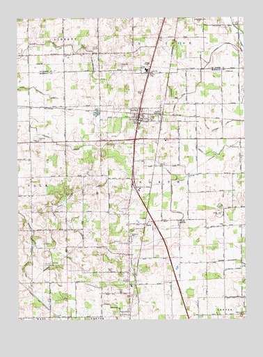
La Paz, IN USGS Topographic Map
Click on map above to begin viewing in our Map Viewer.

This topographic map contains these locations and features:
Feature Name Type Latitude Longitude GNIS ID View Map
Angus FarmLocaleN41.3753°W86.3594°2708887View Map
Birkey Private AirportAirportN41.4464°W86.2732°2676922View Map
Cashen FarmsLocaleN41.4336°W86.3344°2708889View Map
Center ChurchChurchN41.4489°W86.3639°432327View Map
County Line ChurchChurchN41.4775°W86.3014°452576View Map
Davenport FarmsLocaleN41.4639°W86.3378°2708902View Map
Elmer Seltenright DitchCanalN41.4084°W86.2967°434128View Map
Emma Mishler DitchCanalN41.3956°W86.3728°434170View Map
Fair CemeteryCemeteryN41.4875°W86.3328°452596View Map
Fairmount CemeteryCemeteryN41.4106°W86.3133°434307View Map
HarrisPopulated PlaceN41.4148°W86.3036°435776View Map
Harris ArmCanalN41.3859°W86.2581°435777View Map
Highway AcresLocaleN41.4464°W86.2731°2708918View Map
Jesse McKesson DitchCanalN41.4709°W86.3697°437001View Map
La PazPopulated PlaceN41.4598°W86.3083°437489View Map
La Paz - North Township Volunteer Fire DepartmentBuildingN41.4560°W86.3080°2625570View Map
La Paz JunctionPopulated PlaceN41.4595°W86.2950°437490View Map
Lapaz Elementary SchoolSchoolN41.4562°W86.3083°447124View Map
Laville Junior-Senior High SchoolSchoolN41.4789°W86.3042°452651View Map
Lehman DitchCanalN41.4773°W86.2736°437756View Map
LinkvillePopulated PlaceN41.4162°W86.2870°437961View Map
Mangun ArmCanalN41.4670°W86.2903°438513View Map
Martin DitchCanalN41.4459°W86.2569°438673View Map
Mount Zion CemeteryCemeteryN41.4767°W86.3020°439739View Map
Nighthart CemeteryCemeteryN41.3770°W86.2519°440175View Map
Oliver Heckaman DitchCanalN41.4770°W86.3333°452720View Map
Pine CreekStreamN41.4325°W86.3258°452730View Map
Pine Creek ChurchChurchN41.4848°W86.3489°452731View Map
Sherk FieldAirportN41.4269°W86.3150°2677051View Map
Shiloh ChurchChurchN41.4139°W86.2619°443405View Map
Town of La PazCivilN41.4561°W86.3081°2396700View Map
Township of NorthCivilN41.4277°W86.2927°453678View Map
William Forsythe DitchCanalN41.4573°W86.2533°446052View Map

Note: Coordinates in the location and feature list above are referenced to NAD83 datum.


Copyright (C) 2008-2024 Ryan Niemi / Sunset Dynamics ... All Rights Reserved