TopoQuest Logo
Do you find TopoQuest useful?
Help keep TopoQuest running and adding new maps/features by donating!
Bitcoin:  19c7KJd3qBynnjoSw5npx9KScwjBe4ifkT
Litecoin:  LXs6TkuXGGXo1vDsWCkWVdjQX94eUKd6ui
Home View Maps Find Maps Find Places Resources & Links


La Hogue, Illinois Topographic Map

USGS Map Title: La Hogue, IL
USGS Map MRC: 40088G1
DRG (GeoTIFF) Download: o40088g1.tif


Neighboring USGS Topographic Map Quads:


  Cabery, IL  
40088H2
 

  Piper City NE, IL  
40088H1
 

  Clifton, IL  
40087H8
 

  Piper City, IL  
40088G2
 

  La Hogue, IL  
40088G1
 

  Gilman, IL  
40087G8
 

  Buckley NW, IL  
40088F2
 

  Onarga West, IL  
40088F1
 

  Onarga East, IL  
40087F8


Map MRC Location:

N41°
W89°
N41°
W88°
H8 H7 H6 H5 H4 H3 H2 H1
G8 G7 G6 G5 G4 G3 G2 G1
F8 F7 F6 F5 F4 F3 F2 F1
E8 E7 E6 E5 E4 E3 E2 E1
D8 D7 D6 D5 D4 D3 D2 D1
C8 C7 C6 C5 C4 C3 C2 C1
B8 B7 B6 B5 B4 B3 B2 B1
A8 A7 A6 A5 A4 A3 A2 A1
N40°
W89°
N40°
W88°

La Hogue, IL USGS 1:24K Topographic Map Preview:
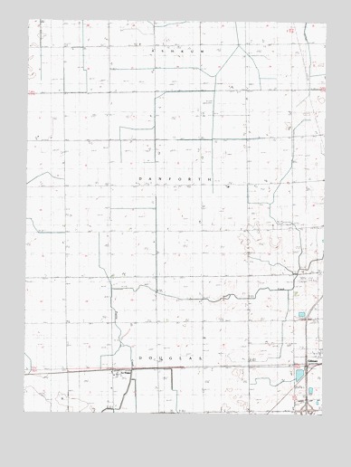
La Hogue, IL USGS Topographic Map
Click on map above to begin viewing in our Map Viewer.

This topographic map contains these locations and features:
Feature Name Type Latitude Longitude GNIS ID View Map
Brinkman School (historical)SchoolN40.8670°W88.1109°404873View Map
Classen FarmsLocaleN40.8350°W88.0339°2740929View Map
Classen School (historical)SchoolN40.8384°W88.0325°406182View Map
Cleary School (historical)SchoolN40.8673°W88.0337°406235View Map
Demoure School (historical)SchoolN40.8370°W88.1087°407114View Map
Fraily FarmsLocaleN40.8228°W88.1186°2740927View Map
Fruin School (historical)SchoolN40.8675°W88.0728°408780View Map
Hopewell School (historical)SchoolN40.7798°W88.0320°410528View Map
Interchange 283CrossingN40.7514°W88.0067°1815562View Map
Kafer FarmsLocaleN40.7667°W88.0675°2741014View Map
Kerns School (historical)SchoolN40.8084°W88.0320°411427View Map
Kidd School (historical)SchoolN40.8375°W88.0709°411456View Map
Kuiper Landing Strip (historical)AirportN40.7931°W88.0070°1719358View Map
La HoguePopulated PlaceN40.7634°W88.0881°411656View Map
Lahogue Post Office (historical)Post OfficeN40.7631°W88.0881°1815574View Map
Lee School (historical)SchoolN40.8070°W88.1081°411913View Map
Paradise FarmsLocaleN40.8339°W88.0533°2741020View Map
Perzee FarmLocaleN40.7944°W88.0689°2740925View Map
Shule School (historical)SchoolN40.8081°W88.0720°418481View Map
Township of DanforthCivilN40.8247°W88.0057°428871View Map
Township of DouglasCivilN40.7700°W88.0040°428907View Map
Triple K Single T FarmsLocaleN40.8225°W88.0286°2740931View Map
Wilken Airport (historical)AirportN40.8473°W88.0478°427198View Map
Zachgo FarmLocaleN40.8506°W88.0328°2740928View Map

Note: Coordinates in the location and feature list above are referenced to NAD83 datum.


Copyright (C) 2008-2024 Ryan Niemi / Sunset Dynamics ... All Rights Reserved