TopoQuest Logo
Do you find TopoQuest useful?
Help keep TopoQuest running and adding new maps/features by donating!
Bitcoin:  19c7KJd3qBynnjoSw5npx9KScwjBe4ifkT
Litecoin:  LXs6TkuXGGXo1vDsWCkWVdjQX94eUKd6ui
Home View Maps Find Maps Find Places Resources & Links


La Grange, California Topographic Map

USGS Map Title: La Grange, CA
USGS Map MRC: 37120F4
DRG (GeoTIFF) Download: o37120f4.tif


Neighboring USGS Topographic Map Quads:


  Keystone, CA  
37120G5
 

  Chinese Camp, CA  
37120G4
 

  Moccasin, CA  
37120G3
 

  Cooperstown, CA  
37120F5
 

  La Grange, CA  
37120F4
 

  Penon Blanco Peak, CA  
37120F3
 

  Turlock Lake, CA  
37120E5
 

  Snelling, CA  
37120E4
 

  Merced Falls, CA  
37120E3


Map MRC Location:

N38°
W121°
N38°
W120°
H8 H7 H6 H5 H4 H3 H2 H1
G8 G7 G6 G5 G4 G3 G2 G1
F8 F7 F6 F5 F4 F3 F2 F1
E8 E7 E6 E5 E4 E3 E2 E1
D8 D7 D6 D5 D4 D3 D2 D1
C8 C7 C6 C5 C4 C3 C2 C1
B8 B7 B6 B5 B4 B3 B2 B1
A8 A7 A6 A5 A4 A3 A2 A1
N37°
W121°
N37°
W120°

La Grange, CA USGS 1:24K Topographic Map Preview:
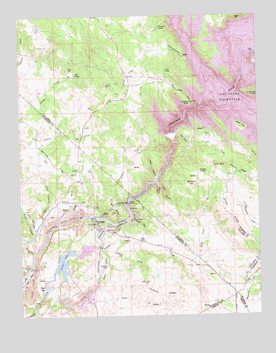
La Grange, CA USGS Topographic Map
Click on map above to begin viewing in our Map Viewer.

This topographic map contains these locations and features:
Feature Name Type Latitude Longitude GNIS ID View Map
Basso BridgeBridgeN37.6455°W120.4963°252006View Map
Beltz LakeLakeN37.6557°W120.4407°219017View Map
Ben Brow HillSummitN37.6791°W120.4107°219024View Map
Big CreekStreamN37.6908°W120.4230°219166View Map
Big Island (historical)IslandN37.7113°W120.3877°1655723View Map
Brush GulchValleyN37.7069°W120.4146°1655724View Map
Butcher Knife PocketValleyN37.7330°W120.4144°220271View Map
Buzzard PointCapeN37.7135°W120.4110°220318View Map
Cardoza LakeLakeN37.6459°W120.4562°220592View Map
Cardoza RidgeRidgeN37.6349°W120.4280°220593View Map
Corner School (historical)SchoolN37.7163°W120.4010°1655725View Map
Dawson LakeReservoirN37.6470°W120.4783°222064View Map
Dawson Lake 68-004 DamDamN37.6399°W120.4777°1663514View Map
Don Pedro Camp (historical)LocaleN37.7163°W120.4057°1655726View Map
Don Pedro Dam (historical)DamN37.7127°W120.4024°1655727View Map
Dunn CreekStreamN37.6458°W120.4099°222732View Map
Dunn RidgeRidgeN37.6666°W120.3907°222736View Map
Eagle Island (historical)IslandN37.7260°W120.4013°1655728View Map
Evans CreekStreamN37.6508°W120.4563°259986View Map
Floto LakeLakeN37.6370°W120.4876°223622View Map
Fortynine Mine (historical)MineN37.7352°W120.4080°1655729View Map
Frank Young GulchValleyN37.7099°W120.4094°1655730View Map
Freeze-Out SpringSpringN37.7458°W120.4266°223862View Map
French PitBasinN37.6599°W120.4605°223915View Map
Gasburg CreekStreamN37.6655°W120.4502°224090View Map
Gillman GulchValleyN37.7110°W120.4063°1655731View Map
Goodwin CreekStreamN37.6535°W120.4599°224317View Map
Indian HillSummitN37.6683°W120.4546°1658814View Map
Jenkins HillSummitN37.7169°W120.3757°1658856View Map
La GrangePopulated PlaceN37.6635°W120.4635°226726View Map
La Grange DamDamN37.6720°W120.4443°226727View Map
La Grange Elementary SchoolSchoolN37.6622°W120.4606°1817179View Map
La Grange PitMineN37.6683°W120.4606°2678215View Map
La Grange Post OfficePost OfficeN37.6617°W120.4612°1817180View Map
La Grange Regional ParkParkN37.6652°W120.4608°1817181View Map
La Grange ReservoirReservoirN37.6804°W120.4325°226728View Map
Laughlin RidgeRidgeN37.7035°W120.3857°226934View Map
Little Twin GulchValleyN37.6788°W120.4288°227394View Map
Lone GulchValleyN37.7108°W120.3957°217919View Map
Lower Dominici CreekStreamN37.6516°W120.4949°227766View Map
Lucas GulchValleyN37.6935°W120.3796°227809View Map
Lucky PointSummitN37.6866°W120.3966°1659025View Map
McDonald CreekStreamN37.6524°W120.4588°228342View Map
McNulty RidgeRidgeN37.6849°W120.3863°228442View Map
McNulty SpringSpringN37.6846°W120.4064°228444View Map
Mexican GulchValleyN37.7030°W120.4227°1655732View Map
Mill GulchValleyN37.6655°W120.4502°228714View Map
Mitchell MineMineN37.7291°W120.4741°228871View Map
Morgan GulchValleyN37.6652°W120.4446°229052View Map
Morton GulchValleyN37.6691°W120.4752°229097View Map
New Don Pedro DamDamN37.6994°W120.4209°229490View Map
Oak Hill MineMineN37.7210°W120.4563°229858View Map
Old La Grange SchoolhouseSchoolN37.6622°W120.4627°1817183View Map
Riley RidgeRidgeN37.6983°W120.4160°231586View Map
Saint Louis Catholic ChurchChurchN37.6627°W120.4616°1817197View Map
Salt SpringSpringN37.7251°W120.4695°232334View Map
Salt Spring CreekStreamN37.7238°W120.4710°233364View Map
Snake RavineValleyN37.6627°W120.4519°234747View Map
Stanislaus Consolidated Fire Protection District Station 35BuildingN37.6635°W120.4598°2623867View Map
Twin GulchValleyN37.6802°W120.4296°236690View Map
Twin GulchValleyN37.6819°W120.4302°236691View Map
Upper Dominici CreekStreamN37.6649°W120.4874°236882View Map
Vizard CreekStreamN37.6524°W120.4241°237119View Map

Note: Coordinates in the location and feature list above are referenced to NAD83 datum.


Copyright (C) 2008-2024 Ryan Niemi / Sunset Dynamics ... All Rights Reserved