TopoQuest Logo
Do you find TopoQuest useful?
Help keep TopoQuest running and adding new maps/features by donating!
Bitcoin:  19c7KJd3qBynnjoSw5npx9KScwjBe4ifkT
Litecoin:  LXs6TkuXGGXo1vDsWCkWVdjQX94eUKd6ui
Home View Maps Find Maps Find Places Resources & Links


Kyle Harrison Canyon, New Mexico Topographic Map

USGS Map Title: Kyle Harrison Canyon, NM
USGS Map MRC: 33105F3
DRG (GeoTIFF) Download: o33105f3.tif


Neighboring USGS Topographic Map Quads:


  Box Lake, NM  
33105G4
 

  Pedernal Arroyo, NM  
33105G3
 

  Huff Hill, NM  
33105G2
 

  Encinoso, NM  
33105F4
 

  Kyle Harrison Canyon, NM  
33105F3
 

  Arroyo Serrano West, NM  
33105F2
 

  Capitan Pass, NM  
33105E4
 

  Capitan Peak, NM  
33105E3
 

  Arabela, NM  
33105E2


Map MRC Location:

N34°
W106°
N34°
W105°
H8 H7 H6 H5 H4 H3 H2 H1
G8 G7 G6 G5 G4 G3 G2 G1
F8 F7 F6 F5 F4 F3 F2 F1
E8 E7 E6 E5 E4 E3 E2 E1
D8 D7 D6 D5 D4 D3 D2 D1
C8 C7 C6 C5 C4 C3 C2 C1
B8 B7 B6 B5 B4 B3 B2 B1
A8 A7 A6 A5 A4 A3 A2 A1
N33°
W106°
N33°
W105°

Kyle Harrison Canyon, NM USGS 1:24K Topographic Map Preview:
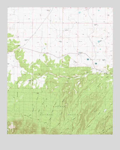
Kyle Harrison Canyon, NM USGS Topographic Map
Click on map above to begin viewing in our Map Viewer.

This topographic map contains these locations and features:
Feature Name Type Latitude Longitude GNIS ID View Map
Antelope LakeLakeN33.7165°W105.2675°903188View Map
Beard LakeLakeN33.6940°W105.2508°903692View Map
BuntonMineN33.6551°W105.2667°916943View Map
Cactus Flat LakeLakeN33.7178°W105.3553°904295View Map
Capitan DivisionCivilN33.7104°W105.2678°1937505View Map
Cherrytree LakeLakeN33.7055°W105.2905°923583View Map
Cocklebur LakeLakeN33.7330°W105.2729°905232View Map
Deep LakeLakeN33.7275°W105.3074°905667View Map
East Lucero CanyonValleyN33.6784°W105.2980°908302View Map
Fox and Fur LodgeLocaleN33.6412°W105.3000°906361View Map
Kelly CanyonValleyN33.6354°W105.2561°912658View Map
Kyle Harrison CanyonValleyN33.6881°W105.2680°907595View Map
Kyle Harrison SpringSpringN33.6770°W105.3475°907596View Map
Middleton LakeLakeN33.7163°W105.3109°908724View Map
Millset SpringSpringN33.6655°W105.3408°908768View Map
Peachtree CanyonValleyN33.6870°W105.2511°909524View Map
Peppin CanyonValleyN33.6701°W105.3325°909564View Map
Pleasant View CemeteryCemeteryN33.6845°W105.2572°899285View Map
Poker LakeLakeN33.6990°W105.2801°909766View Map
Richardson SchoolSchoolN33.6912°W105.3625°910163View Map
Rip LakeLakeN33.7424°W105.2571°910262View Map
Seven CabinsLocaleN33.6323°W105.2980°910955View Map
Shield LakeLakeN33.6981°W105.2605°911012View Map
West Lucero CanyonValleyN33.6815°W105.3069°912643View Map

Note: Coordinates in the location and feature list above are referenced to NAD83 datum.


Copyright (C) 2008-2024 Ryan Niemi / Sunset Dynamics ... All Rights Reserved