TopoQuest Logo
Do you find TopoQuest useful?
Help keep TopoQuest running and adding new maps/features by donating!
Bitcoin:  19c7KJd3qBynnjoSw5npx9KScwjBe4ifkT
Litecoin:  LXs6TkuXGGXo1vDsWCkWVdjQX94eUKd6ui
Home View Maps Find Maps Find Places Resources & Links


Kyburz, California Topographic Map

USGS Map Title: Kyburz, CA
USGS Map MRC: 38120G3
DRG (GeoTIFF) Download: o38120g3.tif


Neighboring USGS Topographic Map Quads:


  Robbs Peak, CA  
38120H4
 

  Loon Lake, CA  
38120H3
 

  Rockbound Valley, CA  
38120H2
 

  Riverton, CA  
38120G4
 

  Kyburz, CA  
38120G3
 

  Pyramid Peak, CA  
38120G2
 

  Old Iron Mountain, CA  
38120F4
 

  Leek Spring Hill, CA  
38120F3
 

  Tragedy Spring, CA  
38120F2


Map MRC Location:

N39°
W121°
N39°
W120°
H8 H7 H6 H5 H4 H3 H2 H1
G8 G7 G6 G5 G4 G3 G2 G1
F8 F7 F6 F5 F4 F3 F2 F1
E8 E7 E6 E5 E4 E3 E2 E1
D8 D7 D6 D5 D4 D3 D2 D1
C8 C7 C6 C5 C4 C3 C2 C1
B8 B7 B6 B5 B4 B3 B2 B1
A8 A7 A6 A5 A4 A3 A2 A1
N38°
W121°
N38°
W120°

Kyburz, CA USGS 1:24K Topographic Map Preview:
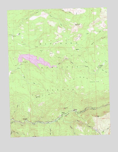
Kyburz, CA USGS Topographic Map
Click on map above to begin viewing in our Map Viewer.

This topographic map contains these locations and features:
Feature Name Type Latitude Longitude GNIS ID View Map
Atherton FlatFlatN38.8010°W120.2688°256364View Map
Beanville CreekStreamN38.7630°W120.3021°256621View Map
Bosworth MeadowFlatN38.8513°W120.3619°257368View Map
Cal Aggie CampLocaleN38.8296°W120.3307°275007View Map
Carpenter CreekStreamN38.7630°W120.3274°257990View Map
Cheese Camp RidgeRidgeN38.8741°W120.3424°258234View Map
China FlatFlatN38.7549°W120.2680°258303View Map
China Flat CampgroundLocaleN38.7544°W120.2680°275010View Map
Chinese Camp RidgeRidgeN38.8736°W120.3375°2778586View Map
Crystal Basin StationLocaleN38.8441°W120.3721°275006View Map
Digger Indian Spring CampgroundLocaleN38.7619°W120.3327°275014View Map
Ditch Camp OneLocaleN38.7644°W120.3749°259393View Map
Eagle RockSummitN38.7682°W120.2682°259677View Map
Eagle Rock CampgroundLocaleN38.7769°W120.2644°275011View Map
El Dorado County Fire Protection District Station 16BuildingN38.7702°W120.3128°2623979View Map
Eldorado National ForestForestN38.7971°W120.3261°1851848View Map
Four Cornered PeakSummitN38.8585°W120.2891°260292View Map
Fry CreekStreamN38.7682°W120.3730°260436View Map
Granite SpringSpringN38.7885°W120.3431°260763View Map
Ice HouseLocaleN38.8135°W120.3744°261675View Map
Ice House 1009 DamDamN38.8235°W120.3591°1664129View Map
Ice House CampgoundLocaleN38.8285°W120.3641°275005View Map
Ice House ReservoirReservoirN38.8247°W120.3431°261676View Map
Ice House VistaLocaleN38.8271°W120.3688°275004View Map
Jones PlacePopulated PlaceN38.8496°W120.3705°1658871View Map
KyburzPopulated PlaceN38.7746°W120.2969°262249View Map
Kyburz Post OfficePost OfficeN38.7744°W120.2961°2789174View Map
Kyburz Post Office (historical)Post OfficeN38.7746°W120.2969°1940085View Map
Lyons CreekStreamN38.8152°W120.2624°263086View Map
Middle CreekStreamN38.7513°W120.2646°263503View Map
Peavine CreekStreamN38.8174°W120.3655°264604View Map
Sand Flat CampgroundLocaleN38.7624°W120.3282°275015View Map
Screech Owl CanyonValleyN38.7557°W120.3738°265950View Map
Silver Fork American RiverStreamN38.7674°W120.3160°267248View Map
Silver Fork Elementary SchoolSchoolN38.7728°W120.3113°266187View Map
Strawberry FlatFlatN38.8296°W120.3524°1733797View Map
SugarloafSummitN38.7769°W120.3088°267863View Map
Sugarloaf Organ CampLocaleN38.7749°W120.3385°275012View Map
Table RockSummitN38.8460°W120.2871°268055View Map
Twentynine Mile Guard StationLocaleN38.7671°W120.3555°268514View Map
Wilson RanchLocaleN38.8180°W120.2588°269211View Map
Windmiller CabinLocaleN38.8338°W120.2885°269221View Map
Windmiller TrailTrailN38.8427°W120.2646°269223View Map

Note: Coordinates in the location and feature list above are referenced to NAD83 datum.


Copyright (C) 2008-2024 Ryan Niemi / Sunset Dynamics ... All Rights Reserved