TopoQuest Logo
Do you find TopoQuest useful?
Help keep TopoQuest running and adding new maps/features by donating!
Bitcoin:  19c7KJd3qBynnjoSw5npx9KScwjBe4ifkT
Litecoin:  LXs6TkuXGGXo1vDsWCkWVdjQX94eUKd6ui
Home View Maps Find Maps Find Places Resources & Links


Kremmling, Colorado Topographic Map

USGS Map Title: Kremmling, CO
USGS Map MRC: 40106A4
DRG (GeoTIFF) Download: o40106a4.tif


Neighboring USGS Topographic Map Quads:


  Tyler Mountain, CO  
40106B5
 

  Hinman Reservoir, CO  
40106B4
 

  Gunsight Pass, CO  
40106B3
 

  Gore Pass, CO  
40106A5
 

  Kremmling, CO  
40106A4
 

  Junction Butte, CO  
40106A3
 

  Radium, CO  
39106H5
 

  Sheephorn Mountain, CO  
39106H4
 

  King Creek, CO  
39106H3


Map MRC Location:

N41°
W107°
N41°
W106°
H8 H7 H6 H5 H4 H3 H2 H1
G8 G7 G6 G5 G4 G3 G2 G1
F8 F7 F6 F5 F4 F3 F2 F1
E8 E7 E6 E5 E4 E3 E2 E1
D8 D7 D6 D5 D4 D3 D2 D1
C8 C7 C6 C5 C4 C3 C2 C1
B8 B7 B6 B5 B4 B3 B2 B1
A8 A7 A6 A5 A4 A3 A2 A1
N40°
W107°
N40°
W106°

Kremmling, CO USGS 1:24K Topographic Map Preview:
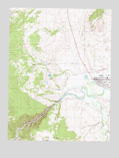
Kremmling, CO USGS Topographic Map
Click on map above to begin viewing in our Map Viewer.

This topographic map contains these locations and features:
Feature Name Type Latitude Longitude GNIS ID View Map
Beaver CreekStreamN40.0008°W106.3803°196487View Map
Beaver Dam GulchValleyN40.0348°W106.4411°173214View Map
Blue RiverStreamN40.0425°W106.3967°173194View Map
Canyon CreekStreamN40.0030°W106.4892°173133View Map
City ReservoirReservoirN40.0616°W106.4503°199865View Map
Colorado State Patrol Kremmling PostBuildingN40.0621°W106.3856°2757317View Map
Cow GulchValleyN40.0880°W106.3985°173207View Map
De Berard RanchLocaleN40.0642°W106.4173°173187View Map
Dry CreekStreamN40.0186°W106.3848°175633View Map
Elliott CreekStreamN40.0178°W106.3806°173213View Map
Engle RanchLocaleN40.0428°W106.3775°173171View Map
GoreLocaleN40.0458°W106.4317°173217View Map
Gore CanyonValleyN40.0006°W106.4955°173193View Map
Grand County Emergency Medical Services Station 4BuildingN40.0580°W106.3834°2735546View Map
Inspiration PointLocaleN40.0025°W106.4853°173218View Map
Jones Number 1 DamDamN40.0567°W106.4506°200728View Map
Jones Number 2 DamDamN40.0600°W106.4523°199864View Map
Jones Number 3 DamDamN40.0733°W106.4539°200730View Map
Jones Reservoir Number 1ReservoirN40.0542°W106.4525°200729View Map
Jones Reservoir Number 3ReservoirN40.0733°W106.4539°200731View Map
Kids PondLakeN40.0484°W106.4403°173188View Map
KremmlingPopulated PlaceN40.0589°W106.3889°204655View Map
Kremmling Community ChurchChurchN40.0578°W106.3914°2043325View Map
Kremmling Fire Protection DistrictBuildingN40.0571°W106.3790°2667348View Map
Kremmling Police DepartmentBuildingN40.0582°W106.3789°2043321View Map
Kremmling Post OfficePost OfficeN40.0592°W106.3872°2043323View Map
Kremmling Riverside CemeteryCemeteryN40.0569°W106.3765°2087608View Map
Kremmling Town HallBuildingN40.0578°W106.3931°2043327View Map
KRKM-FM (Kremmling)TowerN40.0050°W106.4498°204156View Map
Loback DitchCanalN40.0308°W106.3906°1947662View Map
Martin RanchLocaleN40.1050°W106.4284°173182View Map
Middle Park Medical Center Kremmling CampusHospitalN40.0570°W106.3906°2043326View Map
Muddy CreekStreamN40.0430°W106.3978°172999View Map
Saint Peters Catholic Community ChurchChurchN40.0586°W106.3900°2043324View Map
San Toy MountainLocaleN40.0042°W106.4414°173223View Map
Sheep CreekStreamN40.0450°W106.4275°173132View Map
Town of KremmlingCivilN40.0565°W106.3782°2412848View Map
West Grand High SchoolSchoolN40.0603°W106.3795°1947638View Map
West Grand Middle SchoolSchoolN40.0621°W106.3863°2043322View Map
Wolford MountainSummitN40.1180°W106.3914°173181View Map
Wolford Mountain ReservoirReservoirN40.1129°W106.4146°2648439View Map
Yust RanchLocaleN40.0292°W106.3878°173191View Map

Note: Coordinates in the location and feature list above are referenced to NAD83 datum.


Copyright (C) 2008-2024 Ryan Niemi / Sunset Dynamics ... All Rights Reserved