TopoQuest Logo
Do you find TopoQuest useful?
Help keep TopoQuest running and adding new maps/features by donating!
Bitcoin:  19c7KJd3qBynnjoSw5npx9KScwjBe4ifkT
Litecoin:  LXs6TkuXGGXo1vDsWCkWVdjQX94eUKd6ui
Home View Maps Find Maps Find Places Resources & Links


Bardley, Missouri Topographic Map

USGS Map Title: Bardley, MO
USGS Map MRC: 36091F1
DRG (GeoTIFF) Download: o36091f1.tif


Neighboring USGS Topographic Map Quads:


  Wilderness, MO  
36091G2
 

  Handy, MO  
36091G1
 

  Grandin SW, MO  
36090G8
 

  Riverton, MO  
36091F2
 

  Bardley, MO  
36091F1
 

  Briar, MO  
36090F8
 

  Billmore, MO  
36091E2
 

  Gatewood, MO  
36091E1
 

  Poynor, MO  
36090E8


Map MRC Location:

N37°
W92°
N37°
W91°
H8 H7 H6 H5 H4 H3 H2 H1
G8 G7 G6 G5 G4 G3 G2 G1
F8 F7 F6 F5 F4 F3 F2 F1
E8 E7 E6 E5 E4 E3 E2 E1
D8 D7 D6 D5 D4 D3 D2 D1
C8 C7 C6 C5 C4 C3 C2 C1
B8 B7 B6 B5 B4 B3 B2 B1
A8 A7 A6 A5 A4 A3 A2 A1
N36°
W92°
N36°
W91°

Bardley, MO USGS 1:24K Topographic Map Preview:
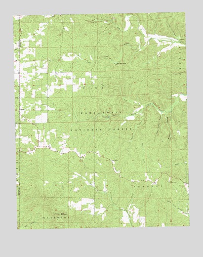
Bardley, MO USGS Topographic Map
Click on map above to begin viewing in our Map Viewer.

This topographic map contains these locations and features:
Feature Name Type Latitude Longitude GNIS ID View Map
BardleyPopulated PlaceN36.6942°W91.1218°748665View Map
Bardley CemeteryCemeteryN36.7017°W91.1210°735233View Map
Bardley ChurchChurchN36.6867°W91.1112°748610View Map
Bardley ChurchChurchN36.7017°W91.1218°748666View Map
BennettPopulated PlaceN36.7337°W91.0046°748784View Map
Bennett Church (historical)ChurchN36.7156°W91.0007°735236View Map
Bennett School (historical)SchoolN36.7370°W91.0190°746898View Map
Blue Hole SpringSpringN36.7210°W91.0503°748927View Map
Briar Lookout TowerTowerN36.6509°W91.0143°755009View Map
Brushy CreekStreamN36.6831°W91.0371°749059View Map
Buffalo Creek CampgroundLocaleN36.6892°W91.0568°749099View Map
Buffalo School (historical)SchoolN36.6937°W91.0154°746899View Map
Camp RoyLocaleN36.6598°W91.0198°735237View Map
Cave ForkStreamN36.7351°W91.0243°749260View Map
Clear ForkStreamN36.6959°W91.0293°749380View Map
Dunn School (historical)SchoolN36.6476°W91.0654°746897View Map
Fourche Creek DamDamN36.6362°W91.0503°765038View Map
Fourche LakeLakeN36.6384°W91.0547°754392View Map
Fourche Lake Boat AccessLocaleN36.6367°W91.0557°754410View Map
Little Sleuter HollowValleyN36.6906°W91.0187°750802View Map
Mill HollowValleyN36.7353°W91.0068°751083View Map
Oak Ridge ChurchChurchN36.6639°W91.0549°751392View Map
Pigeon CreekStreamN36.6931°W91.0332°751578View Map
PineLocaleN36.7162°W91.0949°751597View Map
Pine Bradley Volunteer Fire DepartmentBuildingN36.6729°W91.1033°2621006View Map
Pine Grove Missionary Baptist ChurchChurchN36.7145°W91.0954°735235View Map
Pine SchoolSchoolN36.7134°W91.0818°751627View Map
Sleuter HollowValleyN36.6909°W91.0154°752200View Map
South Buffalo School (historical)SchoolN36.6873°W91.1104°735234View Map
Township of PineCivilN36.7404°W91.0682°767290View Map
Wolf MountainSummitN36.6334°W91.0937°752957View Map

Note: Coordinates in the location and feature list above are referenced to NAD83 datum.


Copyright (C) 2008-2024 Ryan Niemi / Sunset Dynamics ... All Rights Reserved