TopoQuest Logo
Do you find TopoQuest useful?
Help keep TopoQuest running and adding new maps/features by donating!
Bitcoin:  19c7KJd3qBynnjoSw5npx9KScwjBe4ifkT
Litecoin:  LXs6TkuXGGXo1vDsWCkWVdjQX94eUKd6ui
Home View Maps Find Maps Find Places Resources & Links


Kingsford Heights, Indiana Topographic Map

USGS Map Title: Kingsford Heights, IN
USGS Map MRC: 41086D6
DRG (GeoTIFF) Download: o41086d6.tif


Neighboring USGS Topographic Map Quads:


  LaPorte West, IN  
41086E7
 

  LaPorte East, IN  
41086E6
 

  Stillwell, IN  
41086E5
 

  Hanna, IN  
41086D7
 

  Kingsford Heights, IN  
41086D6
 

  Hamlet, IN  
41086D5
 

  English Lake, IN  
41086C7
 

  Knox West, IN  
41086C6
 

  Knox East, IN  
41086C5


Map MRC Location:

N42°
W87°
N42°
W86°
H8 H7 H6 H5 H4 H3 H2 H1
G8 G7 G6 G5 G4 G3 G2 G1
F8 F7 F6 F5 F4 F3 F2 F1
E8 E7 E6 E5 E4 E3 E2 E1
D8 D7 D6 D5 D4 D3 D2 D1
C8 C7 C6 C5 C4 C3 C2 C1
B8 B7 B6 B5 B4 B3 B2 B1
A8 A7 A6 A5 A4 A3 A2 A1
N41°
W87°
N41°
W86°

Kingsford Heights, IN USGS 1:24K Topographic Map Preview:
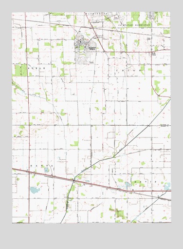
Kingsford Heights, IN USGS Topographic Map
Click on map above to begin viewing in our Map Viewer.

This topographic map contains these locations and features:
Feature Name Type Latitude Longitude GNIS ID View Map
Conboy ArmCanalN41.4025°W86.6711°432846View Map
Cusher ArmBayN41.3884°W86.7217°433263View Map
Davis ChurchChurchN41.3898°W86.7067°433349View Map
Hickleson DitchCanalN41.4750°W86.7395°436089View Map
Hildebrandt DitchCanalN41.4331°W86.6686°436181View Map
Immanuel ChurchChurchN41.4839°W86.6784°436718View Map
Kingsford Fire DepartmentBuildingN41.4830°W86.6911°2626295View Map
Kingsford HeightsPopulated PlaceN41.4806°W86.6917°437334View Map
Kingsford Heights Elementary SchoolSchoolN41.4820°W86.6959°447398View Map
Long DitchCanalN41.4442°W86.6597°438262View Map
Marquardt DitchCanalN41.3750°W86.7386°438641View Map
Maurey DitchCanalN41.4445°W86.6884°438743View Map
Mill CreekStreamN41.4487°W86.7228°450459View Map
North ArmCanalN41.4570°W86.6670°440210View Map
Place Ditch ArmCanalN41.4187°W86.6311°441214View Map
Porter DitchCanalN41.4831°W86.6859°450469View Map
Ridgeway ArmCanalN41.4509°W86.6986°442002View Map
Salisbury DitchCanalN41.4209°W86.6878°442934View Map
Shamrock Airport (historical)AirportN41.4081°W86.7472°449194View Map
Shearin DitchCanalN41.3792°W86.6906°443326View Map
South CenterPopulated PlaceN41.4764°W86.6400°443795View Map
Town of Kingsford HeightsCivilN41.4786°W86.6927°2396692View Map
Township of DavisCivilN41.3843°W86.6429°453254View Map
Township of HannaCivilN41.4070°W86.7483°453369View Map
Township of UnionCivilN41.4646°W86.6477°453922View Map
TracyPopulated PlaceN41.4853°W86.6825°444845View Map
Tracy ChurchChurchN41.4759°W86.6647°444846View Map
Union CenterPopulated PlaceN41.4842°W86.6397°445070View Map
Whitham DitchCanalN41.4245°W86.7078°445987View Map
Winchell ArmCanalN41.4689°W86.6300°446165View Map

Note: Coordinates in the location and feature list above are referenced to NAD83 datum.


Copyright (C) 2008-2024 Ryan Niemi / Sunset Dynamics ... All Rights Reserved