TopoQuest Logo
Do you find TopoQuest useful?
Help keep TopoQuest running and adding new maps/features by donating!
Bitcoin:  19c7KJd3qBynnjoSw5npx9KScwjBe4ifkT
Litecoin:  LXs6TkuXGGXo1vDsWCkWVdjQX94eUKd6ui
Home View Maps Find Maps Find Places Resources & Links


Kimberly, Minnesota Topographic Map

USGS Map Title: Kimberly, MN
USGS Map MRC: 46093E4
DRG (GeoTIFF) Download: o46093e4.tif


Neighboring USGS Topographic Map Quads:


  Waukenabo, MN  
46093F5
 

  Palisade, MN  
46093F4
 

  Minnewawa, MN  
46093F3
 

  Hassman, MN  
46093E5
 

  Kimberly, MN  
46093E4
 

  McGregor, MN  
46093E3
 

  Glen, MN  
46093D5
 

  Thor, MN  
46093D4
 

  Thor NE, MN  
46093D3


Map MRC Location:

N47°
W94°
N47°
W93°
H8 H7 H6 H5 H4 H3 H2 H1
G8 G7 G6 G5 G4 G3 G2 G1
F8 F7 F6 F5 F4 F3 F2 F1
E8 E7 E6 E5 E4 E3 E2 E1
D8 D7 D6 D5 D4 D3 D2 D1
C8 C7 C6 C5 C4 C3 C2 C1
B8 B7 B6 B5 B4 B3 B2 B1
A8 A7 A6 A5 A4 A3 A2 A1
N46°
W94°
N46°
W93°

Kimberly, MN USGS 1:24K Topographic Map Preview:
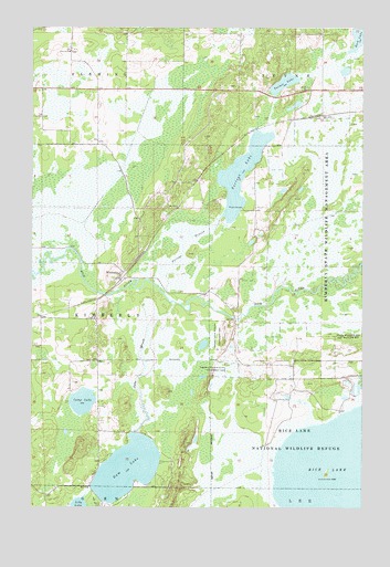
Kimberly, MN USGS Topographic Map
Click on map above to begin viewing in our Map Viewer.

This topographic map contains these locations and features:
Feature Name Type Latitude Longitude GNIS ID View Map
Aitkin CountyCivilN46.6083°W93.4154°663198View Map
Anderson CemeteryCemeteryN46.5062°W93.4832°2070741View Map
Camp LakeLakeN46.5276°W93.4806°640820View Map
Dam BrookStreamN46.5536°W93.4480°642613View Map
Dam LakeLakeN46.5101°W93.4638°642615View Map
Fleming ChurchChurchN46.6186°W93.4858°643737View Map
Howard Private CemeteryCemeteryN46.5063°W93.4831°2070886View Map
KimberlyPopulated PlaceN46.5608°W93.4664°646147View Map
KimberlyLocaleN46.5603°W93.4667°2070891View Map
Kimberly Post Office (historical)Post OfficeN46.5606°W93.4667°2070892View Map
Lansford CemeteryCemeteryN46.6091°W93.3955°646488View Map
Lansford Post Office (historical)Post OfficeN46.6083°W93.4208°2070898View Map
Lily LakeLakeN46.5004°W93.4819°646652View Map
Portage BranchStreamN46.5583°W93.4541°649664View Map
Portage LakeLakeN46.5868°W93.4209°649668View Map
Saron CemeteryCemeteryN46.5008°W93.4736°651219View Map
Township of KimberlyCivilN46.5500°W93.4959°664633View Map
Turner LakeLakeN46.6106°W93.4049°653367View Map

Note: Coordinates in the location and feature list above are referenced to NAD83 datum.


Copyright (C) 2008-2024 Ryan Niemi / Sunset Dynamics ... All Rights Reserved