TopoQuest Logo
Do you find TopoQuest useful?
Help keep TopoQuest running and adding new maps/features by donating!
Bitcoin:  19c7KJd3qBynnjoSw5npx9KScwjBe4ifkT
Litecoin:  LXs6TkuXGGXo1vDsWCkWVdjQX94eUKd6ui
Home View Maps Find Maps Find Places Resources & Links


Kernville, California Topographic Map

USGS Map Title: Kernville, CA
USGS Map MRC: 35118G4
DRG (GeoTIFF) Download: o35118g4.tif


Neighboring USGS Topographic Map Quads:


  Johnsondale, CA  
35118H5
 

  Fairview, CA  
35118H4
 

  Sirretta Peak, CA  
35118H3
 

  Tobias Peak, CA  
35118G5
 

  Kernville, CA  
35118G4
 

  Cannell Peak, CA  
35118G3
 

  Alta Sierra, CA  
35118F5
 

  Lake Isabella North, CA  
35118F4
 

  Weldon, CA  
35118F3


Map MRC Location:

N36°
W119°
N36°
W118°
H8 H7 H6 H5 H4 H3 H2 H1
G8 G7 G6 G5 G4 G3 G2 G1
F8 F7 F6 F5 F4 F3 F2 F1
E8 E7 E6 E5 E4 E3 E2 E1
D8 D7 D6 D5 D4 D3 D2 D1
C8 C7 C6 C5 C4 C3 C2 C1
B8 B7 B6 B5 B4 B3 B2 B1
A8 A7 A6 A5 A4 A3 A2 A1
N35°
W119°
N35°
W118°

Kernville, CA USGS 1:24K Topographic Map Preview:
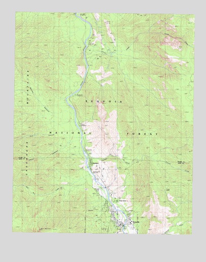
Kernville, CA USGS Topographic Map
Click on map above to begin viewing in our Map Viewer.

This topographic map contains these locations and features:
Feature Name Type Latitude Longitude GNIS ID View Map
Bull Run CreekStreamN35.7816°W118.4456°270078View Map
Camp KemericLocaleN35.7616°W118.4326°240097View Map
Camp OwensPopulated PlaceN35.7686°W118.4309°1660427View Map
Camp Three CampgroundLocaleN35.8066°W118.4537°255404View Map
Cannell CreekStreamN35.7919°W118.4493°270279View Map
Cannell Meadow District Ranger OfficeLocaleN35.7550°W118.4270°274903View Map
Care Ambulance ServiceBuildingN35.7556°W118.4200°2665485View Map
Chico CanyonValleyN35.8016°W118.4598°270412View Map
Chico FlatFlatN35.8177°W118.4681°276152View Map
Circle ParkParkN35.7547°W118.4240°1667546View Map
Corral CreekStreamN35.8505°W118.4537°270604View Map
Corral Creek CampgroundLocaleN35.8555°W118.4518°1655160View Map
Corral Creek Picnic AreaLocaleN35.8572°W118.4504°1667571View Map
Dark CanyonValleyN35.8019°W118.4540°270756View Map
Gilbert CampgroundLocaleN35.7663°W118.4276°242702View Map
Headquarters CampgroundLocaleN35.7958°W118.4520°243320View Map
Hospital Flat CampgroundLocaleN35.8286°W118.4587°1667590View Map
Kern County Fire Department Station 76 KernvilleBuildingN35.7543°W118.4247°2665389View Map
KernvillePopulated PlaceN35.7547°W118.4254°1660834View Map
Kernville Branch Kern County LibraryBuildingN35.7558°W118.4256°1835971View Map
Kernville Census Designated PlaceCensusN35.7532°W118.4321°2408474View Map
Kernville Chamber of CommerceBuildingN35.7558°W118.4181°1835972View Map
Kernville Elementary SchoolSchoolN35.7571°W118.4177°1835973View Map
Kernville Park Recreation AreaParkN35.7605°W118.4237°1835974View Map
Kernville Post OfficePost OfficeN35.7551°W118.4265°1667547View Map
Kernville United Methodist ChurchChurchN35.7575°W118.4279°1835975View Map
Kernville Work CenterLocaleN35.7558°W118.4198°276150View Map
Lower Springhill CampgroundLocaleN35.8613°W118.4493°245275View Map
Powers PeakSummitN35.7794°W118.4058°2494557View Map
River Nook CampgroundLocaleN35.7580°W118.4223°1835980View Map
RiverkernPopulated PlaceN35.7897°W118.4470°1667548View Map
Riverkern Beach Picnic AreaLocaleN35.7838°W118.4454°276151View Map
Riverside ParkParkN35.7530°W118.4245°1667549View Map
Split MountainSummitN35.7511°W118.4823°1661492View Map
Stormy CanyonValleyN35.8175°W118.4595°273924View Map
Tunnel SpringSpringN35.7754°W118.3945°250704View Map
United States Forest Service Kernville StationBuildingN35.7551°W118.4179°2664922View Map
Upper Springhill CampgroundLocaleN35.8649°W118.4490°250857View Map

Note: Coordinates in the location and feature list above are referenced to NAD83 datum.


Copyright (C) 2008-2024 Ryan Niemi / Sunset Dynamics ... All Rights Reserved