TopoQuest Logo
Do you find TopoQuest useful?
Help keep TopoQuest running and adding new maps/features by donating!
Bitcoin:  19c7KJd3qBynnjoSw5npx9KScwjBe4ifkT
Litecoin:  LXs6TkuXGGXo1vDsWCkWVdjQX94eUKd6ui
Home View Maps Find Maps Find Places Resources & Links


Kenyon, Idaho Topographic Map

USGS Map Title: Kenyon, ID
USGS Map MRC: 42113D7
DRG (GeoTIFF) Download: o42113d7.tif


Neighboring USGS Topographic Map Quads:


  Burley SW, ID  
42113E8
 

  Burley, ID  
42113E7
 

  Rupert, ID  
42113E6
 

  Burley Butte, ID  
42113D8
 

  Kenyon, ID  
42113D7
 

  View, ID  
42113D6
 

  Marion, ID  
42113C8
 

  Marion SE, ID  
42113C7
 

  Mount Harrison, ID  
42113C6


Map MRC Location:

N43°
W114°
N43°
W113°
H8 H7 H6 H5 H4 H3 H2 H1
G8 G7 G6 G5 G4 G3 G2 G1
F8 F7 F6 F5 F4 F3 F2 F1
E8 E7 E6 E5 E4 E3 E2 E1
D8 D7 D6 D5 D4 D3 D2 D1
C8 C7 C6 C5 C4 C3 C2 C1
B8 B7 B6 B5 B4 B3 B2 B1
A8 A7 A6 A5 A4 A3 A2 A1
N42°
W114°
N42°
W113°

Kenyon, ID USGS 1:24K Topographic Map Preview:
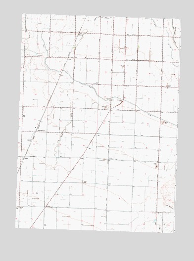
Kenyon, ID USGS Topographic Map
Click on map above to begin viewing in our Map Viewer.

This topographic map contains these locations and features:
Feature Name Type Latitude Longitude GNIS ID View Map
BeetvillePopulated PlaceN42.4885°W113.8314°396098View Map
Big Rocky CreekStreamN42.3910°W113.7600°377581View Map
Burley DivisionCivilN42.4987°W113.7959°1936685View Map
H 18 1/2 LateralCanalN42.4736°W113.7541°2517317View Map
H 19 H LateralCanalN42.4948°W113.7663°2548089View Map
H 19 LateralCanalN42.4946°W113.7639°2517318View Map
Hazel (historical)Populated PlaceN42.3910°W113.7661°399072View Map
J 25 A LateralCanalN42.4456°W113.7556°2517384View Map
J 25 LateralCanalN42.4550°W113.7592°2517402View Map
J 26 A LateralCanalN42.4458°W113.7744°2517403View Map
J 26 B LateralCanalN42.4508°W113.7839°2517404View Map
J 26 LateralCanalN42.4589°W113.7736°2517405View Map
J 26 PipelineCanalN42.4703°W113.7597°2517406View Map
J 27 1/2 LateralCanalN42.4564°W113.7983°2517407View Map
J 27 C LateralCanalN42.4658°W113.7883°2517408View Map
J 27 D LateralCanalN42.4781°W113.8036°2517401View Map
J 27 F LateralCanalN42.4902°W113.7935°2519102View Map
J 27 H LateralCanalN42.4523°W113.7960°2548094View Map
J 27 I LateralCanalN42.4894°W113.7794°2518674View Map
J 27 I PipelineCanalN42.4930°W113.7762°2518675View Map
J 27 J LateralCanalN42.4869°W113.7756°2518676View Map
J 27 LateralCanalN42.4749°W113.7826°2518727View Map
J 27 N LateralCanalN42.4839°W113.7836°2518678View Map
J 27 O LateralCanalN42.4783°W113.7597°2518679View Map
J 27 PipelineCanalN42.4889°W113.7642°2518680View Map
J 27 Q LateralCanalN42.4611°W113.7834°2548095View Map
J 27 R LateralCanalN42.4611°W113.7833°2518681View Map
J 28 1/2 LateralCanalN42.4602°W113.8164°2548096View Map
J 28 PipelineCanalN42.4556°W113.8083°2518682View Map
J 29 1/2 LateralCanalN42.4659°W113.8334°2548097View Map
J 29 A LateralCanalN42.4602°W113.8166°2518672View Map
J 29 LateralCanalN42.4688°W113.8233°2518722View Map
J 32 B LateralCanalN42.4899°W113.8275°2518684View Map
J 32 D LateralCanalN42.4971°W113.8217°2518685View Map
J 32 E LateralCanalN42.4971°W113.8247°2518686View Map
J 32 LateralCanalN42.4920°W113.8233°2518721View Map
J 33 A LateralCanalN42.4825°W113.8550°2518690View Map
J 34 LateralCanalN42.4972°W113.8503°2518691View Map
KenyonPopulated PlaceN42.4155°W113.8703°396736View Map
Kenyon Substation WellWellN42.4169°W113.8036°373396View Map
Morgan DrainCanalN42.4972°W113.8336°2518709View Map
North KenyonPopulated PlaceN42.4321°W113.8611°396970View Map
PellaPopulated PlaceN42.4752°W113.8386°397022View Map
Pella SidingLocaleN42.4746°W113.8384°394948View Map
Pella Ward CemeteryCemeteryN42.4755°W113.8624°374359View Map
Robinson CreekStreamN42.3869°W113.7558°389453View Map
Savage Ranch Landing Area (historical)AirportN42.4735°W113.8592°397343View Map
Willow CreekStreamN42.3813°W113.7645°393495View Map

Note: Coordinates in the location and feature list above are referenced to NAD83 datum.


Copyright (C) 2008-2024 Ryan Niemi / Sunset Dynamics ... All Rights Reserved