TopoQuest Logo
Do you find TopoQuest useful?
Help keep TopoQuest running and adding new maps/features by donating!
Bitcoin:  19c7KJd3qBynnjoSw5npx9KScwjBe4ifkT
Litecoin:  LXs6TkuXGGXo1vDsWCkWVdjQX94eUKd6ui
Home View Maps Find Maps Find Places Resources & Links


Bangor, New York Topographic Map

USGS Map Title: Bangor, NY
USGS Map MRC: 44074G4
DRG (GeoTIFF) Download: o44074g4.tif


Neighboring USGS Topographic Map Quads:


  Bombay, NY  
44074H5
 

  Fort Covington, NY  
44074H4
 

  Constable, NY  
44074H3
 

  Brushton, NY  
44074G5
 

  Bangor, NY  
44074G4
 

  Malone, NY  
44074G3
 

  Saint Regis Falls, NY  
44074F5
 

  Santa Clara, NY  
44074F4
 

  Lake Titus, NY  
44074F3


Map MRC Location:

N45°
W75°
N45°
W74°
H8 H7 H6 H5 H4 H3 H2 H1
G8 G7 G6 G5 G4 G3 G2 G1
F8 F7 F6 F5 F4 F3 F2 F1
E8 E7 E6 E5 E4 E3 E2 E1
D8 D7 D6 D5 D4 D3 D2 D1
C8 C7 C6 C5 C4 C3 C2 C1
B8 B7 B6 B5 B4 B3 B2 B1
A8 A7 A6 A5 A4 A3 A2 A1
N44°
W75°
N44°
W74°

Bangor, NY USGS 1:24K Topographic Map Preview:
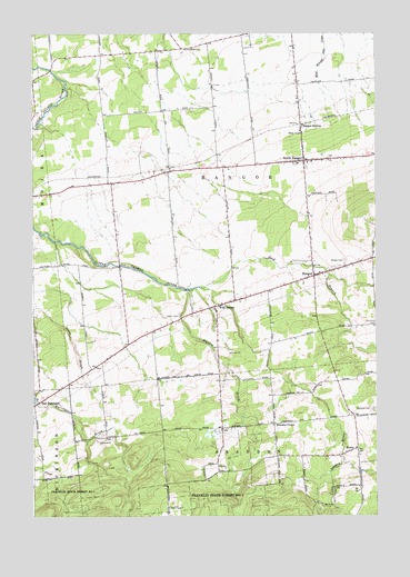
Bangor, NY USGS Topographic Map
Click on map above to begin viewing in our Map Viewer.

This topographic map contains these locations and features:
Feature Name Type Latitude Longitude GNIS ID View Map
BangorPopulated PlaceN44.8123°W74.3974°942962View Map
Bangor Baptist ChapelChurchN44.8043°W74.4333°2615561View Map
Bangor CemeteryCemeteryN44.8164°W74.3859°942963View Map
Bangor Fire DepartmentBuildingN44.8416°W74.4191°2718526View Map
Bangor StationLocaleN44.8509°W74.4018°942964View Map
Brandon CemeteryCemeteryN44.7779°W74.3758°944625View Map
Brandon CenterPopulated PlaceN44.7739°W74.4121°972255View Map
Develin BrookStreamN44.8092°W74.4460°970073View Map
Develin CemeteryCemeteryN44.8022°W74.4464°948357View Map
East Branch Little Salmon RiverStreamN44.8092°W74.4380°970095View Map
East DickinsonPopulated PlaceN44.7795°W74.4977°949059View Map
Malone QuarryMineN44.7686°W74.4608°2516957View Map
North BangorPopulated PlaceN44.8420°W74.4010°958669View Map
North Bangor CemeteryCemeteryN44.8405°W74.4000°2559764View Map
North Bangor Post OfficePost OfficeN44.8424°W74.4020°2618040View Map
North Bangor Seventh Day Adventist ChurchChurchN44.8057°W74.4288°2616145View Map
Plumb Hill FarmLocaleN44.8394°W74.3817°2559386View Map
Saint Augustine CemeteryCemeteryN44.8394°W74.4000°2559763View Map
School Number 11 (historical)SchoolN44.8400°W74.4333°2494910View Map
School Number 2 (historical)SchoolN44.7853°W74.4322°2494900View Map
School Number 3 (historical)SchoolN44.8728°W74.4358°2494911View Map
School Number 4 (historical)SchoolN44.8350°W74.4719°2494908View Map
School Number 5 (historical)SchoolN44.7756°W74.4744°2494897View Map
School Number 6 (historical)SchoolN44.8197°W74.4492°2494899View Map
School Number 7 (historical)SchoolN44.7925°W74.4700°2494898View Map
School Number 9 (historical)SchoolN44.8556°W74.4533°2494909View Map
SkerryPopulated PlaceN44.7678°W74.3818°973073View Map
Southworth CemeteryCemeteryN44.8709°W74.4448°965931View Map
Town of BangorCivilN44.8375°W74.4301°978708View Map
West BangorPopulated PlaceN44.8042°W74.4338°969088View Map

Note: Coordinates in the location and feature list above are referenced to NAD83 datum.


Copyright (C) 2008-2024 Ryan Niemi / Sunset Dynamics ... All Rights Reserved