TopoQuest Logo
Do you find TopoQuest useful?
Help keep TopoQuest running and adding new maps/features by donating!
Bitcoin:  19c7KJd3qBynnjoSw5npx9KScwjBe4ifkT
Litecoin:  LXs6TkuXGGXo1vDsWCkWVdjQX94eUKd6ui
Home View Maps Find Maps Find Places Resources & Links


Kellogg East, Idaho Topographic Map

USGS Map Title: Kellogg East, ID
USGS Map MRC: 47116E1
DRG (GeoTIFF) Download: o47116e1.tif


Neighboring USGS Topographic Map Quads:


  Steamboat Creek, ID  
47116F2
 

  Grizzly Mountain, ID  
47116F1
 

  Prichard, ID  
47115F8
 

  Kellogg West, ID  
47116E2
 

  Kellogg East, ID  
47116E1
 

  Osburn, ID  
47115E8
 

  Masonia, ID  
47116D2
 

  Polaris Peak, ID  
47116D1
 

  Wallace, ID  
47115D8


Map MRC Location:

N48°
W117°
N48°
W116°
H8 H7 H6 H5 H4 H3 H2 H1
G8 G7 G6 G5 G4 G3 G2 G1
F8 F7 F6 F5 F4 F3 F2 F1
E8 E7 E6 E5 E4 E3 E2 E1
D8 D7 D6 D5 D4 D3 D2 D1
C8 C7 C6 C5 C4 C3 C2 C1
B8 B7 B6 B5 B4 B3 B2 B1
A8 A7 A6 A5 A4 A3 A2 A1
N47°
W117°
N47°
W116°

Kellogg East, ID USGS 1:24K Topographic Map Preview:
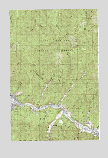
Kellogg East, ID USGS Topographic Map
Click on map above to begin viewing in our Map Viewer.

This topographic map contains these locations and features:
Feature Name Type Latitude Longitude GNIS ID View Map
Alhambra MineMineN47.5121°W116.1035°376530View Map
Big CreekStreamN47.5299°W116.0516°377486View Map
Browns RidgeRidgeN47.5735°W116.0043°378296View Map
Character RidgeRidgeN47.6144°W116.0585°395198View Map
City of OsburnCivilN47.5055°W116.0009°2411340View Map
Crescent MineMineN47.5055°W116.0743°380061View Map
East Fork Elk CreekStreamN47.5277°W116.0927°381090View Map
East Fork Graham CreekStreamN47.6121°W116.0882°381107View Map
East Fork Rosebud GulchValleyN47.5033°W116.0304°381166View Map
Elizabeth ParkPopulated PlaceN47.5296°W116.0929°395354View Map
Elk CreekPopulated PlaceN47.5338°W116.0579°395355View Map
Elk CreekStreamN47.5305°W116.0902°381343View Map
Elk Creek SchoolSchoolN47.5333°W116.0616°381370View Map
Gene Day ParkParkN47.5144°W116.0321°394327View Map
Gold RunValleyN47.5296°W116.0779°382398View Map
Greenwood CemeteryCemeteryN47.5320°W116.1154°382664View Map
Holmes GulchValleyN47.5449°W116.1229°383263View Map
Holmes TrailTrailN47.5666°W116.1057°383265View Map
Italian GulchValleyN47.5433°W116.1171°383791View Map
Jackass TrailTrailN47.6016°W116.0293°383824View Map
Jewell GulchValleyN47.5108°W116.0046°376443View Map
KelloggPopulated PlaceN47.5383°W116.1193°396733View Map
Kellogg Post OfficePost OfficeN47.5345°W116.1217°2781810View Map
KWAL-AM (Wallace)TowerN47.5080°W116.0057°401753View Map
Little Terror GulchValleyN47.5166°W116.0266°384973View Map
McFarren GulchValleyN47.5033°W116.0052°386613View Map
Mineral Mountain MineMineN47.5063°W116.0407°386999View Map
Montgomery CreekStreamN47.5305°W116.0907°387101View Map
Montgomery RidgeRidgeN47.5644°W116.0543°394780View Map
Moon CreekStreamN47.5319°W116.0591°387131View Map
Moon SaddleGapN47.5996°W116.0441°394784View Map
Nellie MineMineN47.5030°W116.0266°387502View Map
Polaris GulchValleyN47.5196°W116.0443°388665View Map
Polaris MineMineN47.5033°W116.0538°388666View Map
Prospect GulchValleyN47.5244°W116.0391°388905View Map
Rosebud GulchValleyN47.5094°W116.0254°389611View Map
Ross GulchValleyN47.5371°W116.1071°389622View Map
ShontLocaleN47.5269°W116.0499°397161View Map
Shoshone Country ClubLocaleN47.5230°W116.0568°400302View Map
Shoshone County Fire Protection District 2 Kellogg StationBuildingN47.5339°W116.1221°2618954View Map
Shoshone County Fire Protection District 2 Sunnyside StationBuildingN47.5397°W116.1170°2619032View Map
Silver Summit MineMineN47.5069°W116.0260°390460View Map
Spring GulchValleyN47.5169°W116.0388°391220View Map
Sunshine MineMineN47.5030°W116.0754°391672View Map
Sunshine Mine Disaster MemorialLocaleN47.5283°W116.0479°400539View Map
Sunshine Tailings Number One DamDamN47.5266°W116.0527°398974View Map
Sunshine Tailings Number Two DamDamN47.5233°W116.0577°398888View Map
Swinnerton GulchValleyN47.5538°W116.0743°400123View Map
Terror GulchValleyN47.5146°W116.0221°391946View Map
West Fork Elk CreekStreamN47.5227°W116.0999°393094View Map
West Fork Montgomery CreekStreamN47.5671°W116.0666°393150View Map
West Fork Moon CreekStreamN47.5516°W116.0363°393152View Map
White Creek SaddleGapN47.6099°W116.0052°394298View Map
White PeakSummitN47.6058°W116.0207°393354View Map

Note: Coordinates in the location and feature list above are referenced to NAD83 datum.


Copyright (C) 2008-2024 Ryan Niemi / Sunset Dynamics ... All Rights Reserved