TopoQuest Logo
Do you find TopoQuest useful?
Help keep TopoQuest running and adding new maps/features by donating!
Bitcoin:  19c7KJd3qBynnjoSw5npx9KScwjBe4ifkT
Litecoin:  LXs6TkuXGGXo1vDsWCkWVdjQX94eUKd6ui
Home View Maps Find Maps Find Places Resources & Links


Karamin, Washington Topographic Map

USGS Map Title: Karamin, WA
USGS Map MRC: 48118G6
DRG (GeoTIFF) Download: o48118g6.tif


Neighboring USGS Topographic Map Quads:


  Toroda, WA  
48118H7
 

  Vulcan Mountain, WA  
48118H6
 

  Curlew, WA  
48118H5
 

  Bodie Mountain, WA  
48118G7
 

  Karamin, WA  
48118G6
 

  Malo, WA  
48118G5
 

  Storm King Mountain, WA  
48118F7
 

  Republic, WA  
48118F6
 

  Cooke Mountain, WA  
48118F5


Map MRC Location:

N49°
W119°
N49°
W118°
H8 H7 H6 H5 H4 H3 H2 H1
G8 G7 G6 G5 G4 G3 G2 G1
F8 F7 F6 F5 F4 F3 F2 F1
E8 E7 E6 E5 E4 E3 E2 E1
D8 D7 D6 D5 D4 D3 D2 D1
C8 C7 C6 C5 C4 C3 C2 C1
B8 B7 B6 B5 B4 B3 B2 B1
A8 A7 A6 A5 A4 A3 A2 A1
N48°
W119°
N48°
W118°

Karamin, WA USGS 1:24K Topographic Map Preview:
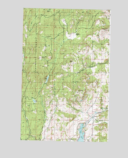
Karamin, WA USGS Topographic Map
Click on map above to begin viewing in our Map Viewer.

This topographic map contains these locations and features:
Feature Name Type Latitude Longitude GNIS ID View Map
Curlew Lake DamDamN48.7641°W118.6600°1532545View Map
Empire LakeLakeN48.8096°W118.7131°1519343View Map
Ferry / Okanogan County Fire District 13 East LakeBuildingN48.7566°W118.6486°2619662View Map
Franson PeakSummitN48.8557°W118.6325°1519769View Map
Goodrich TrailTrailN48.8246°W118.7403°1520140View Map
Granite MountainSummitN48.8266°W118.6825°1520232View Map
KaraminPopulated PlaceN48.7732°W118.6492°1521571View Map
Lake ButteLakeN48.8146°W118.7336°1517162View Map
Lambert CreekStreamN48.7727°W118.6478°1521877View Map
Louis SpringSpringN48.8282°W118.7196°1528497View Map
Lundimo MeadowsFlatN48.8513°W118.6786°1522580View Map
Malo LakeLakeN48.7815°W118.6330°1528498View Map
Mosquito LakeLakeN48.8658°W118.7423°1530358View Map
Mount ElizabethSummitN48.7957°W118.6728°1519262View Map
Ward LakeLakeN48.7863°W118.7309°1528496View Map
West Fork Trout CreekStreamN48.7535°W118.7367°1527982View Map

Note: Coordinates in the location and feature list above are referenced to NAD83 datum.


Copyright (C) 2008-2024 Ryan Niemi / Sunset Dynamics ... All Rights Reserved