TopoQuest Logo
Do you find TopoQuest useful?
Help keep TopoQuest running and adding new maps/features by donating!
Bitcoin:  19c7KJd3qBynnjoSw5npx9KScwjBe4ifkT
Litecoin:  LXs6TkuXGGXo1vDsWCkWVdjQX94eUKd6ui
Home View Maps Find Maps Find Places Resources & Links


Juno, Texas Topographic Map

USGS Map Title: Juno, TX
USGS Map MRC: 30101B1
DRG (GeoTIFF) Download: o30101b1.tif


Neighboring USGS Topographic Map Quads:


  Indian Draw, TX  
30101C2
 

  Brushy Draw, TX  
30101C1
 

  Flat Rock Draw SW, TX  
30100C8
 

  Bee Canyon, TX  
30101B2
 

  Juno, TX  
30101B1
 

  White Draw NW, TX  
30100B8
 

  Sycamore Canyon, TX  
30101A2
 

  Deaton Draw, TX  
30101A1
 

  White Draw, TX  
30100A8


Map MRC Location:

N31°
W102°
N31°
W101°
H8 H7 H6 H5 H4 H3 H2 H1
G8 G7 G6 G5 G4 G3 G2 G1
F8 F7 F6 F5 F4 F3 F2 F1
E8 E7 E6 E5 E4 E3 E2 E1
D8 D7 D6 D5 D4 D3 D2 D1
C8 C7 C6 C5 C4 C3 C2 C1
B8 B7 B6 B5 B4 B3 B2 B1
A8 A7 A6 A5 A4 A3 A2 A1
N30°
W102°
N30°
W101°

Juno, TX USGS 1:24K Topographic Map Preview:
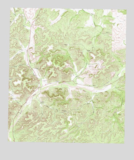
Juno, TX USGS Topographic Map
Click on map above to begin viewing in our Map Viewer.

This topographic map contains these locations and features:
Feature Name Type Latitude Longitude GNIS ID View Map
Beaver Lake RanchLocaleN30.1821°W101.0721°1330272View Map
Bull WindmillLocaleN30.1785°W101.0348°1331619View Map
Cedar Bluff CanyonValleyN30.1775°W101.0532°1332377View Map
Cedar Bluff WindmillLocaleN30.2116°W101.0390°1332379View Map
Cully DrawValleyN30.1604°W101.1089°1333804View Map
Cully WindmillLocaleN30.1649°W101.1207°1333805View Map
East Lake WindmillLocaleN30.1963°W101.0395°1334960View Map
East WindmillLocaleN30.2282°W101.0218°1335025View Map
Hill Trap WindmillLocaleN30.1746°W101.0682°1337792View Map
JunoPopulated PlaceN30.1519°W101.1154°1378509View Map
Juno CemeteryCemeteryN30.1802°W101.0932°1338933View Map
Middle Pasture WindmillLocaleN30.1544°W101.0629°1341510View Map
North Five WindmillLocaleN30.1524°W101.0073°1342724View Map
Oil Well WindmillLocaleN30.2469°W101.1165°1343089View Map
Pecos CanyonValleyN30.1782°W101.0895°1343793View Map
Pecos Canyon RanchLocaleN30.2107°W101.1112°1343794View Map
Rough Pasture DrawValleyN30.1974°W101.1043°1345650View Map
Sulfur Well DrawValleyN30.2094°W101.1079°1348045View Map
Threemile DrawValleyN30.1776°W101.0120°1348534View Map
Two Section DrawValleyN30.1654°W101.0995°1348984View Map
Two Section WindmillLocaleN30.1624°W101.0907°1348987View Map
Twomile DrawValleyN30.1737°W101.0358°1348995View Map
Twomile WindmillLocaleN30.1616°W101.0382°1348996View Map
West Lake WindmillLocaleN30.1935°W101.0962°1349758View Map
White WellWellN30.1408°W101.0493°1349995View Map
Windmill DrawValleyN30.2132°W101.1077°1350294View Map
Windy Point WindmillLocaleN30.2163°W101.0629°1350412View Map

Note: Coordinates in the location and feature list above are referenced to NAD83 datum.


Copyright (C) 2008-2024 Ryan Niemi / Sunset Dynamics ... All Rights Reserved