TopoQuest Logo
Do you find TopoQuest useful?
Help keep TopoQuest running and adding new maps/features by donating!
Bitcoin:  19c7KJd3qBynnjoSw5npx9KScwjBe4ifkT
Litecoin:  LXs6TkuXGGXo1vDsWCkWVdjQX94eUKd6ui
Home View Maps Find Maps Find Places Resources & Links


Juliff, Texas Topographic Map

USGS Map Title: Juliff, TX
USGS Map MRC: 29095D4
DRG (GeoTIFF) Download: o29095d4.tif


Neighboring USGS Topographic Map Quads:


  Missouri City, TX  
29095E5
 

  Almeda, TX  
29095E4
 

  Pearland, TX  
29095E3
 

  Thompsons, TX  
29095D5
 

  Juliff, TX  
29095D4
 

  Manvel, TX  
29095D3
 

  Otey, TX  
29095C5
 

  Rosharon, TX  
29095C4
 

  Liverpool, TX  
29095C3


Map MRC Location:

N30°
W96°
N30°
W95°
H8 H7 H6 H5 H4 H3 H2 H1
G8 G7 G6 G5 G4 G3 G2 G1
F8 F7 F6 F5 F4 F3 F2 F1
E8 E7 E6 E5 E4 E3 E2 E1
D8 D7 D6 D5 D4 D3 D2 D1
C8 C7 C6 C5 C4 C3 C2 C1
B8 B7 B6 B5 B4 B3 B2 B1
A8 A7 A6 A5 A4 A3 A2 A1
N29°
W96°
N29°
W95°

Juliff, TX USGS 1:24K Topographic Map Preview:
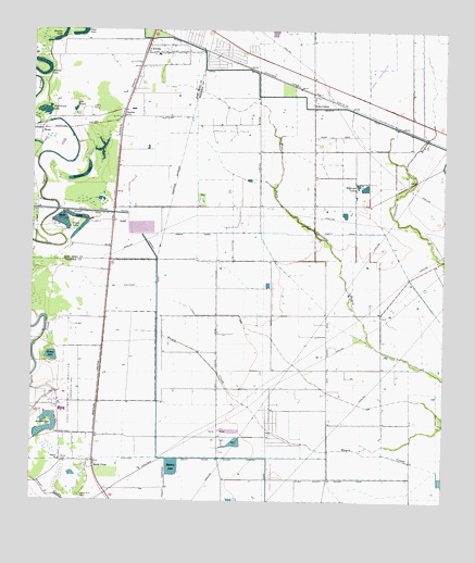
Juliff, TX USGS Topographic Map
Click on map above to begin viewing in our Map Viewer.

This topographic map contains these locations and features:
Feature Name Type Latitude Longitude GNIS ID View Map
ArcolaPopulated PlaceN29.4961°W95.4658°1329659View Map
Arcola Oil FieldOilfieldN29.4733°W95.4391°1329660View Map
Bayless AirportAirportN29.4039°W95.4319°1387425View Map
Brown LakesLakeN29.4481°W95.4846°1331350View Map
Brushy LakeLakeN29.4997°W95.4909°1331452View Map
Cenacle RetreatLocaleN29.4797°W95.4830°1332515View Map
City of Sandy PointCivilN29.3968°W95.4758°2711396View Map
Clear LakeLakeN29.4989°W95.4868°1332949View Map
HawdonPopulated PlaceN29.4788°W95.4724°1378429View Map
Helitrans HeliportAirportN29.4766°W95.4022°1386942View Map
HouseLocaleN29.4738°W95.4974°1338151View Map
Iowa ColonyPopulated PlaceN29.4825°W95.4155°1378484View Map
Iowa Colony CemeteryCemeteryN29.4483°W95.4158°1338488View Map
Iowa Colony City HallBuildingN29.4100°W95.4101°2753542View Map
Iowa Colony Volunteer Fire DepartmentBuildingN29.4094°W95.4102°2334350View Map
Jackson LakeLakeN29.3947°W95.4933°1338595View Map
JuliffPopulated PlaceN29.4502°W95.4755°1378507View Map
Lake JacksonReservoirN29.3939°W95.4957°1857736View Map
Lake Jackson LeveeDamN29.3919°W95.4986°1857735View Map
Lake SiennaLakeN29.4791°W95.4874°1347106View Map
Lawson LakeLakeN29.4883°W95.4983°1339744View Map
Miller LakesLakeN29.4505°W95.4868°1341658View Map
Mount Tabor Baptist ChurchChurchN29.4941°W95.4591°2018836View Map
Mowery LakeReservoirN29.3842°W95.4571°1857734View Map
Mowery Lake LeveeDamN29.3852°W95.4586°1857733View Map
North CanalCanalN29.4466°W95.4280°1342699View Map
Palestine Missionary Baptist ChurchChurchN29.4769°W95.4755°2018842View Map
Pilgrim ChurchChurchN29.3858°W95.4913°1344001View Map
Pilgrim Missonary Baptist ChurchChurchN29.3858°W95.4891°2016162View Map
Rawlings LakesLakeN29.4592°W95.4016°1344839View Map
Sandy PointPopulated PlaceN29.3855°W95.4811°1346604View Map
Sandy Point CemeteryCemeteryN29.3765°W95.4857°1346605View Map
Sugarhouse LakeLakeN29.4787°W95.4966°1348037View Map
Texas Department of Criminal Justice Darrington UnitBuildingN29.3994°W95.4905°1384355View Map
Thompson LakeLakeN29.4609°W95.4863°1348507View Map
Village of Iowa ColonyCivilN29.4409°W95.4167°2413561View Map
Willow LakeLakeN29.4134°W95.4941°1350197View Map
Woods CemeteryCemeteryN29.3858°W95.4908°1350554View Map

Note: Coordinates in the location and feature list above are referenced to NAD83 datum.


Copyright (C) 2008-2024 Ryan Niemi / Sunset Dynamics ... All Rights Reserved