TopoQuest Logo
Do you find TopoQuest useful?
Help keep TopoQuest running and adding new maps/features by donating!
Bitcoin:  19c7KJd3qBynnjoSw5npx9KScwjBe4ifkT
Litecoin:  LXs6TkuXGGXo1vDsWCkWVdjQX94eUKd6ui
Home View Maps Find Maps Find Places Resources & Links


Johnsonburg, New York Topographic Map

USGS Map Title: Johnsonburg, NY
USGS Map MRC: 42078F3
DRG (GeoTIFF) Download: o42078f3.tif


Neighboring USGS Topographic Map Quads:


  Cowlesville, NY  
42078G4
 

  Attica, NY  
42078G3
 

  Dale, NY  
42078G2
 

  Strykersville, NY  
42078F4
 

  Johnsonburg, NY  
42078F3
 

  Warsaw, NY  
42078F2
 

  Arcade, NY  
42078E4
 

  Bliss, NY  
42078E3
 

  Pike, NY  
42078E2


Map MRC Location:

N43°
W79°
N43°
W78°
H8 H7 H6 H5 H4 H3 H2 H1
G8 G7 G6 G5 G4 G3 G2 G1
F8 F7 F6 F5 F4 F3 F2 F1
E8 E7 E6 E5 E4 E3 E2 E1
D8 D7 D6 D5 D4 D3 D2 D1
C8 C7 C6 C5 C4 C3 C2 C1
B8 B7 B6 B5 B4 B3 B2 B1
A8 A7 A6 A5 A4 A3 A2 A1
N42°
W79°
N42°
W78°

Johnsonburg, NY USGS 1:24K Topographic Map Preview:
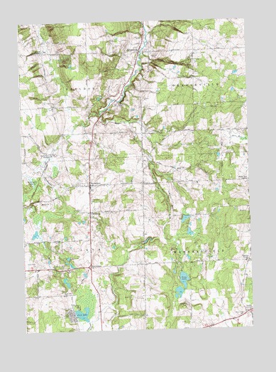
Johnsonburg, NY USGS Topographic Map
Click on map above to begin viewing in our Map Viewer.

This topographic map contains these locations and features:
Feature Name Type Latitude Longitude GNIS ID View Map
Camp Hickory HillLocaleN42.7423°W78.3253°945595View Map
East Fork Tonawanda CreekStreamN42.7120°W78.3311°949072View Map
Eastman CornersLocaleN42.6523°W78.2517°949295View Map
Engine CreekStreamN42.6937°W78.3042°949661View Map
Faun LakeLakeN42.6445°W78.2878°949931View Map
Five CornersLocaleN42.6509°W78.3383°950195View Map
Gallagher SwampSwampN42.6848°W78.3684°950849View Map
Humphrey's Hollows CemeteryCemeteryN42.7381°W78.3607°2515235View Map
Java LakeLakeN42.6312°W78.3439°953944View Map
JohnsonburgPopulated PlaceN42.7376°W78.3095°954143View Map
Johnsonburg CemeteryCemeteryN42.7356°W78.3147°1989260View Map
North JavaPopulated PlaceN42.6837°W78.3378°958831View Map
North Java Fire Department Station 1BuildingN42.6826°W78.3389°2701160View Map
North Java Pioneer CemeteryCemeteryN42.6821°W78.3376°2515238View Map
North Java Post OfficePost OfficeN42.6841°W78.3376°2618044View Map
North Java StationLocaleN42.6970°W78.3586°958832View Map
Poplar Tree CornersLocaleN42.6848°W78.2503°960946View Map
Roberts Roost Airport (historical)AirportN42.6334°W78.3550°977894View Map
Saint Nicholas CemeteryCemeteryN42.6780°W78.3373°964030View Map
Silver Maple CemeteryCemeteryN42.6842°W78.3446°965279View Map
Smiths CornerPopulated PlaceN42.6317°W78.2522°965529View Map
SouthburgPopulated PlaceN42.6728°W78.3378°965898View Map
Torrey Hill CemeteryCemeteryN42.6402°W78.3535°967678View Map
Toziers CornerPopulated PlaceN42.7376°W78.3622°967730View Map
Union CornersLocaleN42.6842°W78.3086°968184View Map
Union Corners CemeteryCemeteryN42.6813°W78.3087°2515239View Map
Wethersfield CemeteryCemeteryN42.6309°W78.2547°970953View Map

Note: Coordinates in the location and feature list above are referenced to NAD83 datum.


Copyright (C) 2008-2024 Ryan Niemi / Sunset Dynamics ... All Rights Reserved