TopoQuest Logo
Do you find TopoQuest useful?
Help keep TopoQuest running and adding new maps/features by donating!
Bitcoin:  19c7KJd3qBynnjoSw5npx9KScwjBe4ifkT
Litecoin:  LXs6TkuXGGXo1vDsWCkWVdjQX94eUKd6ui
Home View Maps Find Maps Find Places Resources & Links


Johnson Mountain, Maine Topographic Map

USGS Map Title: Johnson Mountain, ME
USGS Map MRC: 45070D1
DRG (GeoTIFF) Download: o45070d1.tif


Neighboring USGS Topographic Map Quads:


  Catheart Mountain, ME  
45070E2
 

  Long Pond, ME  
45070E1
 

  Misery Knob, ME  
45069E8
 

  Enchanted Pond, ME  
45070D2
 

  Johnson Mountain, ME  
45070D1
 

  Black Brook Pond, ME  
45069D8
 

  Basin Mountain, ME  
45070C2
 

  Pierce Pond, ME  
45070C1
 

  The Forks, ME  
45069C8


Map MRC Location:

N46°
W71°
N46°
W70°
H8 H7 H6 H5 H4 H3 H2 H1
G8 G7 G6 G5 G4 G3 G2 G1
F8 F7 F6 F5 F4 F3 F2 F1
E8 E7 E6 E5 E4 E3 E2 E1
D8 D7 D6 D5 D4 D3 D2 D1
C8 C7 C6 C5 C4 C3 C2 C1
B8 B7 B6 B5 B4 B3 B2 B1
A8 A7 A6 A5 A4 A3 A2 A1
N45°
W71°
N45°
W70°

Johnson Mountain, ME USGS 1:24K Topographic Map Preview:
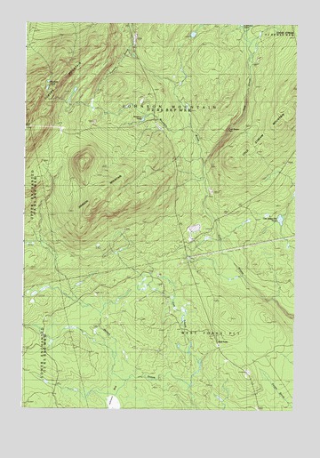
Johnson Mountain, ME USGS Topographic Map
Click on map above to begin viewing in our Map Viewer.

This topographic map contains these locations and features:
Feature Name Type Latitude Longitude GNIS ID View Map
Cold Stream FallsFallsN45.4659°W70.0315°1908513View Map
Cold Stream MountainSummitN45.4797°W70.0008°564199View Map
East Branch Salmon StreamStreamN45.3837°W70.0481°565573View Map
Johnson MountainSummitN45.4417°W70.0919°568933View Map
Johnson Mountain TownshipCivilN45.4759°W70.0597°1987419View Map
Little Wilson Hill PondLakeN45.4369°W70.0069°570106View Map
Markham PondLakeN45.4690°W70.0706°570786View Map
Mountain BrookStreamN45.4550°W70.0440°571795View Map
Mountain PondsLakeN45.4788°W70.1148°571814View Map
Plantation of West ForksCivilN45.3912°W70.0084°582805View Map
Salmon Stream FarmLocaleN45.3953°W70.0817°574783View Map
West ForksPopulated PlaceN45.3970°W70.0362°579817View Map

Note: Coordinates in the location and feature list above are referenced to NAD83 datum.


Copyright (C) 2008-2024 Ryan Niemi / Sunset Dynamics ... All Rights Reserved