TopoQuest Logo
Do you find TopoQuest useful?
Help keep TopoQuest running and adding new maps/features by donating!
Bitcoin:  19c7KJd3qBynnjoSw5npx9KScwjBe4ifkT
Litecoin:  LXs6TkuXGGXo1vDsWCkWVdjQX94eUKd6ui
Home View Maps Find Maps Find Places Resources & Links


Jefferson Island, Montana Topographic Map

USGS Map Title: Jefferson Island, MT
USGS Map MRC: 45111G8
DRG (GeoTIFF) Download: o45111g8.tif


Neighboring USGS Topographic Map Quads:


  Black Butte, MT  
45112H1
 

  Doherty Mountain, MT  
45111H8
 

  Negro Hollow, MT  
45111H7
 

  Whitehall, MT  
45112G1
 

  Jefferson Island, MT  
45111G8
 

  Sappington, MT  
45111G7
 

  Manhead Mountain, MT  
45112F1
 

  Pony, MT  
45111F8
 

  Harrison, MT  
45111F7


Map MRC Location:

N46°
W112°
N46°
W111°
H8 H7 H6 H5 H4 H3 H2 H1
G8 G7 G6 G5 G4 G3 G2 G1
F8 F7 F6 F5 F4 F3 F2 F1
E8 E7 E6 E5 E4 E3 E2 E1
D8 D7 D6 D5 D4 D3 D2 D1
C8 C7 C6 C5 C4 C3 C2 C1
B8 B7 B6 B5 B4 B3 B2 B1
A8 A7 A6 A5 A4 A3 A2 A1
N45°
W112°
N45°
W111°

Jefferson Island, MT USGS 1:24K Topographic Map Preview:
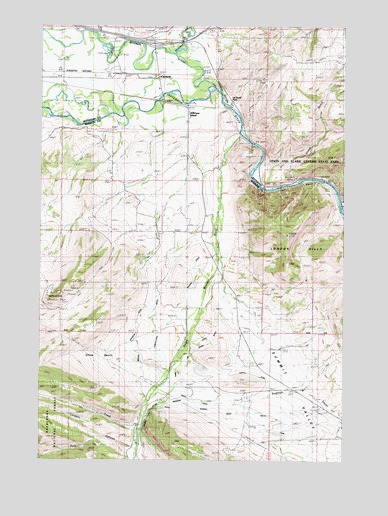
Jefferson Island, MT USGS Topographic Map
Click on map above to begin viewing in our Map Viewer.

This topographic map contains these locations and features:
Feature Name Type Latitude Longitude GNIS ID View Map
01S02E17AAB_01 WellWellN45.7577°W111.9897°811735View Map
02N03W33DCD_01 WellWellN45.8746°W111.9772°812974View Map
02N03W34CCD_01 WellWellN45.8749°W111.9680°812982View Map
Agricultural DitchCanalN45.7916°W111.9567°806891View Map
Bardsen (historical)LocaleN45.8466°W111.9175°1762523View Map
Boulder RiverStreamN45.8669°W111.9455°780285View Map
Boulder ValleyValleyN45.8669°W111.9455°780287View Map
Bricker Sparrow DitchCanalN45.7869°W111.9608°780390View Map
CardwellPopulated PlaceN45.8599°W111.9525°780936View Map
Cardwell (historical)LocaleN45.8599°W111.9525°1762504View Map
Cardwell Bridge Fishing Access SiteLocaleN45.8519°W111.9519°1744465View Map
Cardwell Census Designated PlaceCensusN45.8621°W111.9554°2407961View Map
Cardwell Post OfficePost OfficeN45.8603°W111.9529°1762502View Map
Cardwell SchoolSchoolN45.8569°W111.9521°1762532View Map
Cave MountainSummitN45.8374°W111.8794°1762631View Map
Cavern (historical)LocaleN45.8319°W111.8842°1762493View Map
Church DitchCanalN45.7644°W111.9347°781266View Map
Dodge DitchCanalN45.7671°W111.9369°782430View Map
Eau Clair (historical)Populated PlaceN45.8430°W111.9197°1797528View Map
Father De Smet Historical MarkerParkN45.8721°W111.9564°1762626View Map
Highway 10 QuarryMineN45.8305°W111.8947°803587View Map
Interchange 256CrossingN45.8699°W111.9547°1762619View Map
Jefferson IslandPopulated PlaceN45.8508°W111.9405°785440View Map
Jefferson Island (historical)LocaleN45.8508°W111.9405°1797507View Map
Jefferson Island Post Office (historical)Post OfficeN45.8508°W111.9405°1797506View Map
Jefferson SloughStreamN45.8574°W111.9300°785446View Map
La Hood ParkPopulated PlaceN45.8530°W111.9222°785870View Map
La Hood Park CampgroundLocaleN45.8530°W111.9222°1762592View Map
La Hood Park MineMineN45.8527°W111.9244°803584View Map
Lewis & Clark Caverns State ParkParkN45.8391°W111.8867°786069View Map
Lewis and Clark Expedition Campsite Historical MarkerParkN45.8721°W111.9564°1762627View Map
Lime Spur (historical)LocaleN45.8288°W111.9053°1762669View Map
Lime Spur Post Office (historical)Post OfficeN45.8288°W111.9053°1762553View Map
Limekiln CreekStreamN45.7596°W111.9600°786136View Map
Limespur Fishing Access SiteLocaleN45.8216°W111.8755°1744469View Map
London PeakSummitN45.8149°W111.8992°1797805View Map
Mayflower Extension MineMineN45.7944°W111.9994°804601View Map
Missouri DitchCanalN45.7658°W111.9280°787510View Map
NE SW Section 25 MineMineN45.8083°W111.9258°804378View Map
North Fork Missouri DitchCanalN45.7749°W111.9139°788213View Map
NW NW Section 20 MineMineN45.8271°W111.8828°804609View Map
Oliverson MineMineN45.8638°W111.9300°803586View Map
Pole CanyonValleyN45.7549°W111.9605°789832View Map
Primus Post Office (historical)Post OfficeN45.7999°W111.8919°1797408View Map
Quarry MineMineN45.8305°W111.8980°803455View Map
Randall DitchCanalN45.8010°W111.9369°789380View Map
Rundell DitchCanalN45.7585°W111.9086°789854View Map
Shaw BasinBasinN45.7821°W111.9661°801878View Map
Sheep GulchValleyN45.8313°W111.8986°790344View Map
South Boulder AirportAirportN45.8127°W111.9268°2650684View Map
South Boulder CemeteryCemeteryN45.8169°W111.9389°790878View Map
South Boulder RiverStreamN45.8433°W111.9186°790880View Map
Summit ValleyValleyN45.8033°W111.9314°793858View Map
Summit ValleyPopulated PlaceN45.7705°W111.8925°791674View Map
Three Jim DitchCanalN45.7788°W111.9389°792127View Map

Note: Coordinates in the location and feature list above are referenced to NAD83 datum.


Copyright (C) 2008-2024 Ryan Niemi / Sunset Dynamics ... All Rights Reserved