TopoQuest Logo
Do you find TopoQuest useful?
Help keep TopoQuest running and adding new maps/features by donating!
Bitcoin:  19c7KJd3qBynnjoSw5npx9KScwjBe4ifkT
Litecoin:  LXs6TkuXGGXo1vDsWCkWVdjQX94eUKd6ui
Home View Maps Find Maps Find Places Resources & Links


Jeddo, Michigan Topographic Map

USGS Map Title: Jeddo, MI
USGS Map MRC: 43082B5
DRG (GeoTIFF) Download: o43082b5.tif


Neighboring USGS Topographic Map Quads:


  Applegate, MI  
43082C6
 

  Croswell, MI  
43082C5


  Roseburg, MI  
43082B6
 

  Jeddo, MI  
43082B5


  Avoca, MI  
43082A6
 

  Ruby, MI  
43082A5
 

  Lakeport, MI  
43082A4


Map MRC Location:

N44°
W83°
N44°
W82°
H8 H7 H6 H5 H4 H3 H2 H1
G8 G7 G6 G5 G4 G3 G2 G1
F8 F7 F6 F5 F4 F3 F2 F1
E8 E7 E6 E5 E4 E3 E2 E1
D8 D7 D6 D5 D4 D3 D2 D1
C8 C7 C6 C5 C4 C3 C2 C1
B8 B7 B6 B5 B4 B3 B2 B1
A8 A7 A6 A5 A4 A3 A2 A1
N43°
W83°
N43°
W82°

Jeddo, MI USGS 1:24K Topographic Map Preview:
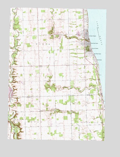
Jeddo, MI USGS Topographic Map
Click on map above to begin viewing in our Map Viewer.

This topographic map contains these locations and features:
Feature Name Type Latitude Longitude GNIS ID View Map
AmadorePopulated PlaceN43.1950°W82.5858°1617415View Map
Amadore Post Office (historical)Post OfficeN43.1944°W82.5861°2554395View Map
Amadore Station (historical)LocaleN43.1947°W82.5956°2554179View Map
Baker CemeteryCemeteryN43.1567°W82.6227°1624364View Map
Bardwell CemeteryCemeteryN43.1953°W82.5694°2554451View Map
Bethel ChurchChurchN43.1959°W82.5466°621217View Map
Birch BeachPopulated PlaceN43.2020°W82.5124°621396View Map
Birch Beach Post Office (historical)Post OfficeN43.2020°W82.5124°1926648View Map
Birch CreekStreamN43.1653°W82.5013°1624394View Map
Black CreekStreamN43.2131°W82.6185°621489View Map
Blue Water BeachPopulated PlaceN43.2072°W82.5155°621647View Map
Burtch CreekStreamN43.1636°W82.5063°1624429View Map
Carmen CemeteryCemeteryN43.2217°W82.5471°622740View Map
Castor CemeteryCemeteryN43.2411°W82.5272°2554449View Map
Church of Jesus Christ of Latter Day SaintsChurchN43.1978°W82.5114°2554125View Map
Cook SchoolSchoolN43.1681°W82.5455°1618133View Map
Darrell's LandingAirportN43.2419°W82.5858°2717260View Map
Diamond Cemetery (historical)CemeteryN43.2472°W82.5128°2554448View Map
Gospel Light Baptist ChurchChurchN43.1917°W82.5108°2554122View Map
Grant DrainStreamN43.1609°W82.5091°1624575View Map
Grant Township Fire and Rescue DepartmentBuildingN43.1353°W82.5816°2619952View Map
Great Lakes BeachPopulated PlaceN43.2170°W82.5221°627275View Map
Huronia HeightsPopulated PlaceN43.2122°W82.5227°628881View Map
JeddoPopulated PlaceN43.1517°W82.5833°1624628View Map
Jeddo Post OfficePost OfficeN43.1522°W82.5833°2582159View Map
Jeddo Station (historical)LocaleN43.1514°W82.5931°2582158View Map
Lake Huron CampLocaleN43.1631°W82.5027°1624655View Map
Lakeview CemeteryCemeteryN43.2395°W82.5580°630051View Map
Lexington HeightsPopulated PlaceN43.2250°W82.5246°630361View Map
Living Word Missionary ChurchChurchN43.2450°W82.5300°2554119View Map
Locke CemeteryCemeteryN43.1667°W82.5939°2554482View Map
Matthews Farm Historical MarkerParkN43.2097°W82.5842°2554484View Map
Mill CreekStreamN43.2200°W82.5202°632321View Map
Reorganized Church of Jesus Christ of Latter Day SaintsChurchN43.2000°W82.5269°2554124View Map
Saint Lawrence CemeteryCemeteryN43.1534°W82.5683°1624894View Map
Strevel CemeteryCemeteryN43.1370°W82.5958°1624963View Map
Township of WorthCivilN43.2079°W82.5805°1627291View Map
Whispering Pines Animal KingdomLocaleN43.2250°W82.5597°2554121View Map
Wixon DrainStreamN43.1489°W82.5060°1625026View Map
Worth Township CemeteryCemeteryN43.2092°W82.6119°1618134View Map
WYDG-FM (Lexington)TowerN43.2095°W82.5360°1625735View Map

Note: Coordinates in the location and feature list above are referenced to NAD83 datum.


Copyright (C) 2008-2024 Ryan Niemi / Sunset Dynamics ... All Rights Reserved