TopoQuest Logo
Do you find TopoQuest useful?
Help keep TopoQuest running and adding new maps/features by donating!
Bitcoin:  19c7KJd3qBynnjoSw5npx9KScwjBe4ifkT
Litecoin:  LXs6TkuXGGXo1vDsWCkWVdjQX94eUKd6ui
Home View Maps Find Maps Find Places Resources & Links


Baldy Bill Point, Arizona Topographic Map

USGS Map Title: Baldy Bill Point, AZ
USGS Map MRC: 33109E4
DRG (GeoTIFF) Download: o33109e4.tif


Neighboring USGS Topographic Map Quads:


  Maverick, AZ  
33109F5
 

  Hoodoo Knoll, AZ  
33109F4
 

  Hannagan Meadow, AZ  
33109F3
 

  Freezeout Mountain, AZ  
33109E5
 

  Baldy Bill Point, AZ  
33109E4
 

  Strayhorse, AZ  
33109E3
 

  Willow Mountain, AZ  
33109D5
 

  Robinson Mesa, AZ  
33109D4
 

  Rose Peak, AZ  
33109D3


Map MRC Location:

N34°
W110°
N34°
W109°
H8 H7 H6 H5 H4 H3 H2 H1
G8 G7 G6 G5 G4 G3 G2 G1
F8 F7 F6 F5 F4 F3 F2 F1
E8 E7 E6 E5 E4 E3 E2 E1
D8 D7 D6 D5 D4 D3 D2 D1
C8 C7 C6 C5 C4 C3 C2 C1
B8 B7 B6 B5 B4 B3 B2 B1
A8 A7 A6 A5 A4 A3 A2 A1
N33°
W110°
N33°
W109°

Baldy Bill Point, AZ USGS 1:24K Topographic Map Preview:
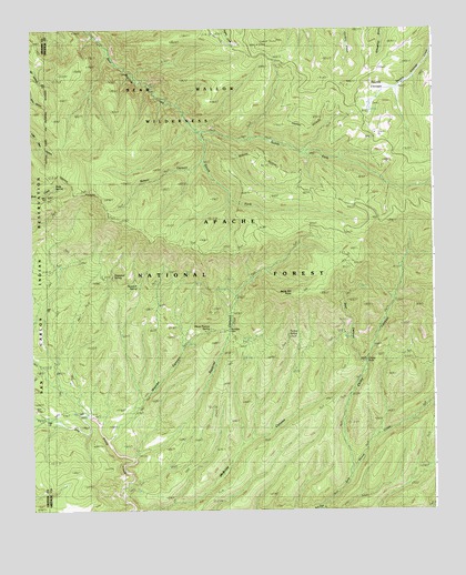
Baldy Bill Point, AZ USGS Topographic Map
Click on map above to begin viewing in our Map Viewer.

This topographic map contains these locations and features:
Feature Name Type Latitude Longitude GNIS ID View Map
Baldy Bill PointCliffN33.5567°W109.4204°25924View Map
Bear CanyonValleyN33.5381°W109.3962°26060View Map
Bear SpringSpringN33.5449°W109.4010°42554View Map
Bear Wallow WildernessReserveN33.6025°W109.4550°41540View Map
Chitty CanyonValleyN33.5092°W109.4012°27606View Map
Chitty Canyon Trail Thirty FourTrailN33.5412°W109.3992°39943View Map
Chitty Creek SpringSpringN33.5253°W109.4031°42558View Map
Chitty FallsFallsN33.5391°W109.3962°25422View Map
Chitty Trap CorralLocaleN33.5137°W109.4031°42557View Map
Conklin Creek CampgroundsParkN33.6139°W109.4081°39950View Map
Cottonwood TankReservoirN33.5089°W109.3876°39957View Map
Cowhead TankReservoirN33.5376°W109.4873°39958View Map
Dogwood SpringSpringN33.5576°W109.4695°39967View Map
Double CienegaFlatN33.6073°W109.3898°28552View Map
Dry Prong Trail Forty-fiveTrailN33.5120°W109.4701°39973View Map
Eagle TankReservoirN33.5002°W109.4112°1853688View Map
Horse Pasture SpringSpringN33.5473°W109.4448°40001View Map
Horse Pasture SpringSpringN33.5473°W109.4449°44776View Map
Long Canyon TankReservoirN33.5234°W109.4456°40023View Map
Malay CorralLocaleN33.5248°W109.4826°42383View Map
Malay TankReservoirN33.5335°W109.4885°40027View Map
Maverick SpringSpringN33.5601°W109.4654°40030View Map
Maverick SpringSpringN33.5578°W109.4666°44777View Map
McBride CorralLocaleN33.5239°W109.4201°42556View Map
McBridge CanyonValleyN33.5003°W109.4690°31622View Map
Miller SpringSpringN33.5436°W109.4331°40035View Map
North Fork Bear Wallow CreekStreamN33.5984°W109.4484°32357View Map
Red Tail TankReservoirN33.5076°W109.4687°40070View Map
Reno LookoutLocaleN33.6214°W109.4293°42381View Map
Reno LookoutLocaleN33.6206°W109.4301°25349View Map
Reno SpringSpringN33.6181°W109.4340°40071View Map
Salt House CreekStreamN33.5006°W109.4117°33991View Map
Sanders CorralLocaleN33.5464°W109.4404°42379View Map
Saunders CabinLocaleN33.5467°W109.4392°44778View Map
Schell CanyonValleyN33.5903°W109.4470°34128View Map
South Fork Bear Wallow CreekStreamN33.5984°W109.4484°34654View Map
South Squirrel SpringSpringN33.5403°W109.4423°40089View Map
Squirrel CanyonValleyN33.5137°W109.4684°34788View Map
Squirrel Canyon TankReservoirN33.5217°W109.4543°42378View Map
Squirrel SpringSpringN33.5476°W109.4384°42380View Map
Squirrel TankReservoirN33.5270°W109.4492°40093View Map
Steer Pasture TankReservoirN33.5070°W109.4902°40098View Map
Turkey SpringSpringN33.5431°W109.4209°40115View Map
Turkey Trap TankReservoirN33.5262°W109.4311°42555View Map
Upper Bear SpringSpringN33.5601°W109.4042°40118View Map
Upper Malay TankReservoirN33.5634°W109.4912°42382View Map
Upper McBride SpringSpringN33.5453°W109.4101°40122View Map
Warren CanyonValleyN33.5187°W109.4768°35898View Map
Warren TankReservoirN33.6234°W109.4670°1853686View Map
Yellowjacket CorralLocaleN33.5584°W109.4551°1853690View Map
Yellowjacket SpringSpringN33.5618°W109.4526°1853687View Map

Note: Coordinates in the location and feature list above are referenced to NAD83 datum.


Copyright (C) 2008-2024 Ryan Niemi / Sunset Dynamics ... All Rights Reserved