TopoQuest Logo
Do you find TopoQuest useful?
Help keep TopoQuest running and adding new maps/features by donating!
Bitcoin:  19c7KJd3qBynnjoSw5npx9KScwjBe4ifkT
Litecoin:  LXs6TkuXGGXo1vDsWCkWVdjQX94eUKd6ui
Home View Maps Find Maps Find Places Resources & Links


Jackson Hill, Montana Topographic Map

USGS Map Title: Jackson Hill, MT
USGS Map MRC: 45113D3
DRG (GeoTIFF) Download: o45113d3.tif


Neighboring USGS Topographic Map Quads:


  Wisdom, MT  
45113E4
 

  Stewart Mountain, MT  
45113E3
 

  Odell Lake, MT  
45113E2
 

  Fox Gulch, MT  
45113D4
 

  Jackson Hill, MT  
45113D3
 

  Maverick Mountain, MT  
45113D2
 

  Jackson, MT  
45113C4
 

  Butch Hill, MT  
45113C3
 

  Tash Peak, MT  
45113C2


Map MRC Location:

N46°
W114°
N46°
W113°
H8 H7 H6 H5 H4 H3 H2 H1
G8 G7 G6 G5 G4 G3 G2 G1
F8 F7 F6 F5 F4 F3 F2 F1
E8 E7 E6 E5 E4 E3 E2 E1
D8 D7 D6 D5 D4 D3 D2 D1
C8 C7 C6 C5 C4 C3 C2 C1
B8 B7 B6 B5 B4 B3 B2 B1
A8 A7 A6 A5 A4 A3 A2 A1
N45°
W114°
N45°
W113°

Jackson Hill, MT USGS 1:24K Topographic Map Preview:
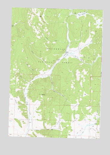
Jackson Hill, MT USGS Topographic Map
Click on map above to begin viewing in our Map Viewer.

This topographic map contains these locations and features:
Feature Name Type Latitude Longitude GNIS ID View Map
Bear CreekStreamN45.4952°W113.2931°779499View Map
Butch HillSummitN45.3758°W113.3206°794528View Map
Carney MineMineN45.3830°W113.3159°780957View Map
Carney MineMineN45.3833°W113.3162°802508View Map
Clemow Cow CampLocaleN45.4585°W113.2962°781373View Map
Cox CreekStreamN45.4549°W113.2984°781802View Map
Cox ParkFlatN45.4063°W113.2848°781805View Map
Deer PeakSummitN45.4919°W113.3370°782271View Map
Gloss Upper DitchCanalN45.3877°W113.2581°783996View Map
Heath CreekStreamN45.4688°W113.2956°784698View Map
Hunter CreekStreamN45.3944°W113.2537°778810View Map
Jackson CreekStreamN45.4383°W113.3187°785386View Map
Jackson HillSummitN45.4130°W113.3653°785395View Map
Jardine DitchCanalN45.3777°W113.3653°785423View Map
Knight GulchValleyN45.4366°W113.3331°785804View Map
Kunselman CreekStreamN45.3860°W113.2609°785859View Map
Little Milk CreekStreamN45.4358°W113.3212°786328View Map
Old Tim CreekStreamN45.4549°W113.2995°788425View Map
Open ParkFlatN45.3927°W113.2837°788472View Map
Poison CreekStreamN45.4274°W113.3476°789029View Map
Richards ParkFlatN45.3935°W113.3053°789567View Map
Star ParkFlatN45.4180°W113.2714°791448View Map
Steer LakeLakeN45.4960°W113.2899°791487View Map
Steer MeadowSwampN45.4946°W113.2798°791488View Map
West Side DitchCanalN45.3755°W113.2828°793130View Map
Woody CreekStreamN45.3833°W113.3473°793539View Map
Woody MountainSummitN45.4166°W113.3306°793540View Map

Note: Coordinates in the location and feature list above are referenced to NAD83 datum.


Copyright (C) 2008-2024 Ryan Niemi / Sunset Dynamics ... All Rights Reserved