TopoQuest Logo
Do you find TopoQuest useful?
Help keep TopoQuest running and adding new maps/features by donating!
Bitcoin:  19c7KJd3qBynnjoSw5npx9KScwjBe4ifkT
Litecoin:  LXs6TkuXGGXo1vDsWCkWVdjQX94eUKd6ui
Home View Maps Find Maps Find Places Resources & Links


Izee, Oregon Topographic Map

USGS Map Title: Izee, OR
USGS Map MRC: 44119A4
DRG (GeoTIFF) Download: o44119a4.tif


Neighboring USGS Topographic Map Quads:


  Suplee Butte, OR  
44119B5
 

  Graylock Butte, OR  
44119B4
 

  Flagtail Mountain, OR  
44119B3
 

  Funny Butte, OR  
44119A5
 

  Izee, OR  
44119A4
 

  Lewis Creek, OR  
44119A3
 

  Big Mowich Mountain, OR  
43119H5
 

  Whiskey Mountain, OR  
43119H4
 

  Alsup Mountain, OR  
43119H3


Map MRC Location:

N45°
W120°
N45°
W119°
H8 H7 H6 H5 H4 H3 H2 H1
G8 G7 G6 G5 G4 G3 G2 G1
F8 F7 F6 F5 F4 F3 F2 F1
E8 E7 E6 E5 E4 E3 E2 E1
D8 D7 D6 D5 D4 D3 D2 D1
C8 C7 C6 C5 C4 C3 C2 C1
B8 B7 B6 B5 B4 B3 B2 B1
A8 A7 A6 A5 A4 A3 A2 A1
N44°
W120°
N44°
W119°

Izee, OR USGS 1:24K Topographic Map Preview:
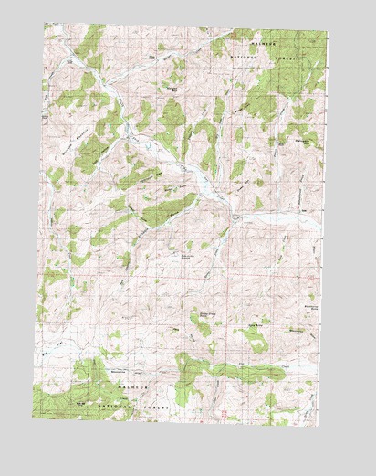
Izee, OR USGS Topographic Map
Click on map above to begin viewing in our Map Viewer.

This topographic map contains these locations and features:
Feature Name Type Latitude Longitude GNIS ID View Map
Alder CreekStreamN44.0190°W119.4155°1137076View Map
Big FlatFlatN44.0238°W119.4866°1138026View Map
Brisbois CreekStreamN44.0965°W119.4983°1155359View Map
Brisbois GulchValleyN44.0726°W119.4297°1138632View Map
Brisbois RanchLocaleN44.0735°W119.4236°1156193View Map
Buck CreekStreamN44.0651°W119.3900°1138758View Map
Bush MillLocaleN44.0057°W119.4811°1139026View Map
Davis RanchLocaleN44.0896°W119.4622°1638109View Map
Dons ButteSummitN44.0321°W119.4041°1141186View Map
Dry Soda CreekStreamN44.0721°W119.4239°1141358View Map
Elkhorn CreekStreamN44.0829°W119.4369°1141813View Map
Hack HollowValleyN44.0213°W119.4300°1143185View Map
Harrison MountainSummitN44.0924°W119.4786°1143334View Map
Hole-in-the GroundBasinN44.0535°W119.4400°1143661View Map
IzeePopulated PlaceN44.0671°W119.3861°1144149View Map
Izee CemeteryCemeteryN44.0688°W119.3908°1152959View Map
Izee Post Office (historical)Post OfficeN44.0671°W119.3861°1165446View Map
Keerins RanchLocaleN44.1135°W119.4886°1156946View Map
Magill CreekStreamN44.0624°W119.3777°1145732View Map
Mahogany MountainSummitN44.0904°W119.3836°1145747View Map
McCoy CreekStreamN44.1201°W119.4280°1145947View Map
Moonshine AlleyValleyN44.0151°W119.4483°1146427View Map
Morgan CreekStreamN44.1051°W119.4733°1146450View Map
Morgan MountainSummitN44.1040°W119.4411°1146453View Map
Phillips RanchLocaleN44.1149°W119.4508°1156945View Map
Phillips SpringSpringN44.1004°W119.4629°1154196View Map
Pine CreekStreamN44.1151°W119.4875°1147692View Map
Poison CreekStreamN44.0651°W119.3955°1147824View Map
Pole CanyonValleyN44.0526°W119.4600°1147841View Map
Rosebud CreekStreamN44.0624°W119.3780°1148733View Map
Schoolhouse GulchValleyN44.0688°W119.3866°1149141View Map
Sheep CreekStreamN44.0646°W119.4133°1149317View Map
Sheep Creek ButteSummitN44.0340°W119.4294°1149332View Map
Smith RanchLocaleN44.0893°W119.3955°1156192View Map
Snake DenValleyN44.0718°W119.4166°1149790View Map
Sock HollowValleyN44.0890°W119.4641°1149843View Map
Soldier GulchValleyN44.0615°W119.4514°1149868View Map
Spoon CreekStreamN44.0071°W119.4541°1150136View Map
Walker GulchValleyN44.0768°W119.4325°1151833View Map
Waterspout DrawValleyN44.0801°W119.4441°1151958View Map
Wildcat GulchValleyN44.0982°W119.4191°1152349View Map

Note: Coordinates in the location and feature list above are referenced to NAD83 datum.


Copyright (C) 2008-2024 Ryan Niemi / Sunset Dynamics ... All Rights Reserved