TopoQuest Logo
Do you find TopoQuest useful?
Help keep TopoQuest running and adding new maps/features by donating!
Bitcoin:  19c7KJd3qBynnjoSw5npx9KScwjBe4ifkT
Litecoin:  LXs6TkuXGGXo1vDsWCkWVdjQX94eUKd6ui
Home View Maps Find Maps Find Places Resources & Links


Ithaca, Michigan Topographic Map

USGS Map Title: Ithaca, MI
USGS Map MRC: 43084C5
DRG (GeoTIFF) Download: o43084c5.tif


Neighboring USGS Topographic Map Quads:


  Alma North, MI  
43084D6
 

  Saint Louis, MI  
43084D5
 

  Breckenridge, MI  
43084D4
 

  Alma South, MI  
43084C6
 

  Ithaca, MI  
43084C5
 

  Rathbone, MI  
43084C4
 

  Perrinton, MI  
43084B6
 

  Pompeii, MI  
43084B5
 

  Ashley, MI  
43084B4


Map MRC Location:

N44°
W85°
N44°
W84°
H8 H7 H6 H5 H4 H3 H2 H1
G8 G7 G6 G5 G4 G3 G2 G1
F8 F7 F6 F5 F4 F3 F2 F1
E8 E7 E6 E5 E4 E3 E2 E1
D8 D7 D6 D5 D4 D3 D2 D1
C8 C7 C6 C5 C4 C3 C2 C1
B8 B7 B6 B5 B4 B3 B2 B1
A8 A7 A6 A5 A4 A3 A2 A1
N43°
W85°
N43°
W84°

Ithaca, MI USGS 1:24K Topographic Map Preview:
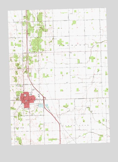
Ithaca, MI USGS Topographic Map
Click on map above to begin viewing in our Map Viewer.

This topographic map contains these locations and features:
Feature Name Type Latitude Longitude GNIS ID View Map
Beaver DrainCanalN43.3236°W84.5508°620922View Map
Beaver DrainStreamN43.3350°W84.5208°620923View Map
BeebePopulated PlaceN43.3353°W84.5481°620991View Map
Beebe CemeteryCemeteryN43.3475°W84.5686°620992View Map
Beebe Post Office (historical)Post OfficeN43.3353°W84.5481°2562139View Map
Brady CemeteryCemeteryN43.2797°W84.5230°621858View Map
City of IthacaCivilN43.2909°W84.5958°1626534View Map
Community of Christ ChurchChurchN43.3614°W84.6064°2561882View Map
Dodge SchoolSchoolN43.3059°W84.5086°624735View Map
Family Medical Care of IthacaHospitalN43.2928°W84.6078°2561935View Map
First Presbyterian ChurchChurchN43.2903°W84.6050°2561942View Map
Gratiot Country ClubLocaleN43.3161°W84.6061°2561970View Map
Gratiot CountyCivilN43.2927°W84.6049°1622971View Map
Gratiot County CourthouseBuildingN43.2911°W84.6047°2562152View Map
Gratiot County Historical MarkerParkN43.2911°W84.6047°2562155View Map
Gratiot County Sheriff's OfficeBuildingN43.2912°W84.6050°2737390View Map
Herron SchoolSchoolN43.3064°W84.5533°628151View Map
Interchange 117CrossingN43.2931°W84.5819°2562165View Map
Interchange 119CrossingN43.3208°W84.6014°2562164View Map
IthacaPopulated PlaceN43.2917°W84.6075°629141View Map
Ithaca Baptist ChurchChurchN43.3031°W84.6067°2561939View Map
Ithaca CemeteryCemeteryN43.2944°W84.6133°2562145View Map
Ithaca Church of GodChurchN43.2986°W84.5992°2561934View Map
Ithaca City HallBuildingN43.2925°W84.6089°2561964View Map
Ithaca City LibraryBuildingN43.2917°W84.6086°2561929View Map
Ithaca County Sheriff's OfficeBuildingN43.2911°W84.6044°2561937View Map
Ithaca Family Care CenterHospitalN43.2928°W84.6053°2561930View Map
Ithaca Family PracticeHospitalN43.3039°W84.6069°2561931View Map
Ithaca Fire DepartmentBuildingN43.2919°W84.6084°2561936View Map
Ithaca High SchoolSchoolN43.3011°W84.5956°2561965View Map
Ithaca Police DepartmentBuildingN43.2912°W84.6051°2561932View Map
Ithaca Post OfficePost OfficeN43.2906°W84.6072°2561938View Map
Ithaca Rest AreaLocaleN43.3528°W84.6000°2562163View Map
Ithaca StationLocaleN43.2889°W84.6097°2561928View Map
Ithaca Wesleyan ChurchChurchN43.3008°W84.6069°2561940View Map
Jackson Weller House Historical MarkerParkN43.2917°W84.6081°2562153View Map
Meadow Lanes Estates Mobile Home ParkPopulated PlaceN43.2872°W84.6008°2561933View Map
North SchoolSchoolN43.2961°W84.6061°633644View Map
Pine Grove CemeteryCemeteryN43.3356°W84.5911°634927View Map
Saint Pauls Apostolic Catholic ChurchChurchN43.2922°W84.5983°2561962View Map
Seventh-Day Adventist ChurchChurchN43.3050°W84.6086°2561972View Map
Seventh-Day Adventist SchoolSchoolN43.3050°W84.6086°2561971View Map
South SchoolSchoolN43.2836°W84.6025°638414View Map
Staton Farm CemeteryCemeteryN43.2564°W84.5833°2562143View Map
Township of EmersonCivilN43.3372°W84.5458°1626238View Map
United Brethren ChurchChurchN43.2906°W84.6064°2561941View Map
United Methodist ChurchChurchN43.2919°W84.6050°2561963View Map
WFYC-AM (Alma)TowerN43.3689°W84.6053°1625148View Map
WFYC-FM (Alma)TowerN43.3689°W84.6053°1625336View Map
WMLM-AM (Saint Louis)TowerN43.3523°W84.6042°1625311View Map
Woodland ParkParkN43.2928°W84.6161°1616761View Map

Note: Coordinates in the location and feature list above are referenced to NAD83 datum.


Copyright (C) 2008-2024 Ryan Niemi / Sunset Dynamics ... All Rights Reserved