TopoQuest Logo
Do you find TopoQuest useful?
Help keep TopoQuest running and adding new maps/features by donating!
Bitcoin:  19c7KJd3qBynnjoSw5npx9KScwjBe4ifkT
Litecoin:  LXs6TkuXGGXo1vDsWCkWVdjQX94eUKd6ui
Home View Maps Find Maps Find Places Resources & Links


Isaac Meadows, Montana Topographic Map

USGS Map Title: Isaac Meadows, MT
USGS Map MRC: 45113E6
DRG (GeoTIFF) Download: o45113e6.tif


Neighboring USGS Topographic Map Quads:


  Elk Creek, MT  
45113F7
 

  Big Hole Battlefield, MT  
45113F6
 

  Gibbons School, MT  
45113F5
 

  Big Hole Pass, ID  
45113E7
 

  Isaac Meadows, MT  
45113E6
 

  Highland Ranch, MT  
45113E5
 

  Shewag Lake, ID  
45113D7
 

  Jumbo Mountain, MT  
45113D6
 

  Ajax Ranch, MT  
45113D5


Map MRC Location:

N46°
W114°
N46°
W113°
H8 H7 H6 H5 H4 H3 H2 H1
G8 G7 G6 G5 G4 G3 G2 G1
F8 F7 F6 F5 F4 F3 F2 F1
E8 E7 E6 E5 E4 E3 E2 E1
D8 D7 D6 D5 D4 D3 D2 D1
C8 C7 C6 C5 C4 C3 C2 C1
B8 B7 B6 B5 B4 B3 B2 B1
A8 A7 A6 A5 A4 A3 A2 A1
N45°
W114°
N45°
W113°

Isaac Meadows, MT USGS 1:24K Topographic Map Preview:
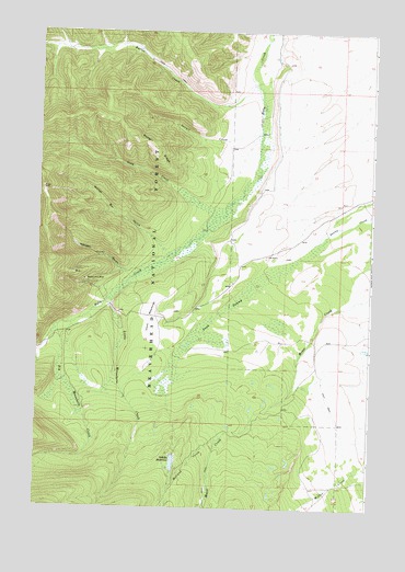
Isaac Meadows, MT USGS Topographic Map
Click on map above to begin viewing in our Map Viewer.

This topographic map contains these locations and features:
Feature Name Type Latitude Longitude GNIS ID View Map
Badger RidgeRidgeN45.5944°W113.7070°779248View Map
Big Moosehorn CreekStreamN45.5474°W113.7420°779843View Map
Butler CreekStreamN45.6113°W113.6706°780685View Map
Gory CreekStreamN45.5791°W113.6806°784133View Map
Holland CreekStreamN45.5177°W113.6817°784941View Map
Isaac MeadowsFlatN45.5494°W113.7084°785347View Map
Little Moosehorn CreekStreamN45.5544°W113.7226°786333View Map
Moose Horn MineMineN45.5594°W113.7312°787649View Map
Moosehorn (historical)Populated PlaceN45.5360°W113.7392°1797378View Map
Moosehorn MineMineN45.5596°W113.7326°802516View Map
Nickel Bar GulchValleyN45.5696°W113.7059°787993View Map
One Thousand One Hundred Twenty RanchLocaleN45.5666°W113.6653°788467View Map
Portal GulchValleyN45.5627°W113.7198°794583View Map
Ruby RanchLocaleN45.6185°W113.6634°794582View Map
Sawpit CreekStreamN45.5988°W113.6681°790084View Map
Schultz DamDamN45.5133°W113.6992°795921View Map
Schultz ReservoirReservoirN45.5117°W113.6986°790139View Map
Wenger GulchValleyN45.5608°W113.7162°792940View Map
Yank SwampSwampN45.5516°W113.6812°793588View Map

Note: Coordinates in the location and feature list above are referenced to NAD83 datum.


Copyright (C) 2008-2024 Ryan Niemi / Sunset Dynamics ... All Rights Reserved